
Pulau Kapas, Malaysia

IN BRIEF:
Pulau Kapas is a beautiful little island off the East coast of Peninsular Malaysia, near Kuala Terengganu.
It has some great snorkelling, but you have to know where to go, as there are occasional patches of greatness hidden amongst large areas of sandy bottom or dead coral.
Bestish Seascape:

All images on this site are clickable for bigger versions
Typical Seascape:
Sorry, I can’t select a ‘typical’ scene as there is so much variation from area to area. See the detailed accounts of each one, below.
.
.


All images on this site are clickable for bigger versions
Pulau means ‘island’. That aerial picture is taken from the North, with little Gemia Island in the foreground.
I swam all around Kapas and neighbouring Gemia Island, checking out the various areas. The short version is that there is:
• Awesome coral in area R-S-T (about 10 minutes walk + 10 minutes swim from the main resort areas)
• Awesome coral in area GE-GF-GG, but you need a kayak or boat to reach it from the main (Kapas) island.
• Very good coral in area Y, but you probably need a boat to get to it.
• Good coral in area L. This is easily accessible from the main beaches and resorts and is your best-bet for an easy snorkel.
• A pretty good chance of seeing turtles in area I, about 100m off the main beach.
• Reasonable chances of seeing black-tip reef sharks, particularly around area CD (scared about sharks? Read this)
– – – –
IN NOT-SO-BRIEF :
Let’s start with a bit of orientation. Note that in the map, North is off to the left.
Kapas island is reasonably small – about 2km long by 1km wide.
The West side of Kapas (closest to the mainland) is long, sandy beach. At several points, there are clusters of rocks dividing it into separate, smaller beaches. There are concrete staircases and walkways to get you from one beach to another. You can walk the entire length of the beachy coast in about 40 minutes.
There are about 8 resorts along the West coast. Your ferry will drop you at the jetty (halfway along the West coast) or at the resort of your choice.
At the North end of the island, there is another long, sandy beach.
There is another small island (Gemia/Gem) about 600m North of Kapas. Gemia has a single, hi-end resort on it.
Beach naming on Kapas is erratic – there aren’t definitive names for the various beaches. I’m using the names from the diveshop chart, but you will find completely different names from other sources. The venerable Tezza does his usual good job of describing the island – I also cross-reference the names he uses.
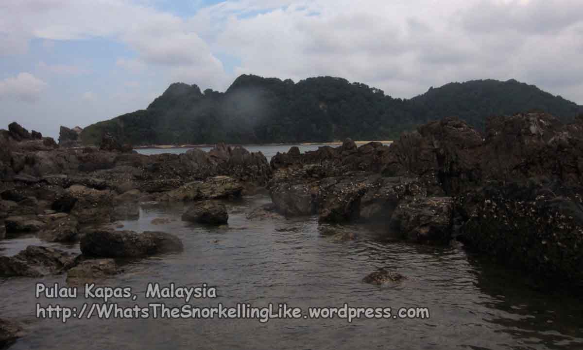
The East coast of Kapas is all steep, rugged cliffs and is largely inaccessible. There are a couple of ‘jungle trek’ tracks that lead from the beachy West-side to a bay on the East side, but that bay is the only spot you can reach by land. There is no accommodation or facilities on the East side.
I swam all the way around Kapas and Gemia to try and make sure I didn’t miss any good snorkelling spots. It is about a 15 hour swim in total, so I’m not recommending that you do it. You can reach most of the best spots with a short swim or kayak ride from the beachy West side.
When I visited (August), the weather was fine and sunny with light Southerly and Easterly winds. There were no currents to speak of. Underwater visibility was consistently about 8 metres. On one day, viz was down to 2-4m. The week before, the visibility in the nearby Perhentian Islands had been 6 metres. I dunno where the ‘crystal clear’ waters that everyone talks about have got to.
Fauna:
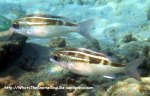
There are lots of your standard, common reef fish at most places where there is coral. Here’s a few of the fish that you will find everywhere on Kapas.
Moon wrasse, Sergeant Major Damselfish, Parrotfish, Checkered snapper, Needlefish, Squirrelfish
Slightly less common, but still pretty widespread:
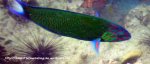
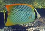
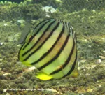
Chevron butterflyfish, Eight Banded Butterflyfish, Slingjaw Wrasse, Blackedged Thicklip Wrasse, Blue Ringed Angelfish, Orangespined Unicornfish
Less common species (mouseover the pictures for species names):


Nudibranchs:


Less common species pictured downpage (you don’t need to click these links) :
6 Banded Angelfish, Batfish, Silver Batfish, Yellow Boxfish, Cuttlefish, Long Jawed Mackerel, Nemos (false clown amenonefish), Tomato anemonefish, Coral rabbitfish, Brown sweetlips, Blacktip sharks, Big eyed trevally, Sweepers, Blue-spotted-stingray,
Whitetail stingray, Turtles
Better pictures and more information about fish species are at the SPECIES LIST.
.
– – – –
.
For a more detailed exploration of Kapas, let’s start at point A – the most southerly spot.
Point A is only included for completeness – in reality you probably wouldn’t come here. The coral is quite good, but the area is difficult to reach without a boat and there is better coral at other, easier-to-reach locations.
If you were coming to point A from the land, you would enter the water at Kapas Turtle Valley resort (near D on the map. Tezza calls this ‘Turtle Beach’) and swim the 600 metres over sandy bottom and dead coral fragments to get to point A (actually, this entry route applies to any of A-D). Alternatively, to cut down on the swimming, you could get in the water at Kapas Turtle Valley resort, swim the 20 metres around the rocky headland at the South, then get out again and walk 400m along that empty beach before getting back in again and swimming out to point A.
Entry into the sea at Kapas Turtle Valley resort (D) can be difficult – (there are patches of slippery rock and fragments of broken-up dead corals in the shallows), but it is possible if you are careful. Alternatively, you could enter the water at Captain Longhouse Resort, which has easier entry, but will give you a longer swim.
There were lots of jellyfish on this stretch (D to A) in the mornings and the surface was usually quite choppy in the afternoons. The seabed is generally very uninspiring. I came to this area on my first day and was initially put off by the effort-to-reward ratio. On the upside, at point A, I did see a couple of Hawksbill Turtles off in the murky distance,

.. and the coral there is reasonably good. These pictures are taken at 2-3 metres depth at point A.


The jellyfish in the area were bastards!


They’ll give you a sting like someone sticking a pin into you, then it itches and stings for about 15 hours. The itching will go away after a night’s sleep. A week later the scar is still visible. Wear long clothes. Still – at least they aren’t deadly.
The tentacles recoil down to about 10cm if the jellyfish is under attack.

Go on, eat the bastard.
There are also yer traditional translucent stingies, too (sea wasps, etc.). These don’t hurt so much but will give you an itchy rash for a couple of days.
.
Moving North West from A, things get more rocky and the bottom is pretty boring.

Generally in the stretch B to F, in the shallower waters (0 to 3 metres deep; in the 30 metres closest to shore), the bottom is very dull. Actually, it’s rather depressing. It seems to go on like this forever:

But don’t despair – head out towards the deeper water. There are a few interesting reef-lets in a line parallel to the beach and 40 or 50 metres offshore (Areas CDEFG).
Around point C, someone is trying to seed new coral growth on some plastic A-frames. This provides an interesting diversion. Unusually for the area, there is also a gorgonian sea-fan:

The A-frames provide some shelter for bigger fish like this Batfish and Porcupine fish:

and this group of Brown Sweetlips:

.
Continuing North West, there is a lone gorgonian around point D, which attracts a range of reef fish posing for photos.


This is about 40m offshore, opposite the solo skinny white tree trunk that nestles among all the greenery on the island.
.
At point E (50 metres off the Southern end of Kapas Turtle Valley Resort beach, at about 4 metres depth) there is another little cluster of coral.


This Spotted Moray Eel lives underneath it, and in the mornings is usually stretched out taking the air. Look out for a small head of blue staghorn coral at the deepest point which identifies this patch.

.
At point F (about 50 metres off the dead-centre of Kapas Turtle Valley Resort beach; at about 3 metres depth) is another little patch of reef. It has diverse coral in reasonable condition, and it seems to attract all the reef fish in the area.


It’s like an oasis of life in that big surrounding area of dead coral fragments.
Silver batfish were cruising nearby:

.
There are more, similar-looking, oases of coral as you head southwards (stay on the line where the seabed is 3-4 metres deep).
These are roughly around area G.


I should remind you that these pretty parts are the exception, not the norm. 90% of seabed in this area is flat sand or broken up coral like this. You’ll have to hunt around for the good bits.
.
I only saw the one Giant Moray (Gymnothorax-javanicus) in Kapas. It was about here, in Area G.

.
The main reason to visit this inhospitable southerly stretch of coastline is that this is the place where you are most likely to see black-tip reef sharks. (Scared of sharks? Read this).
In the boring, grey, shallow waters (typically at 2 metres depth, near area B to F, but closer into shore), there is a group of around ten Cuttlefish. The cuttlefish on Kapas are the most chilled-out dudes I’ve ever seen. Often, cuttlefish will speed-off as soon as you get within 5 metres, but the ones in Kapas are happy to hang-out and pose for snaps.


The cuttlefish spend most of the time mating – hanging around in groups of 4 or 5 with the dominant male on top of the female as she nonchalantly forages for food and/or places eggs under rocks. Another two or three males skulk in the background, waiting for a bit of action but rarely getting any – the dominant male fights them off if they get too close.
Cuttlefish enjoy a range of sex-positions – sometimes doing it like they do on the discovery channel, sometimes face to face.


Apparently the male has a sperm-carrying arm (the hectocotylous arm), and uses it to impregnate the female when mating face to face. They can often be seen with one or two arms in the air, like this.

Here’s a couple of wobbly 5ex-tapes. Watch out for the dominant male attacking the cheeky chancers at the end.
.
Cuttlefish make a tasty meal for sharks and if you find a group of cuttlefish, then there’s a good chance that a black-tip shark will soon be along for a snack.
Hunting time for sharks is generally at first light and at dusk. The cuttlefish helpfully light up with bright white markings while mating, acting like a flashing neon light advertising food.


On my first day at Kapas, I saw a group of 6 cuttlefish and was soon joined by three orbiting black-tip sharks. This was a cool sight, although the sharks stayed right on the edge of visibility, making photography difficult. Eventually, one shark made his move and struck with unbelieveable speed at the cuttle-orgy. It turns out that he missed – I saw the cuttlefish regrouped about ten minutes later.

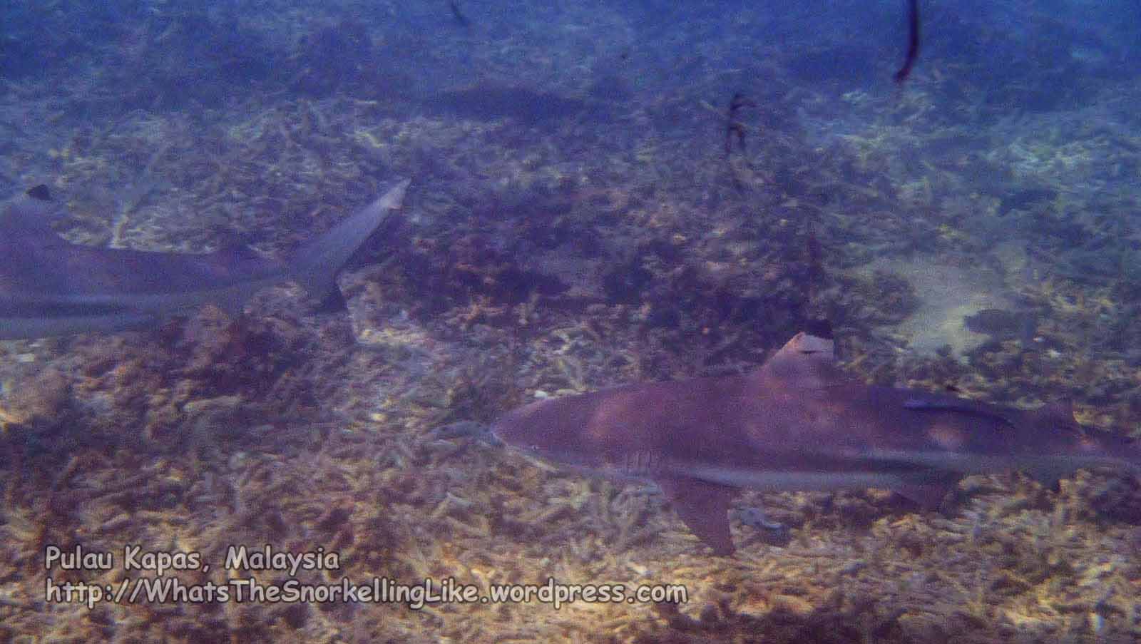

The red/black blobs in the water is ink left by the cuttlefish as they fled an attack.
Your best bet for finding a shark is to head out to this area (halfway between the beach and the line of points CDE) in the early morning or late evening and swim around until you find some cuttlefish, then stick with them. When they start looking nervous and back off by 5 – 10 metres, they have sensed a shark; so start looking for it at the edge of visibility. Correspondingly, if you see a shark passing by, then chances-are that there are cuttlefish nearby, so try and find the cuttlefish so you can be around for the return visit from the shark. I did this with successful shark spottings for 4 days in a row. In the early mornings, you might have to slalom around the jellyfish, but they seem to disperse later in the day. In the heat of the middle of the day you are less likely to find the sharks.
Here are a couple of short video clips of passing sharks here :
.

The little white wiggly things on the Barrel Sponges are actually small Sea Cucumbers (Synaptula lamperti) There is a symbiotic relationship here. The Sea Cucumbers are protected from predators by the toxicity of the sponge and, in turn, the sea cucumbers provide a service by feeding on detritus that settles on the sponge, and would otherwise clog its pores.
.
Continuing on North, past the headland at Captain Longhouse resort, the jellyfish disperse a bit and the bottom becomes flat sand. There’s not too much to see here, but there are a few flat anemones at about 4 metres deep (point H) where you might find these funky little Anemone Shrimps:

..or this unusual species of nemo – the Saddleback Anemonefish:

I also saw an Eagle Ray cruising around past here one day. If you squint hard you might just be able to make him out:
.
There are some patches of ordinary lump coral closer into shore (about 20m off the beach) outside Ko Ko restaurant (Area J. Tezza calls this “Pier Beach South”). I did spot these juvenile Batfish and some Stingrays there, but generally there’s not much exciting in this area.


.
Continuing North, the next highlight is the turtles that live on the grassy patch about 100m off the beach near the dive shop (Aquasport Divers). This is a fairly big area (I), perhaps 300m from North to South and 150m from East to West. It goes from about 3 metres deep to over 7m (when you lose visibility). The visibility here is worse than elsewhere because of the sandy/muddy nature of the bottom.
I saw turtles here every day (August). There were three of them – two were pretty nervous and always took-off as soon as I came into visible range, but the other one was pretty chilled-out and, after an initial assessment, was happy to hang-out and pose for pictures.


.
There’s an interesting phenomenon going on with the Batfish and the Turtles here. A Batfish pairs-up with a Turtle and follows it everywhere.

The batfish get quite territorial about it. If a human or another batfish turns up, the original batfish will try and chase them away. This one is getting all up in my face, and then chasing off another batfish wannabe.


I’m not sure what the turtles and batfish get from this arrangement. The turtle is only interested in chowing-down on the sea-grass and turtles elsewhere seem to survive just fine without the help of batfish. As for what the batfish gets out of it – I once saw the batfish eating from what the turtle had dug up. Presumably that’s what he is there for.

Can anyone shed some light on the turtle-batfish symbiosis? Do post a comment below.
.
Another interesting species I found at this spot was the Mimic Octopus. These are fun brown/black and white striped octopus which contort themselves into the shapes of harmful sea-creatures to disguise themselves or to frighten-off predators.
Here he is doing a striped flounder flatfish

Here – just a natural Octopus.

They also do a good seasnake and a not-so-good Lionfish. There’s some video on YouTube.
.
Heading North past Kapas Island Resort, towards the jetty, there’s not too much to see. In the deeper water (around K) there are a few more flat anemones hosting Saddleback Anemonefish. In the shallows there are a few patches of lump coral and discarded bricks. I saw one poisonous Stonefish on a small patch of reef there, so watch where you tread! (see the section on Safety).
.
The next highlight is the jamboree under the jetty. Thousands and thousands of silver fish turn the patch under the jetty into a swirling whirl of black and silver that parts for you when you swim through it. Watch them avoid the stinging anemones on the bottom and gyrate around the legs of the jetty. Watch the food chain in action as 40 needlefish hunt the silverfish and the locals on the jetty hunt the needlefish. What fun 🙂


.
North of the jetty, there is flat sandy bottom past Pak Ya Seaveiw Resort (Tezza: “North Pier Beach”) and the little bridge that goes over the rocks to another beach where you can find Kapas Beach Chalet; Mak Cik Gemok Beach Resort and Kapas Coral Beach Resort.

.
This little bay (Tezza:”Beach 4”) is pleasantly sheltered from the southerly winds if they are blowing-up. Mostly the snorkelling here is boring sandy bottom, but the coral starts again at the northern end of it (roughly 30 metres off Coral Beach resort).
.
Area L, about 20m off the concrete walkway between Coral Beach Resort and Qimi’s beach has some good coral, a decent range of reef fish and is certainly the easiest to access from the mid-island resorts. I would make this your first stop.


The reef here is only about 100 metres long, starting with some unspectacular brown staghorn coral in the South,

..but steadily building up to more diverse reef as you progress towards Qimi’s beach.

I also spotted this little White-Eyed Moray Eel hiding under a rock there.

.
Continuing North along Qimis Chalets’ beach, the coral is pretty reasonable.


It fades out a bit as you reach the rocky islet at the northern end of Qimis beach.

.
The southern face of the islet is mainly just barnacle-covered rocks. There are some scrape-y looking channels through the middle

and I saw a black and silver Banded Seasnake there one morning. That was the same morning my camera decided to spring a leak and die. Kudos to the kind lady who loaned me hers so I could continue snapping.
.
The North side of the rocky islet (M) has some OK lump/hump coral, but it’s not that spectacular.

.
As you move North along Bt. Berhala beach (M-N on the map; Tezza: “Camping Beach”),

.. the coral gets a little more interesting:

.
Around the middle of this bay (between M and N), about 30 metres offshore, there are some old discarded shipping/engineering parts.


By the coral growth, it looks like they have been here for several decades. I wonder what the story is. The 24 inch pipe isn’t connected to anything at the other end.
.
Here’s a spot two-thirds the way up Bt. Berhala beach:

.
And another towards the Northern end:

For all the areas mentioned above (J to N) – access to the water is easy. Just step off a sandy, sloping beach.
.
There is another rocky headland at the North end of Bt. Berhala beach. It’s a longer swim around this headland and the coral isn’t that spectacular here,


…so you might want to use the steep steps at the end of the beach to reach the North coast.
.
There’s a good view of Pulau Gemia from the top of the steps


And here’s the view from sea level (at point O) of the steps that go back down to the tiny beach at O and of the second walkway heading left/East, towards Bt Paming beach; Derdat Beach (Area O-P; Tezza: “North Beach”) and Long Beach (Area P-Q; Tezza: “Kayak only beach”).

.
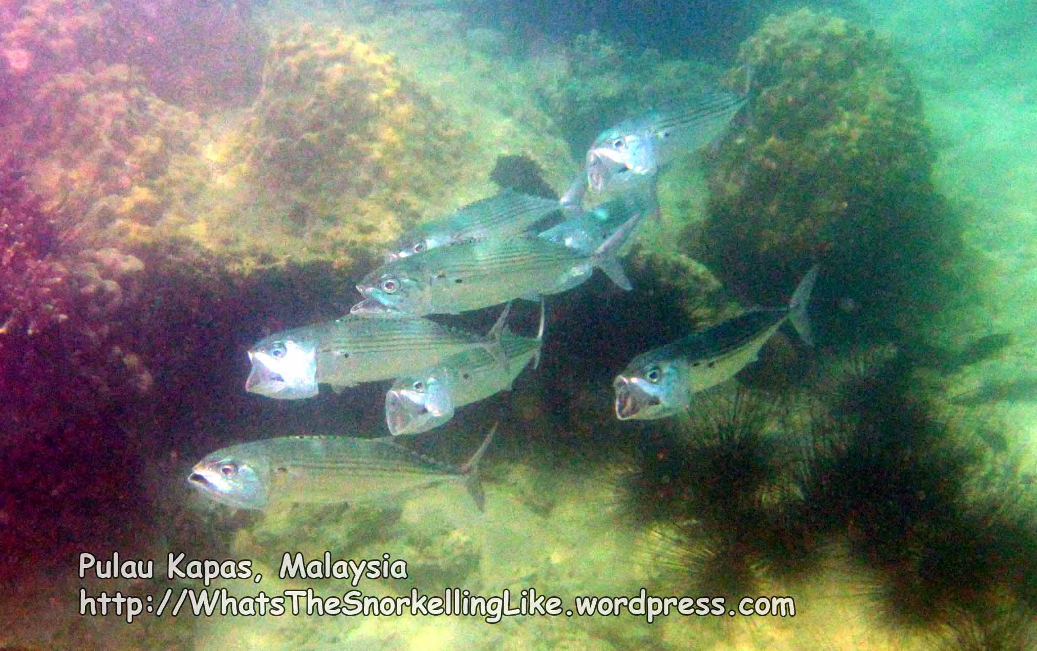
I found these fun Long Jawed Mackerel around point O. They expand their gills, swing open their big mouths and swim around in perfect formation hoovering-up any food in their paths.

.
Here’s some coral West of O:

There are some more A-frames seeding coral growth near here.

.
You can also spot the water-pipe across to Gemia Island.

It had sprung a leak when I first passed it. The escaping stream of high pressure water was drilling a hole in the coral underneath. They fixed it pretty quick when I told them about it, though. I’m sure this was for environmental, rather than commercial reasons.
.
Here’s some coral just East of O:

.
.
The North coast beach is known for the best snorkelling on Kapas, which is right. But watch out – this beach is deceptive. There is a range of reasonable, but not stunning, corals all the way up from O to Q, at about 20 metres offshore. But this isn’t the good stuff. You’ll think it is, because the island throws in a deceptive boring (deep, sandy) strip further out from the coral to make you think that there’s no more coral to be found. But there is. Out into the channel – past the OK coral: past the boring deep sandy bottom; that’s where the good stuff is.
Here’s some of the OK stuff directly off the beach at O to P and (mostly) P to Q.


Note that at point P there is 40 metres of rough rocks, halfway along the coast, splitting the beach in two. It’s easy to swim around them to get to the eastern end of the beach (P to Q). I have seen people trying to climbing over the rocks, but it looked like a lot of hard work, especially in flippies. It is much easier to swim round – you’re going snorkelling anyway, right?
Access to the water is possible (but a little difficult) on both sides of rock P. At low tides, access to the water along the rest of O to Q can be very difficult because of the shallow, sharp coral. If in doubt, aim to get in/out of the water at each side of point P.
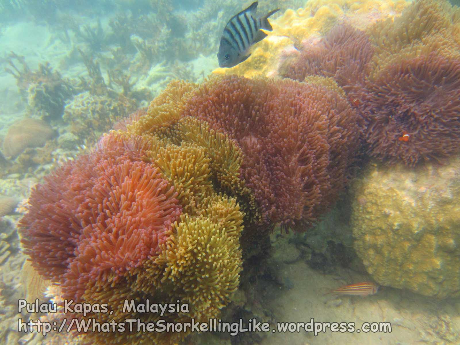
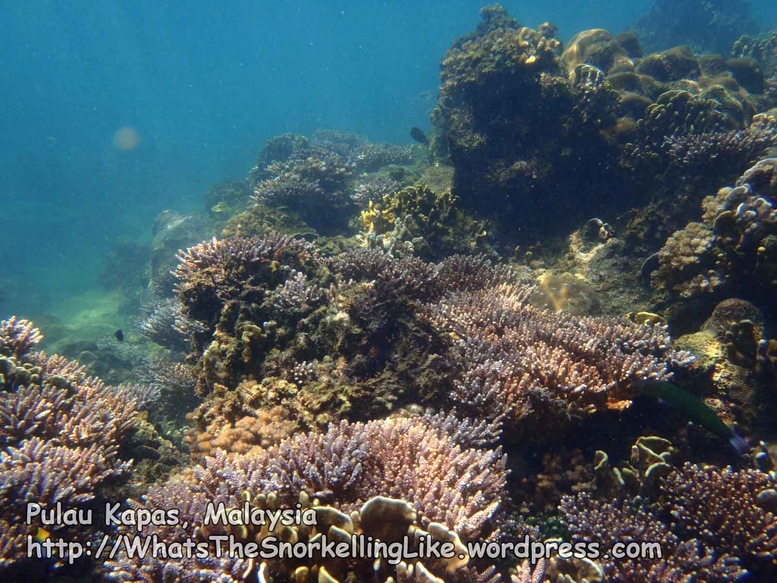
OK, so now for the best stuff. There is a big area of beautiful, diverse coral in shallow waters covering the whole of area RST. Although this is a big area, the bay itself is much bigger and you will still have to search for it. You’ll know when you hit the sweet spot, just keep going until you find it. The very best bit is probably nearest to point R. Walk as far as you can up the beach to point Q (where the sand stops and rocks start). The best spot is about one third the distance from the start of the rocks to the eastern tip of the island and about 200m out into the channel (i.e. just under halfway to Gemia Island). Swim out from the beach at point Q (the end of the sand) towards Gemia, and head slightly to the right. At low tides there is only about 20cm clearance over the top of the reef, so it’s better to go at higher-tide times and to really breathe in! Please don’t break the corals!!
This is what you will get for your efforts.


There is about 100×50 metres of gorgeous coral there. I recommend starting around R, heading out towards T and then slowly slaloming your way over towards S.
It was lowish tide when I was there and most of the fish were pretty small, probably due to the shallow waters. There was a slightly deeper trench to the North side of the coral garden, where the bigger fish were all larking about in the deeper water, including some unusually playful Surgeonfish and a decent sized inquisitive Shark (about 1m).


Actually, I had quite a few sightings of sharks off this beach, although most of them were just making a rapid exit.
After the deeper channel, the coral garden resumes as you get closer to Gemia (around GN-GO), although the quality/health of the coral is not as good as it was on the Kapas side.
I did find this litte growth of a cute sea grass there.

and another Spotted Moray Eel

.
From point S, heading West, the coral stops

then there is an ancient string of buoys going diagonally from Gemia to Kapas.

I guess that this is the demarcation line for boats vs. swimmers. Boats don’t go into the East side of this bay. Buoys aside, the water is too shallow for them.
.
I will come back and talk about Gemia down this page, but for now, lets head up to point U and then around the East coast of Kapas.
.
The stretch directly between Q and U is shallow. There were breakers there when I visited. Breaking waves + sharp coral = a bad place to swim, so if visiting point U, it’s wiser to approach from the deeper water around point R or V.
On the way to U, you can see right through a narrow cave which goes through the rocks over to the East coast.

.
Actually, there’s not much to see at point U itself, except this lovely patch of soft coral. I haven’t seen this one dressed in yellow before.

.
Round the corner on the East side (point W), things get much more rugged and, err, oceanic. The sea was usually pretty choppy there and most kayakers gave up pretty quickly.


The Yellowback fusiliers were enjoying the food rising-up on the deep-sea upwells.

Underwater, the seascape is a continuation of the rocky cliffs above, with large boulders and gaping channels between them. There were a few sharks around area W and it was cool to see them patrolling these prehistoric alleyways.
.
Heading North from W towards X, the ‘bottom’ mostly started 6 metres down and rapidly sloped off into the deep. With only 8 metres of visibility, I found myself just looking at grey fuzz for a long, dull, 1 km swim. There are sporadic small patches of coral growing on the rocks, but you could hardly see them from the surface.

Diving down to 5 or 6 metres, there were a few highlights on this stretch – like this pink growth on the rock. You see them occasionally – a single strip, coiled round in a spiral, looking like a flower. I think it’s a worm. (edit: Catherine and Joe have kindly commented that these are actually Nudibranch eggs).

There was this uncommon Six Banded Angelfish nestling in the depths between some rocks. These are biggies, at around 60cm:

Fish seem to be bigger over on the East side. It doesn’t look like it, but this Blue Stingray had a wingspan of over a metre and was almost 3 metres from nose to tail.

I was going to put my foot next to it for scale, but it glared at me and grunted something about Steve Irwin, so I left it there.
.
Generally, it might be worth having a peek around area W if you are nearby, but overall it’s not really worth slogging round this half of the island. Not by swimming, anyway.
.
There are two cross-island trails that arrive at a bay about halfway up the East coast (point X). If you want to visit the East side, use the trails.
The more southerly of the two trails is longer and hillier. It starts at the top of the concrete steps between Captain Longhouse Resort and Kapas Turtle valley resort. It is maybe 1500m long and goes up and down a few steep inclines, requiring much clinging-on to climb-ropes on the way.
The other track goes across the middle of the island, starting opposite chalet 51 at Kapas Island Resort (remember that chalet number – there is no way you will find the start of the trail without it). It also has a few steep climbs, but is generally flatter than the other track. It is a more direct route (~ 800m long) and follows the riverbed for a long way. I guess it might involve wading if it has rained recently. I prefer this trail – it has more character and there seems to be more wildlife on the way. People reported seeing snakes on this one.
Both these trails tip-out at the same stony beach on the East side of the island.

There is some reasonable coral in the bay here, but it is not up to the standards of some other places on the island.

.
If you are feeling tough and are up to a twenty minute (each way) swim, there are some lovely corals in the next bay around the headland to the right (in area Y). Go past the little cave on your right

..and continue on towards the southern end of the bay. These corals are in 1-4 metres of water.


Strangley, there were no fish there.
.
.
If you were continuing South from Y, you’d just find another looong stretch of underwater rocks ~ 8m deep with limited underwater visibility:

In other words, it’s generally not worth the effort.
.
Around point Z there was a surge-y gap in the rocks where the fish were having fun playing around in the rush of the gulleys.


Here are those Blue Ringed Angelfish in motion:
..a little bit of coral and some interesting reef fish.


.
Then it is back to plain rocks until you find yourself back at A and the decent coral, just south of A.

.
– – – – – –
.
Gemia Island
Gemia island to the North of Kapas is privately owned. It has a single mid-end resort with rooms around 350MYR (about 100USD). It is said that there was a turtle hatchery there in the past, but I’m not sure of the current status.
Gemia is less than a km away from Kapas. It’s an easy kayak ride. You can rent kayaks from several resorts on Kapas for around 15MYR an hour. I’m sure you could also pay a boatman to take you there for about 15MYR, or hop on one of the guided snorkel trips that will call in there.
If you want to DIY, you can swim there. From point O to point GB is a bit of a hike, maybe 800m, requiring a 30 minute swim. There is boring sandy bottom at about 8 metres depth all the way across. On one of the days that I swam this route, I got stung to hell by all the translucent stingys blowing in from the West. Also, the local boat drivers don’t like you coming this way, stopping to shout at you as they pass. I wonder if they tell the turtles not to swim there as well.
It’s a much shorter swim at the eastern end of the channel (Q to R to GM) and there’s no boat traffic in the Eastern half of the bay, so it is better to take that route. And I saw an Eagle ray at point V one day. Sweet. Unfortunately, the best snorkelling at Gemia is at the opposite corner (GE), so you’ll have to make your way over there and end up swimming the same distance overall. At least the scenery is better this route.
Here’s a picture of Gemia island again.
Let’s assume you are arriving at the main beach of the resort (GA, at the left end of the picture). It has sand and soft corals like this out front.

(Actually, the tide was too low for me to get in and take a picture, so I have borrowed this one from the Philippines).
The good snorkelling is at the back of Gemia island. To reach it, if it’s high tide and you can get into the main beach (GA),

then walk up to the back of the beach, along a short path and then down the concrete steps on the right to reach the back-beach (GD). Access to the water is a little tricky here (rocky/broken coral fragments on a sandy beach), but it is possible. When you are in the water, turn right.
If it is low tide and you can’t swim into Gemia’s main beach, you’ll have to make the short swim (?200m) around the rocky headland to the West (GB-GD). There are some funky rock/cave formations on this route and even a surface-level swim-through if the tide is right. The coral around the headland is nothing special, although I did find a nudibranch party there:
.
and this cushionstar:

.
Rejoining your other self at the back-beach of the resort (GD), head North-East up the coast. (This area is front-of-shot in the aerial picture). You will see two pointed rocks sticking out of the water. About 150m North-north East of the back-beach and about 40m offshore, the coral starts (at GE).

This is the view from GE looking backwards towards the resort’s back beach at GD:

From here – continue in the same direction you had been going (towards the two rocks). The quality and health of the coral starts to improve and there is a big expanse of beautiful, diverse coral in the area – about 200m by 40m (GE-GF-GH) This is the best coral on Gemia.


I came here a few times and each time I was lucky to be joined by an inqusitive shark who hung around for a while.

.
Passing the two rocks that stick out of the water, and continuing on East, the quality of the coral drops off again and you alternate between areas of good, then bad coral. Here’s some bits towards GJ:


.
and at GJ:


.
Around point GK, I was treated to a formation flyby of the Blue Ringed Angelfish display team.


I was also pleased to see that little yellow butterflyfish that is cruising with them – it is the Panda Butterflyfish (Chaetodon adiergastos), and is the first one of this species that I have seen around these parts.
There was also an appearance by two out of a total of only four Moorish Idols I saw at Kapas.

And all those shoolers – they must breed like rabbits. eh ?

.
At high tide you can swim through the rocky gaps at point GK and end up next to a small beach at GM.
It not being high tide, I had to take the long way round the rocky headland at the East end of Gemia. There is some reasonable coral early-on,

but generally, the seascape around the cape is pretty boring – deep rocks with sporadic patches of coral in the murky depths – the same as the rest of the East coast.

I did find a couple of nudis there
.
Back round on the South side of Gemia, at lowish tide, the water was too shallow for me to really cover the area in front of the chalets (GM-GA). I went a bit deeper out into the channel, but I still couldn’t cover all of it. Generally, it is something like this midway between GM and GA :

And, close to GA, approaching from the East, like this:

.
.
And that just about covers all the coastline of Kapas and Gemia. Here’s some leftover pretty pictures:


.
.
General :
Currents: There wasn’t much current around the island.
Season: The dry season runs from about April to October. During monsoon season, most places are closed and underwater visibility will be very bad.
Boats: Generally, the volume of boat traffic is low and isn’t a safety problem for snorkellers.
There are three big-boat ferry companies dropping-off on the West coast of the Island. These are easily seen and avoided.
There are a handful of small speedboats doing snorkelling trips around the island. These generally aren’t a problem, but the drivers might not be looking-out for snorkellers away from the touristed West coast beaches. Bright clothing and a watchful outlook are advised.
Snorkelling trips: Most guesthouses offer snorkel trips around the island for around 25MYR. These last a couple of hours and visit the better spots.
Diving: I didn’t try it. There is one dive shop (Aquasport). If I remember correctly it was 95MYR per dive in 2012. Dive sites are shown in alternate map #3, below.
Facilities: There are no roads/vehicles, internet cafes, stores or ATMs on the island. The restaurant near the jetty has shaky wifi access.
Accommodation:
It was Ramadan when I was there. Many guesthouses were closed and it could take over an hour to be served food in the few remaining restaurants. I’m sure it is better the rest of the year.
Here is a resort pricelist produced by the Suria Ferry company (2012). It seemed pretty accurate. Prices in Malaysian Ringett (MYR).
Kapas Turtle Valley:
-Family room 340
-Bungalow 170
Captain Longhouse:
-Fan room 60
-Dorm 30
Duta Puri Island Resort
?
Pak Ya Sea View Chalet
-Fan room 60
Kapas Island Resort
-AC room 160/180/200
-Fan room 130
Kapas Beach Chalet (KBC)
-Fan Room 40/60/70
Makcik Gemok Beach Resort
-AC room 120/150
-Fan room 40/80
Qimy Chalet
-AC Family room 300
-Fan room 80/100/130
Kapas Coral Beach Resort (KCB)
-AC room 200B
Harmony Camp site
-Per person 10
-Tent rental 15
(location is just North of Qimi Chalets)
Gems Island Resort 350
I’m a cheapskate. The camping place was closed, so the only two budget options were Kapas Beach Chalet or Captain Longhouse. The staff in both were thoroughly charming. The dorm in Captain Longhouse was a single, high ceilinged, long room with beds dotted around the place and a mozzie net hanging from the ceiling for each one. There were one or two fans dotted around, but it all looked a bit warm to me. And 30MYR for a dorm is a bit steep.
The ‘dorm’ in KBC isn’t really a dorm. It’s a small, ordinary double room, with three single-beds jammed in. The low ceilings and absence of windows made it only suitable for fans of the black hole of Calcutta. Bathrooms are across the courtyard.
I doubled-up in a twin with someone else. This was a far more civilised option and not too expensive. The private rooms there were basic, but fine. As you are on the edge of the forest, expect some creepy-crawlies wherever you stay. The crabs/lizards will steal your soap bars from the bathroom in the night.
Getting there:
Tezza covers topside and transport logistics in detail on his excellent blog here.
There are two ferryboat companies that go from the same jetty. Prices are about the same (40MYR return, half price for under 12s).
Here are a few alternative maps 1 2 3
———————————————————————————
Originally visited/written: August 2012 Last updated: August 2012

Outstanding site. I will be there in April. Thank you for this.
The “pink growth on the rock.. a single strip, coiled round in a spiral, looking like a flower.” Nudibranch egg mass. 🙂
Interesting – thanks a lot 🙂
Excellent guide – many thanks to Star for his sterling work! I had a week on Kapas and did pretty much all the west and northern areas. Areas RST are indeed very good reefs and seldom visited from what I could see. Its a bit of a swim in sea-wasp infested waters, but well worth it. I found the headland between L and M a really good spot for an easy snorkel – some beautiful golden yellow coral there that looks fantatic when the sun hits it. Also, this was the only area that I saw a shark in. I hung out with the copulating cuttlers a few times, but was unlucky not to see any shark action there I guess. Overall, I found Kapas a pretty good snorkel island with some healthy coral, but was a little dissapointed with visibilty on some days. I saw more sharks in the Perhentians, but the coral there was not as good as Kapas. Don’t think I’ve seen more sea urchins in one place before, there were herds of them – so if you are into urchins (is that possible?), this is the place to come. Many thanks again Star – got any new snorkelling destinations planned for the future?
Thanks for the updates, Jos.
I’m currently snapping away in Sulawesi, Indonesia so should have a few spots from there to add when I get a chance. I also have some updates to add on the full ’round-the-island’ experience in Perhentian Besar.
Happy snorkelling 🙂
Hello, I come back from Kapas, very good snorkeling by the beaches. I even saw a Blackchin guitarfish (I think it was that) in the main beach under the pear. I took a video, but it is not a good qualities. You can see it there : https://www.youtube.com/watch?v=cNvj3HNrq_4&list=PL9AEF6EA3014129AD
As you, I saw turtle with batfish (on the same main beach). The most beautifull for me, was between Gem and Kapas (area U RST) et after the Kapas turtle valley. Thank you for your informations. In february 2015 I go to Phi Phi (I think I can do some snorkeling in front of “long beach”), do you try ? and come back to Kradan.
Great about snorkling in Pulau Kapas.
I like how unpopular this island compared to other island in east coast.
Thanks for putting in so much effort and detail into your site.
Pingback: Pulau Kapas: the perfect Malaysian island to do nothing | The Tiny Wanderer
Thanks so much, your effort is hugely appreciated. I am in Kapas now, and would not have known about RST coral without checking your blog beforehand. In RST I have been snorkelling on my own the whole time (although the island is packed), seen a turtle, several sharks and two eagle rays, the latter only just before sunset. Plenty of other fish I dont know the name of. The coral looks very healthy in RST, but people complain it has deteriorated significantly in other parts of the island. Accommodation is expensive, and food often not great, but the snorkelling – and the beauty of the island – definitely make up for it. How was the Perenthian Besar around the island swim?
Hi – thanks for the update, it’s a lovely island.
Re:the bits of Perhentian Besar that I haven’t written up yet: I wouldn’t put them on a priority list – the East coast is all big boulders underwater (no coral). There is one small beach with some OK coral there, but the beach is a haven for sandflies. There is coral along the South Coast, but generally in worse condition than at 21a and spots on the West coast of Besar. I’d stick with the West side.