Koh Tao, Thailand

IN BRIEF :
Ko Tao is the Northernmost of the three big islands in the Southern Gulf of Thailand. It is famous as a place where backpackers go to get dive-certified.
I visited for a couple of months in early 2009 and a week in May 2013.
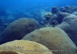
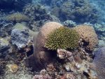
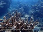
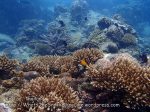
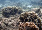
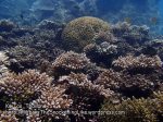
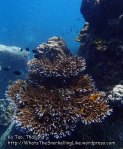
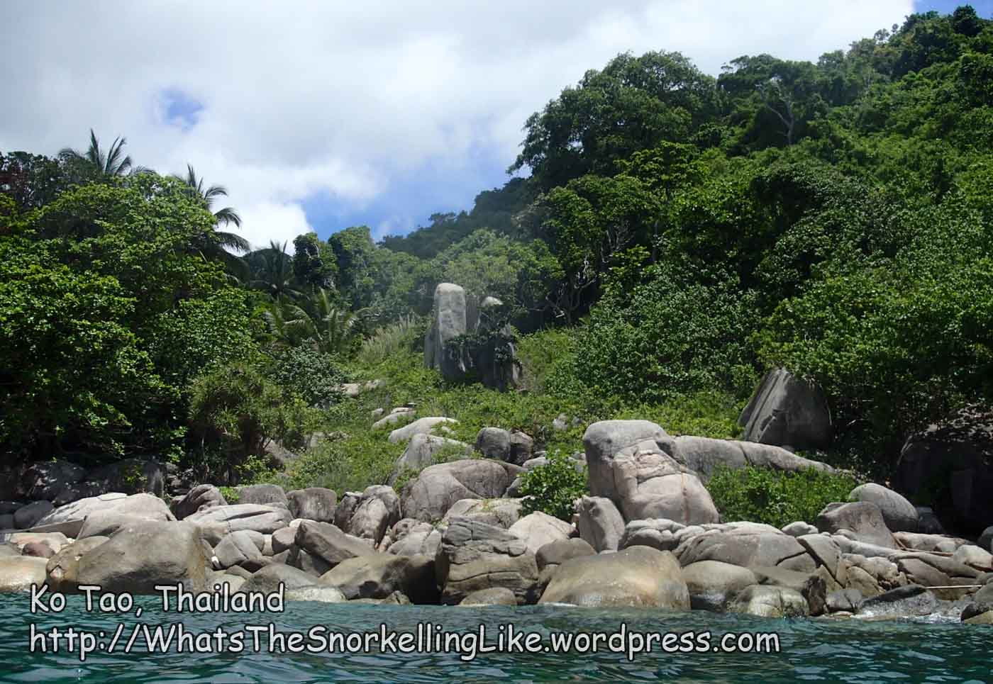
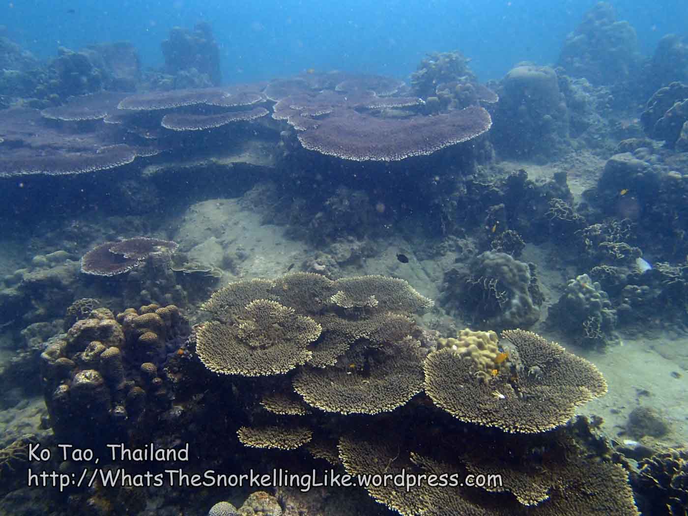
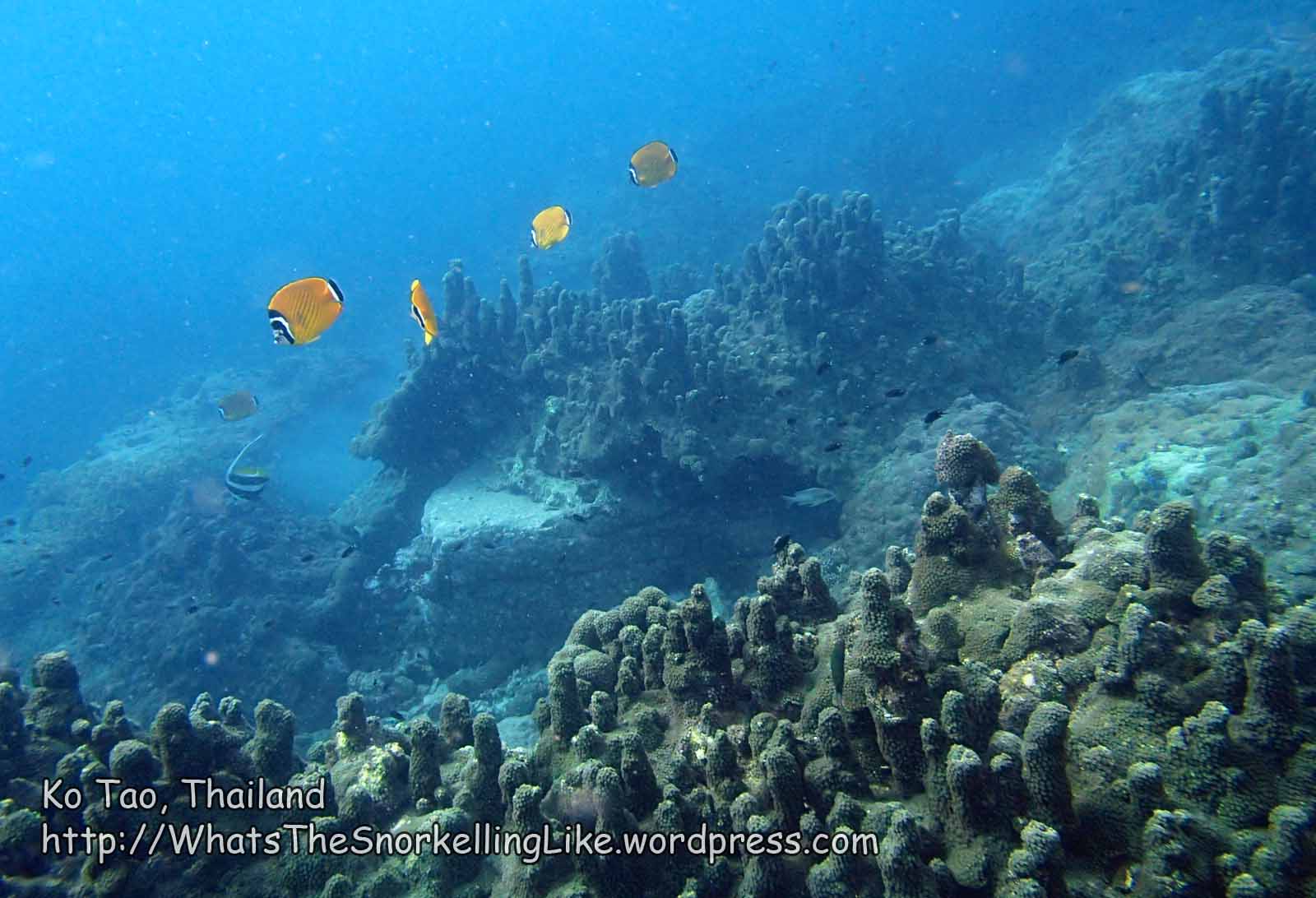
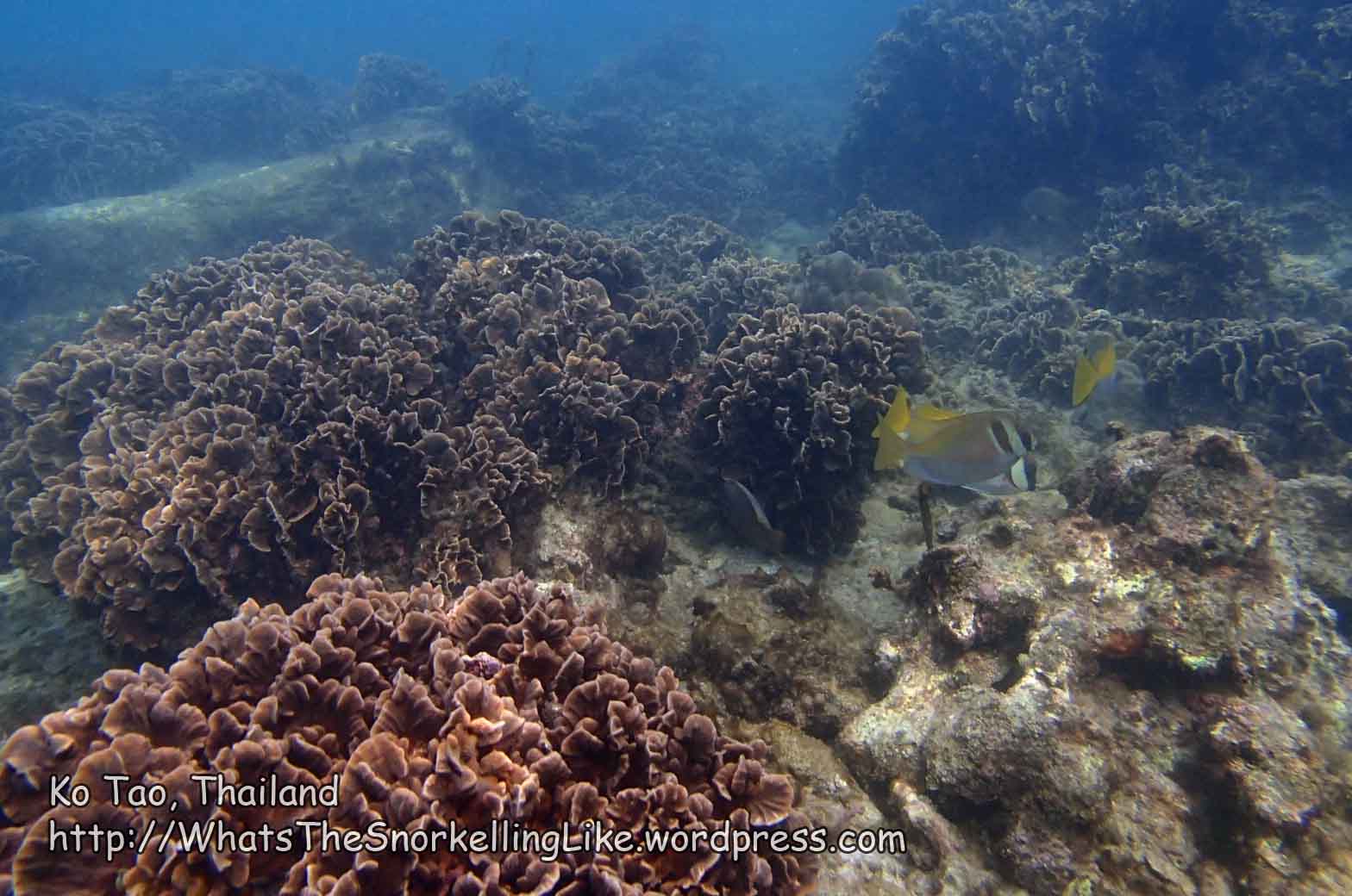
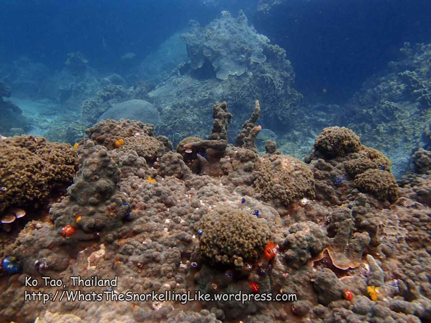
Ko Tao has some very good coral growth. It is one of the best spots in Thailand for coral (since temperature-change events hit corals on the Western (Andaman) side. (However, the Andaman side still has reasonable corals and is better for fishlife and ‘picture-postcard’ beaches, IMO)).
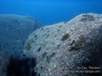
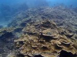
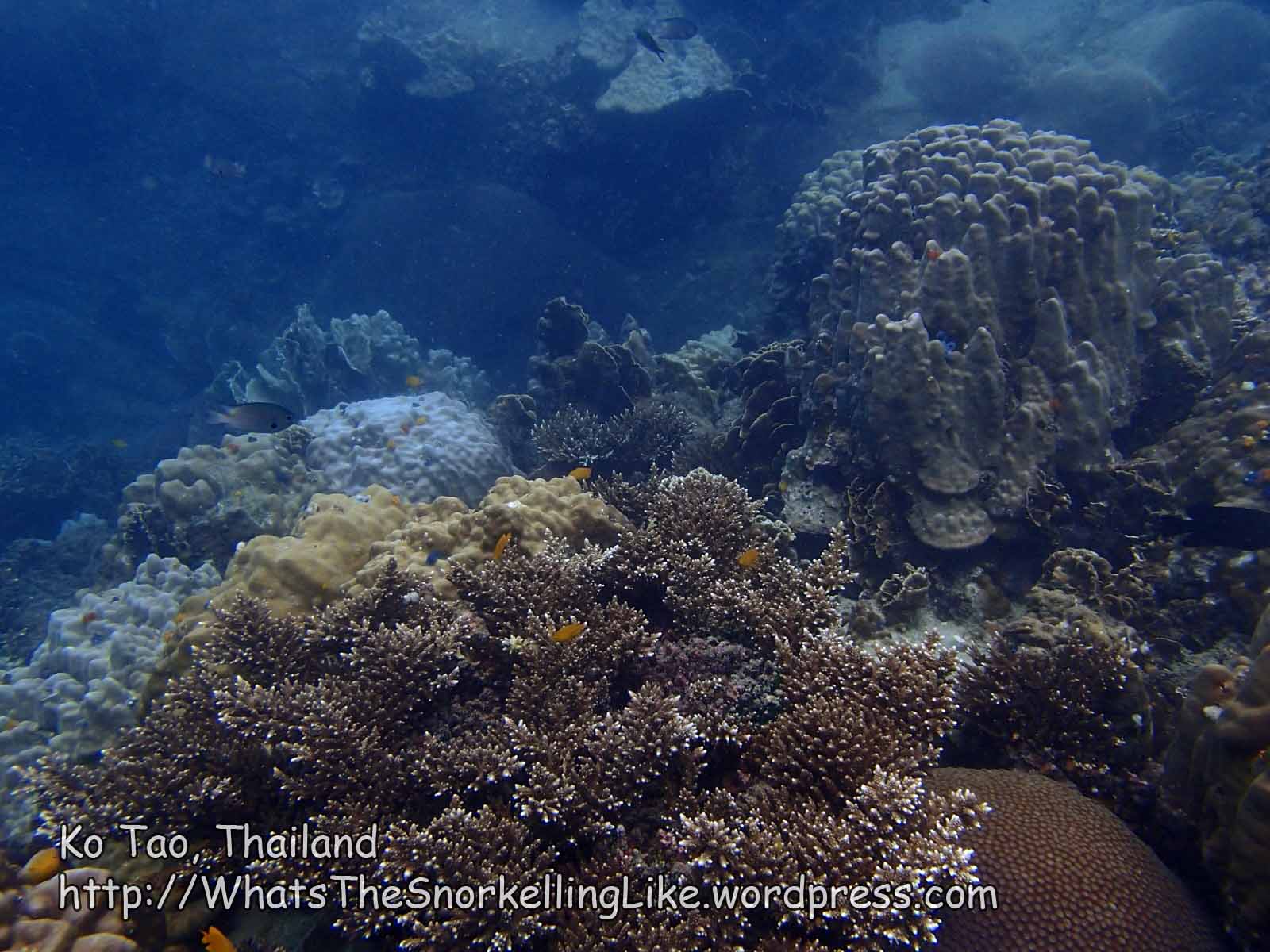
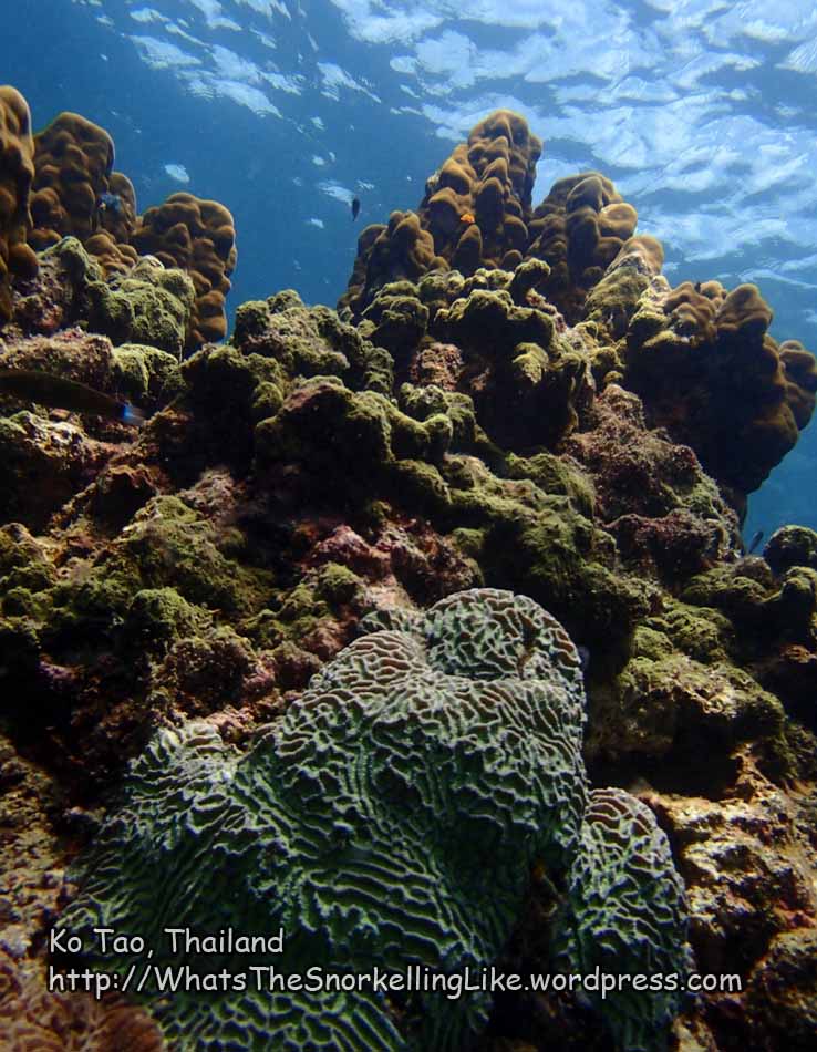
Ko Tao is rocky. The coral grows on top of rocks, rather than as a discrete fringing reef. There is very good diversity of coral species.
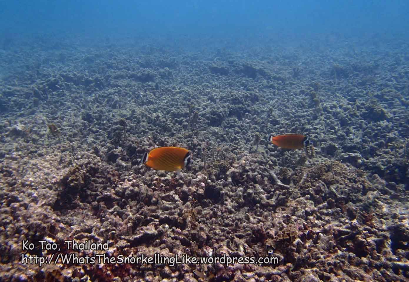
There aren’t vast numbers of fish around, compared with other locations.
The best areas for coral are spread far-and-wide around different parts of the island. There are only a handful of beaches and the best snorkelling is often not at the beaches. Consequently, you hear many different views about where the ‘best’ snorkelling is. Each area has its own pros and cons. Typically, the top spots (in no particular order) are:
Nang Yuan island (Area V on the map below). There are a couple of lovely snorkelling spots. The downside is that you must either sleep at the island’s expensive resort or visit by taxi-boat (plus pay an extra entrance fee (!) for the island). Once the hoards of day-trippers have gone home, the island itself is beautiful.
Hin Wong Bay (Area A). Lovely snorkelling, but the area is all rocks and access to the water is difficult. There is a tiny private beach, but again, you have to pay to use it. Hin Wong is far removed from the main, touristic part of the island, so this may be a downside if you are wanting night-time entertainment.
Ao Tanote (C). Sandy beach, decent coral and friendly fish directly off the beach. Accommodation is a little expensive, but this place is a good bet if you can afford it. Suitable for families.
Sai Deang Beach (F). Famous for baby sharks cruising around in the rocky shallows. The coral in the bay is disappointing, although there is a small patch of good stuff at one end of the bay. Decent beach. Remote location – not good for those wanting lively entertainment.
Mango Bay (Ao Ma Muang) (W). Some great snorkelling in this isolated bay at the North of the island. Accommodation is expensive. Getting to the location is via boat or 4-wheel drive only. There is a ‘road’ leading to it , but it is near-suicide for motorcyclists. Technically, it is walkable, but is a looong way.
.
.
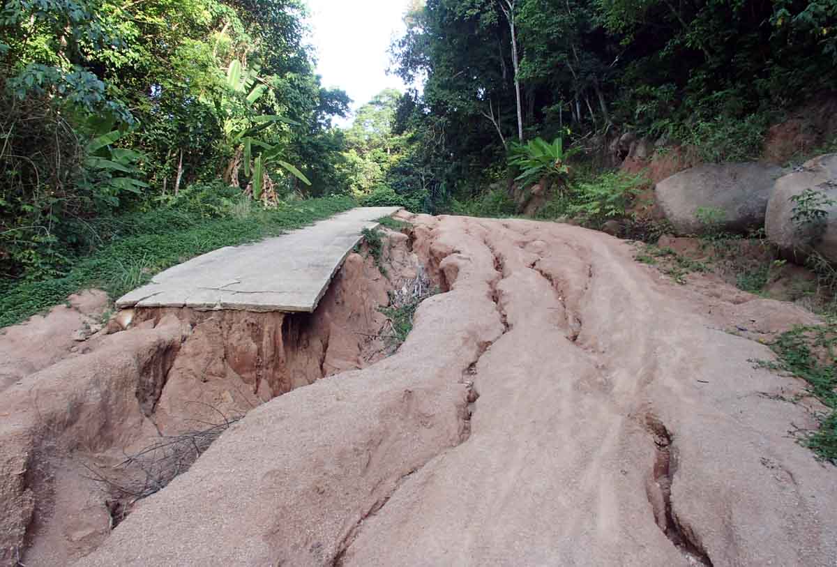
The cheapy-backpacker days of Ko Tao are mostly over, as resorts have moved upscale to cater to the midrange market. Cheapskates looking for access to reasonable snorkelling and sleeps under 500B might check out Lang Khaai Bay, Hin Wong Bay, or stay in the main town (Mae Haad) and walk/ride out to the beaches & bays for their snorkelling. Note that the hills on the island are VERY steep and the roads are often in bad condition. In the more remote parts of the island, the roads are not suitable for motorcyclists. Most places are reachable via a stiff walk, though.
The dry season is about January to August.
The island is relatively developed – there are ATMs, health clinics, shooting ranges, hotels with infinity pools and a million diveshops.
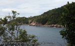
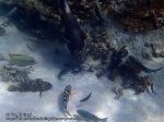
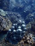
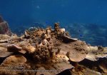
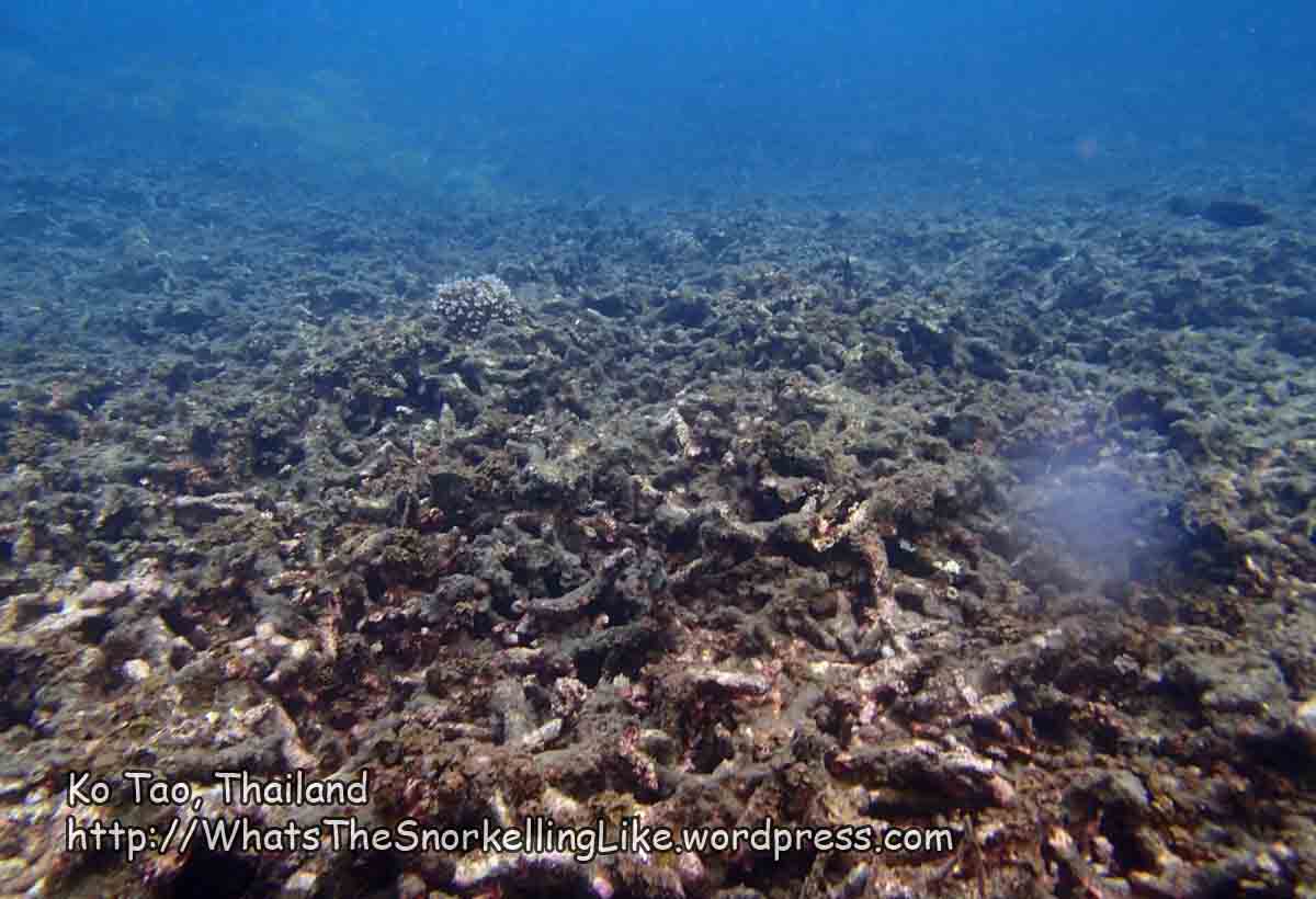
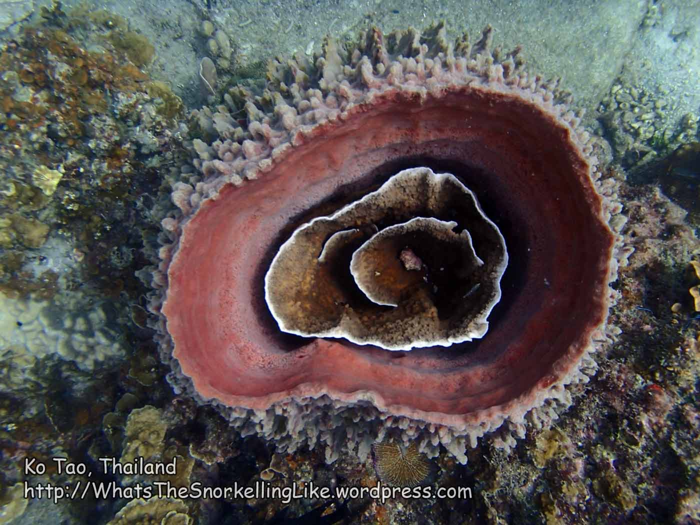
Best-ish seascape:

.
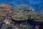
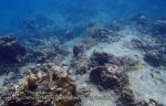
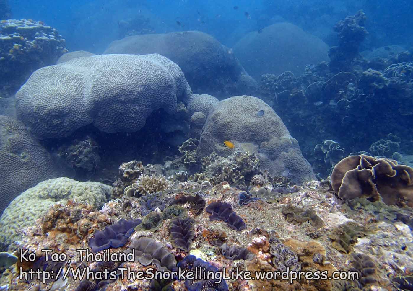
Typical seascape:

All images on this site are clickable for bigger versions.
– – – –
IN NOT-SO-BRIEF:

All images on this site are clickable for bigger versions.
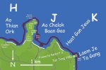
Map Notes: Ao = Bay; Laem= Cape/Point; Haat=Beach; Hin=Rock. The red line around the edge of the island is the areas I snorkelled. The big letters are references to each area listed below.
Don’t take my representation of the tracks and roads as 100% accurate. Grab an up-to-date free map when you get off the ferry.
I have only listed resort names when they are relevant to my text -there are actually hundreds of resorts on Tao.
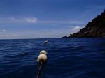
Day trip
There is a round-island, big-boat snorkelling daytrip run by several operators. The itinerary seems about the same for all of them: Pickup from your resort; Depart from Mae Haat; Au Sai Daeng (Area F) Ao Leuk (D); Ao Hing Wong (A); Ao Ma Muang (=Mango Bay)(W); Lunch onboard; Ko Nang Yuan (V). The trip is a good way to get an orientation around the island and some of the better snorkelling spots. At about 800B, I wasn’t bowled-over with the value-for-money, but I guess it’s nothing compared with the price of your flight! There are accounts of all the stops in my detailed sections below.
Of course, you can also charter a longtail boat for an expensive private trip.
On my main trip there, I swam around almost all of the island. I didn’t quite have time to cover that North East corner. (Edit: I have since gone back and covered it, but haven’t had a chance to write-it-up yet. It is nice, but almost impossible to reach without a boat).
Because I was swimming it, I haven’t-much researched walking routes to the various beaches. Tezza can help you out on that one.
.
There is no airport on Koh Tao. Ferries from Chumphon/Pha Ngan/Samui arrive at the main town port of Mae Haat (on the West coast, near Area Q, on the map). The main tourist/beachy area is Sairee, about 2km North of the jetty.
For my run-down of the snorkelling – let’s start across on the quiet East coast, in Ao Hin Wong/ Hin Wong Bay.
.
.
Area A – Ao Hin Wong

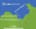
Hin Wong is a quiet, rocky bay on the mid-East coast. There are three or four resorts there, including one classic ‘backpacker-y’ one (Hin Wong Bungalows). The bay is very remote and is no good for those wanting easy access to the party-town of Sairee on the other coast. The owner of Hin Wong resort has a pick-up/ute and goes across to the West coast a few times a day (He cruises for customers around the docks in Mae Haat when the ferries arrive). Guests of the resort can go along on the transport free-of-charge.
There is some great snorkelling in Hin Wong bay, but understand that the whole bay has a rocky coastline and access to (actually, access from) the water is tricky.
It’s not too hard to jump into the water from a rock, but the only way I found to get out of the water was to reverse-abseil up a rope tied to a small rock, then balance-beam the 5 metres along the frame of this old jetty.

There is a tiny, privately owned beach right next door (Mol’s bar). They charge you 100B (or the price of a drink at the bar) to sit on the beach. When I explained that I just wanted to pass through to get into the sea, they let me in without paying. I’m not sure whether this is the norm – if it is, then this is your best-option for access to the water.

.
Here is the view from the restaurant of Hin Wong Bungalows, looking left (North) towards the Northern jaw of the bay.

That’s where we are going to start, up at point A1 (on the local map, above). So lets jump in and sprint up to A1, then turn round and start a slow-sweep Southwards.
.
.
Area A1:
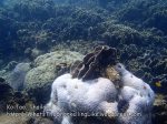
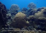
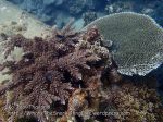
Most of the coral in this bay is growing on top of rocks. There is a great diversity in the coral species. Here are a few samples from the 200m run A1 to A2. These are a good representation of the best of Ko Tao:


.
At A2, just off Welcome View Rock Resort, there was this nice patch of anemones:

All the guide books wax-lyrical about the multicoloured anemones in Ko Tao. These purpley ones are nice, but apart from this and the usual pink-variety I didn’t see any other colours.
‘Welcome View Rock Resort’ has a floating jetty out front. You could use it to jump in the water, but it looks too tall to use for getting-out again.
Heading from A2 back to where we started at A3 (Hin Wong Bungalows), there are some more attractive corals, parked-up on top of the underwater rocks:


.
Here’s the view looking right from Hin Wong Bungalow’s restaurant:

We’re going to follow the coastline round and out to the headland in the far distance (A6).
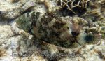
There was a cool Scrawled Filefish hanging around the end of the little jetty. (btw, for the names of fish, see my SPECIESLIST).

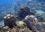
After that, here are some samples of coral, mostly 10-15 metres off the rocky coast from A3 to A4:


.
There is a monstrous apartment block at A4. It looks mostly empty. That guy has had a pirate flag up for at least 4 years. I do hope that he’s not paying for the place!

Here is some coral from directly outside it:

The seascape continues like this on-around the sweep of the bay.
Area A5 is the bit where the day-trip boats stop (mostly late morning).

.
There is a roped-off area marking-off the snorkelling–zone from the boat-zone:

.
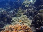
There is some great coral in this snorkelling area (A5).


Most of the better stuff is about 4 metres deep, but you can still get an OK view from the surface.
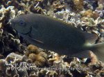
There weren’t that many fish around, but notable exceptions included this Blackcap Butterflyfish, schooling Virgate Rabbitfish, and blue-tailed Needlefish:


.
Huge schools of Fusiliers like to hang around underneath the big-boats on the edge of the demarc-line:

.
.
Now, ready for the Great Leap Southwards, I headed-on around the cape at A6 to start down the East Coast.
.
.
From A to B (Hin Wong Bay to Laem Thian)
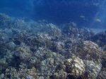
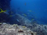
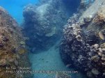
The East coast of Tao is characterised by huge rocks, both above and below the surface. Underwater, the rocks usually have coral growing on them – sometimes a lot of interesting, diverse species and sometimes not much at all.
This first stretch Southwards was one of the more boring sections, coral-wise.
Mostly it was like this:

With an occasional uplift to this:

But mostly it was an unrewarding, hour long slog. Not recommended.
.
Towards the Southern end of this stretch, as you approach the cape of Leam Thian (“Laem” means Cape/Point/Headland), the maps show an indentation to the right labelled as Ao Mao (Mao Bay).
There used to be a resort on the Southern side of the cape and the maps show a walking track from the resort to the back of Ao Mao. I guess it was a fun yomp to trek down to this remote bay. Other than that, I can’t see why Ao Mao qualifies for a name (any more than a hundred other unnamed bays). It doesn’t have any notable features. Maybe they were drunk when they decided to give it a name.
Here is the most landward part of Ao Mao. If it had a beach, this is where it would be. But it doesn’t.

.
Underwater, heading from the ‘beach’ back towards the tip of Laem Thian (on its North side), the sights were mostly unspectacular:


.
Quirky Barrel Sponges gave a couple of highlights:


.
Arriving at the most Easterly point of Leam Thian, this was the view West into Ao Mao and this was the view back North up the coast towards Ao Hin Wong.
.
This is the Northern side of Laem Thian:

.
Heading South – round the cape, itself, was mostly plain rock:

But there were these Orange-spine Unicornfish, spicing things up:

.
.
Area B – Laem Thian
Around the South side of the cape is what most people to refer to as Laem Thian. Here, you can see the ruins of the old resort:

I don’t know what happened to it. There are reports from 2009 of it being a great place to stay, but obviously something went wrong. FWIW, the old website url was laemthian.com – but it’s dead now. I assume that the tracks to the resort and to Ao Mao have grown over now.
The beach here is cute and a few longtails were bringing people the 1km from Tanote Bay here for some isolation. That’s them on the beach.
.
I had a good search of the bay outside the resort, but there was nothing doing, coralwise. Mostly it was just long-dead Staghorn coral.


.
.
From Area B to Area C – Laem Thian to Ao Tanote
Heading South from Area B, there is a 1 km stretch of rocky coastline leading to the developed Tanote Bay.

.
Underwater, the rocks have some patches of coral on top :


This stretch to the North of Tanote Bay (Area B to Area C) is sometimes recommended as a place to explore if you are staying in a resort at Tanote Bay and you get bored with the bay itself. That is fine, but personally I found the rocky stretch to the South of Tanote bay to have better coral. On the other hand, the Southern stretch doesn’t have the sandy beach at the end of it, like the Northern one does.
.
You can’t help but notice Tanote Bay as you round the corner into it. Here’s one of the next batch of a dozen bungalows being constructed up on the rocks:

.
.
Area C – Tanote Bay


All images on this site are clickable for bigger versions
Tanote bay is a snorkel-friendly bay on the East coast of Ko Tao. It is characterised by a clump of big rocks in the centre of the bay, just 30 meters from the soft sandy beach (right above the “com” of the watermark in the photo). There is decent snorkelling around these rocks and the mid-sized reef fish in the shallows are the friendliest and chilled-out fish that I have ever seen. The soft, gently sloping beach makes it easy for family snorkelling.
There is a fair-bit of development up-top and the accommodation looks to be expensive. Neither of these features attract me, but I’m picky like that. The snorkelling is very acceptable, though.
.
Since we are approaching from the North – let’s start with some (mostly submerged) rocks in the North East corner of the bay. These aren’t the main rocks in the centre of the bay – these one are much more rugged – shooting up from the seabed at about 8 metres deep, to just break the surface out on the North East corner.

Casual beach snorkellers probably wouldn’t come this far out (about 200m from the beach), but I thought that the rocks spelled ‘intrigue’ and had a good look around them.
Well, it turns out, I was wrong. There wasn’t much growth on them:


Being so close to the surface, any surge/waves in the sea mean that if you get too close, you might be dragged across the top surface and sanded like a coffee table. Be careful.
Heading in from the NE rocks towards the centre of the bay, there is a lot of new Staghorn coral about 7 metres down.

.
I watched this Titan Triggerfish demolish about two square metres of it to get to a sea-urchin who was living underneath.

.
Out here in the deeper water, you might find some fish other than the traditional ‘reef’ dwellers, like these Longfin Pike.

.
The main snorkelling spot in Tanote Bay is the big rock 30 metres off shore, right in the middle of the bay.

(That’s Ko Pha Ngan in the background).
.
The best coral is on the North and West side of the big rock (closest to beach and the left end of the bay, as you stand on the beach).


.
As you head around the seaward side, the coral gets deeper
And the rock plunges straight down to the seabed at about 7 metres down.

.
The Southern (right) side is a little patchy and unimpressive.

Although I did see a lovely Six-Banded Angelfish there. (But the picture didn’t turn out – that one is borrowed from elsewhere on Tao).
.
In the shallows between the beach and the rock, I found the most chilled-out fish that I have seen anywhere.


Mouseover for species names. Mostly these species of fish run a mile as soon as they see you coming I guess they’ve realised that there is no subsistence-fishing going on in well-heeled Tanote Bay.
Slingjaw Wrasse can shoot out their lower jaw to capture unsuspecting prey. This happens very quickly and is almost impossible to photograph. This chilled out denizen of Tanote Bay gave me the opportunity to photograph him doing it. Too bad he swam behind something at the same time!

.
The 10 metres closest to the shore were pretty skanky, coral-wise.


But weren’t entirely without merit:

.
Moving over to the South (right) side of the bay :

The Southern headland had some reasonable coral growth on it:


As you get to the end of the headland, things get back to traditional ‘rocky’ again:

.
.
From Area C to Area D – Au Tanote to Au Leuk
Outside the bay and to the South, you have more rocky coastline:

and more coral-on rocks below the waterline. The diversity of the corals here was better than the more Northerly stretches of the coast:


.
There was also a Square Tailed Grouper hanging around:

.
.
Ao Lang Khaai
About half-way from Tanote to Leuk there is this little bay (Ao Lang Khaai) with cute traditional backpacker-style bungalows. This resort is Yang’s Bungalows.

I haven’t seen the bungalows up-close, but I stayed at the Yang family’s restaurant in Mae Haat, and they seem like decent folk. These huts were listed as 300B. There is road access and another couple of resorts in this bay.
The bay itself is nothing special. There is a rough sand beach with difficult access to the sea (a few rocks underwater and some surge, when I was there). Snorkelling in the bay was unspectacular. But if you want somewhere quiet and cheap to hang your hammock and you don’t mind a long, pleasant snorkel round to either Tanote or Leuk – this could be for you.
.
Southwards from Ao Lang Khaai, there wasn’t much coral growth on the rocks.
Chasing Small Spotted Dartfish and watching the surge make plumes of spray were the main attractions here.


.
further on South, there were a few decent patches.

.
Continuing South, the free island map shows a Dive site called ‘Ao Leuk point’, just before the coastline takes a right to head into the beach at Ao Leuk. There was a single mooring buoy here. I assume that this marks the Dive site.

This was all I could see there (at only about 6m, mind you)

.
A little further South, there was some more coral growth:

.
and I had a run-in with a few cool fish (a Six-Banded Angelfish, Blue Ringed Angelfish and some Yellowtail Scad)

.


.
Rounding the corner into the wide jaws of Ao Leuk,there is this resort up on the cliffside.

It doesn’t seem to be marked on the maps, but it represents the start of a long run of surprisingly good corals heading towards the beach at Ao Leuk.


and some cool fish, too:


There is a roped-off swim-zone on this North side of the bay. This is your best bet for finding scenes like those above. There are even some concrete steps leading out of the water between the rocks. These steps lead to a fancy spa-resort on the cliffs to the Northern side of the bay. But with any kind of a swell or waves in the sea, the steps give a false sense of confidence and are more trouble than they are worth.
.
.
Area D – Ao Leuk

Ao Leuk is a wide, V-shaped bay. The overall bay is huge. It has is a sandy beach about 300m long and has several resorts on the beach. About 100m straight off the beach (towards the Northern end (left, when standing on the beach) is a roped-off swim zone with some decent snorkelling in it. All the daytrip snorkelling boats call in here, so it shouldn’t be difficult to find. The area is quite big, so you shouldn’t have trouble avoiding the crowds.
Here is a dump of photos taken here while on a snorkelling daytrip.


..most of that was around 3 metres deep. The seabed slopes down and you can find more (generally, less pretty) stuff at 4-6 metres depth:


.
.
Ao Leuk South
There seems to be quite a bit of boat traffic in the centre of the bay at Au Leuk. I went there at 7:30am one day to avoid the boats and check-out the area to the South/right of the roped-off swim zone. There was reasonable coral all across the bay, but not good-enough to justify jousting with boat propellers.
A much more user-friendly spot was the rocky, Southern cape of the bay.
.
There is decent coral starting close to the beach on the right/South end of the bay.


.
The little indentation at the Southern reaches of this cape is often labelled as Ao Hin Ngam (Beautiful Rock Bay). I can’t say I saw any beautiful rocks here. Perhaps it refers to nearby Shark Island which is pretty cute.
.
.
Area E – Leam Kong Sai Daeng
The little cape that divides Ao Leuk from Ao Saai Deang is called Leam Kong Saai Daeng.
Underwater, the tip is mostly plain rock and unspectacular. There was a ginger Crown-of-Thorns starfish here, munching on some coral.

.
.
Area G – Shark Island
While we are here at the end of the cape, let’s have a look at Shark Island (Ko Chalaam).

The island is only a couple of hundred metres off the cape, but it is not safe to swim to it because of all the boat traffic passing through the channel.
I swam out to here at 6:30am, before any boat trips had started. One dive boat arrived an hour later, but otherwise everything was deserted.
The Northern end of Shark Island is closest to Ko Tao. I started in the North and went clockwise around the island (N-E-S-W on the picture).
My welcoming committee was a huddle of Black Cap Butterflyfish; a Maori Wrasse, a Blue Ringed Angelfish and a few Moon Wrasse. You usually only find such an agglomeration when there is a Titan Triggerfish halfway through lunch, but there was no Titan to be found here.

.
The North East quadrant of Shark Island had some very good coral at depths from 2-5 metres.


Do you see the Grouper hiding in that Barrel Sponge at the end? I do like a ‘Grouper-in-a-Barrel-Sponge’ shot. It’s a shame that these sponges are diseased.
.
Around to the East side, the rocks slope down more steeply and what coral there is, is quite deep (5+ metres):


Around to the Southern tip, things are just plain rocky.

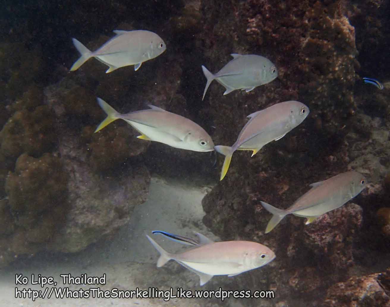
You might meet a few friendly Trevally coming in from the sea.

.
Back around the West side, near the little fishermens’ hut, I saw a Scrawled Filefish:

and a gorgeous Six-Banded Angelfish.

.
Further round to the WNW corner, there is a Dive site marked on maps. The coral in the shallows (2-4m) was pretty reasonable there:


.
Just as I got back round to the start and was about to leave Shark Island, this cute little Pinktail Triggerfish came up to say goodbye.

aaah..
.
.
Area F – Ao/Haat Saai Daeng
Arriving back at the tip of Laem Kong Saai Daeng (E) and continuing clockwise around Ko Tao – the Western side of the Laem Kong Saai Daeng (towards Ao Saai Daeng)

has some decent looking coral.

Continuing around the corner into Ao Saai Daeng itself, this continues:
.
It doesn’t last too long, though. As you head-in towards the beach, the bottom turns into rocks and you are into shark territory.
This North East end of Ao Saai Daeng is the most famous spot on Ko Tao for spotting sharks. (Scared about sharks? Read this). They can be difficult to see at first, but as you get your eye in and they get more comfortable, they will probably come within visible range. I went there at 7am and was the only one in the water. There were about six sharks there, about 1 metre long, all patrolling that end of the bay.


Sweet.
My big-boat snorkelling day-trip was supposed to stop here, but they skipped this location as some people had arrived late and they needed to make-up time, so I don’t know exactly where the boat trips park. Some people report not seeing any sharks here. I imagine having 50 snorkellers flapping around might be a good reason for them to stay away. Generally, you have the best chance of finding sharks at dawn and dusk.
.
Staying quite close to the rocks on the North East end of the bay and heading in towards the beach, there were a few other fish species worth seeing:


Mouseover for species names, or check out the species list.
.
Here’s a view along the beach, taken from the North East end:

.
Further along the beach, in the shallows, there were a few of these cute Banded Sleeper Goby.

.
Continuing South along the bay (and clockwise around the island) – the rest of the bay is spectacularly unspectacular. There is a shallow rake to the seabed. About 100m off the beach the water is still less than a metre deep. It mostly looks like this:
.
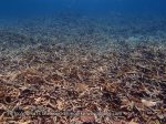
100+ metres away from the beach, the water is a little deeper, but the seabed is all dead, broken-up Staghorn coral. Thank heavens for those Rabbitfish brightening things up:

.
Here’s a shot looking into Ao Saai Daeng from the South Western end.

.
At the far (South West) end of the bay, there was a lot of Fungia Mushroom Coral sitting on the bottom.
.
.
Going around the cape into Thian Ork bay, there is some patchy, healthy coral on the rocky headland:


.
.
Area H – Ao Thian Ork
(btw, Ork is also variously spelled Og, Org, Ok. The Thai is ออก, which is ‘Ork’ in my book).
Ao Thian Ork is a long and good-looking beach. Don”t expect too much from the snorkelling though. The bay is dead coral, pretty-much throughout.
Here’s a spot outside Jamahkiri Resort at the East end of the sandy beach:

.
Schooling Rabbit/Butterflyfish save the day in these shots, but the coral is toast:


.
These bannerfish were making the most of the cover of a single bommy of Hump Coral in the middle of the bay.

In the centre of the bay, there was a line of buoys that looked like they were demarcing some kind of snorkel zone, but the coral was muck on both sides of it.


.
Out past the end of the main beach and past New Heaven Resort, there is a Dive site marked on some maps as “Biorock Artificial Reef”. Some maps show a ‘Taa Chaa Bay’ here. It was somewhere around here that I found this little field of healthy Staghorn coral

I’m not sure whether that’s officially the reef in the name of the Dive site, but I guess so.
.
.
H to J: Around the cape from Ao Thian Org into Ao Chalok Baan Gao
The big cape dividing Ao Thian Ork from the next bay, Ao Chalok Baan Gao, doesn’t seem to have a name (edit: I since found one map in Thai that calls it แหลมตาโต๊ะ, Laem Taa Toh). It is famous for having a viewpoint (John Suwan Rock) where you can look North and see those two beaches to the right and the left and also the rest of Ko Tao off in the distance (example).
There are two sacred rocks at the tip of the bay: Hin Aa Mae (aka Hin Ya Ai Mae) and Hin Taa Toh. I think that this one is Hin Taa Toh:

Underwater, the scenery is big rocks with some spots of varied coral:


.
.
Area J – Ao Chalok Baan Gao
You might find some alternative spellings for the name of this bay. The Thai is โฉลกบ้านเก่า – so it’s ‘lucky old house bay’, not lucky mountain house or lucky white house, as you might think.
Rounding the headland and looking back, you can see both sacred rocks – I think that that is Hin Aa Mae on the left.

On the West side, coral growth starts to pick up:

and I had a flyby from this school of Halfbeaks:

.
Heading along the cape towards the main beach, you will see a smaller beach on the right (Freedom Beach/ Freedom Beach Resort). There is a large patch of good coral about 50 metres off that beach.


The bigboat daytrips don’t come here but there were plenty of longtail and speedboat tours dropping snorkellers here, so it should be easy to find.
.
Heading in towards the shallows of the long, main beach, coral was patchy.

The Banded Sleeper Goby from (F) has a cousin living here:

.
The main beach is about 800 metres long. Underwater, there is a quite a shallow rake to the bay and you have to go out about 100m before you get past the skanky murk-zone and into the real coral.
Most of the deeper seabed in the bay alternates between live and dead patches of Staghorn coral.


Sometimes you get both in the same spot:

And there is the occasional patch of other species:


..but mostly it’s the Staghorn.
.
Midbay, I had a fleeting glimpse of some Yellowtail Barracuda

But the shallow waters generally seemed to be like this along the whole length of the main beach:

.
.
J to K – Around the cape from Ao Chalok Baan Gao to Haat Gun Jeua
Going around the headland past Viewpoint Resort

I mostly found broken-up, dead coral.


There were one or two exceptions in the bay:

.
…and off the point

.
but mostly it was shabby.
.
The main highlight was a visit from an inquisitive Barracuda:

.
.
Area K: Ao/Haat Gun Jeua
Gun Jeua is another place with different spellings. There are two spellings in Thai (กุลเจือ, จุนเจือ) and (at least) two romanised versions of each of those, leading to Kul Jeua; Kun Jeua; Jun Jeua as well as Gun Jeua.

Whatever it’s called, this bay is a long one, with rocky stretches at either end and a long beach in the middle section. Visually, it is dominated by the nasty-looking Pinnacle Resort.

Subtle.
.
Starting at the South Eastern end, the coral is all dead and broken up. These photos are sequential, working Northwards to about the midpoint of the bay.


You can see the condition improving a little as you reach the middle of the bay. This spot is near to the (new) Orchid Cliff resort:

.
Moving out into deeper water and continuing North West, the coral condition is better still:


.
and coming back into shallow water, it is all grotty again:

.
We are past the sandy part of the bay now and into the final rocky stretch. This is dominated by an Eastern extension of the old Tao Tong Villa. This new extension isn’t on any of my maps, but Tezza calls it Tao Tong 2.

Again, the corals in the shallow water are mostly dead:
You have to head out about 70m for things to get better:


Further out still, near this mooring buoy, there is an explosion of Staghorn coral:


.
Stay at this depth and continue North West towards the cape (Je Ta Gang) for some more fields of decent coral.


.
.
Area L : Laem Je Ta Gang (alt Jeda Kang)
Next comes a cute little cape. At its base is a small beach that connects to the bay on both sides. The original Tao Tong Villa is located here – it is a nice backpackery looking joint.

Heading into the sandy shallows, I had a photo session with a Batfish:

before climbing out and looking at the beach itself.
Here’s the view from the other side of the beach, looking Northwards up the coast.

.
Back into the water on the South West side, I took the scenic route and swam around the outside of the cape.
Saying hello to a Tripletail Wrasse on the way:
.
and heading out to the South Western end of the cape,

the underwater scene was this:

.
A little further round, there were some bulk corals:

Those are sea cucumbers at the front. Do you see the blue sponges on top of the Double Star Coral bommie at the back?
.
Here they are up close:

.
Further out was mostly plain rock:

.
And then rounding the cape into the Northern bay, there was some decent coral:


.
This one is looking back at Tao Tong Villas’ Northern beach.

and this one is the same thing, just taken from further out to sea:

.
.
The Long Stretch North.
The coastline straightens out here and runs on a simple North-South line for about 1.5km. There are a few tiny bays on this stretch. Various different maps name these differently. The freebie island map talks about a Sai Nuan Bay in the South and a Sai Nuan Beach further North. I follow this nomenclature. Tezza (and some other maps) label this area Sai Nuan 1 in the North and Sai Nuan 2 further South. No worries.
.
.
Area L to Area M: Cape Je Ta Gang to Ao Sai Nuan
Here‘s that shot again, looking North along this stretch L to M .
Underwater, the coral is largely uninspiring:


with the occasional quirk:


.
.
Area M: Au Sai Nuan (Sai Nuan Bay)

This is the place with Cha(r) Bungalow/Restaurant and Siam Cookies Bungalow/Restaurant and Banana Rock Bar. It looks like a nice, chilled-out spot.
Underwater in the shallows, the seabed was unspectacular

.
but there were a couple of small Sharks swimming around, which was a fun diversion:

.
There is a big rocky island in the water, not far from the beach.
I had a swim around it. The coral was unimpressive, but there was a Squaretail Coral Grouper sheltering underneath the rocks.


.
Slightly further North, and about 100m off the coast, the coral was slightly better:


.
.
Area M: Sai Nuan Beach

Continuing North to Sai Nuan Beach/Sai Nuan 1, and a good way out to sea, the coral was rather tasty:


.
I also saw this unusual Butterflyfish here. I haven’t seen this one before. It seems to be an Ocellate Butterflyfish/Coralfish, Parachaetodon ocellatus

.
.
Area N to Area O: Sai Nuan Beach to Leam Hin Saam Kon
Continuing North from Sai Nuan is a long, rocky stretch, at the surface.
Underwater, the coral is mostly uninspiring.

with the occasional decent patch, further out from the land:

Generally, the condition of the coral here improves as you travel North.
.
About halfway along this stretch, I saw a good-sized shark :


.
I’m not certain, but I’m guessing that this resort is either Koh Tao Bamboo Huts, or maybe a Southern extension of Charm Churee Village:

.
There is some good coral here, especially 30+ metres away from the shore.


.
.
Area O: Leam Hin Saam Kon
This is a mostly unremarkable cape, just before you get to Jansom Bay.
There were a few bulk corals,

But, underwater, was mostly deep rocks, with a few interesting fish:


Do you see the Grouper departing?
This is the surface view as you approach the turn into Jansom Bay. You can see the Bungalows of pricey Charm Churee Resort across the mouth of the bay.

.
.
Area P: Jansom Bay
Jansom bay is a cute little inlet enclosed on three sides by high cliffs and expensive resorts. As you emerge from consuming your grasshopper in the Elvis bar, you can go for a snorkel in the sheltered bay.
Mostly the coral is a murky grey-green. There were a few more varied coral species present

and some interesting fish, including these Honeycomb Rabbitfish:

and some schooling Virgate Rabbitfish:

.
.
Area Q: Around to Mae Haat
This is the final run back into the main shipping, transport hub of Mae Haat. We’re getting into heavy-boat territory here and this area isn’t really suited to leisure-snorkelling.
Coming out of Jansom bay and past its Northern rocks, you see this thing, waiting to be beamed back up to the mothership. I guess this is an extension to Charm Charee Village.
.
The coral here was in OK condition, but was short of diversity.

Past a couple of intriguing pipes going out to sea (?water for dive boats?) and Jansom Bay Bungalows


you are into Mae Haad itself.

.
There is some reasonable coral near to the rusting lighthouse


.
and a few more bits and pieces as you head in towards the beach at Mae Haat.


.
As you enter the shallows, you might find this old iron shipwreck
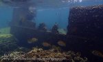
.
.
Continuing towards the main beach, the patchy coral gets shallower and shallower

until you have to stand up and tippy-toe your way back onto Haat Mae Haat.
.
.
Area R: Mae Haat
Mae Haat is where all the big ferries arrive. I imagine that the jetty area is not suitable for snorkelling, but I ain’t about swim through the bilgewater and crap to try it out.
There are sandy beaches to the North and South of the jetty area. I can’t say that I have tried snorkelling these, but from the surface they look very much like ‘boring sandy bottom’ territory.
.
.
Area S- Sairee
Sairee (beach) is the main touristic beach on the island. The few spots I have checked out (in the middle of the bay) were all plain, sandy bottom. I suspect that all the rest is the same.
There is also a fair amount of boat traffic in the bay during the daytime. Here is the bay at 6am, before everone wakes up:

.
.
Area T: Sairee to Sun Lord Bungalows
Immediately to the North of Sairee beach there is some OK snorkelling. If you are on Sairee beach, go out to the headland at the right-hand end of the bay and have a look around there.
I snorkelled a lot around here on my 2009 trip, but I didn’t have an underwater camera then. The coral is OK, but not spectacular. It was already dark when I passed through on my 2013 visit, but these crappy flash shots might give you an idea of what the coral is like.


Note that if you are starting at the Sairee end, you will have to turn around and swim back to Sairee when you finish. You can get into the water at the Northern point (Sun Lord Bungalows), but you can’t get out.
If you want to cover the whole stretch, walk the 1.5km along the main road North from Sairee until you get to the Eden bar building on the left.

Then take a sharp left turn and walk down the big hill, through Sun Lord’s restaurant and on down to the rocks where you can hop into the sea and start swimming South.
.
.
Nang Yuan Island
You must have seen pictures of Nang Yuan Island (Ko Nang Yuan). It is a picture-postcard combination of three rocky islets all linked together by a white sand spit. Go on – do an image search for it now.
It is a privately-owned island and they charge you for setting foot on it. In the daytime, it is absolutely packed with daytrippers. Neither of these things appeal to me, so I swam there at dawn instead.
Like with Shark Island in the South, it isn’t safe to get here by swimming after the tourist boats start up around 8:30am. So if you are going to swim it, you have to be out and back before then.
To get there, walk as far North as you can on the Sairee road. There is a fancy resort at the end of the road and you can cut through it to get to the water. I think that the resort is called the Dusit Buncha. If you get to the Dusit Buncha and there is still a long tarmacced road ahead of you, keep going until you get to the last resort.
Be polite and respectful as you pass through the nice peoples’ classy resort. The path through the breakfast area leads you to some steps and prominent rocks, right by the sea.

There is a tiny jetty for boats. You can jump in the water here, but it looks like it might be difficult to get out. Don’t start something you can’t finish – before you get in the water, figure out whether you will be able to get out at the end! I wasn’t planning on getting out here, so I didn’t pay much attention to it.
.
.
Area U – Dusit Buncha resort
While I was in the area, I had a quick look around underwater near the Dusit Bancha jetty.


.
It is a boring, twenty minute swim across the strait to Ko Nang Yuan.
.
.
Area V – Nang Yuan Island

Arriving at Nang Yuan near the swimzone markers at the South East beach (V1), I was greeted by a nervous Blacktip Shark,

and a disinterested (poisonous) Sea Snake (aka Sea Krait)
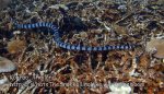
While we’re on the subject of poisonous – take a look at my safety section.
.
The corals around here were all broken up,
but there was lots of Mushroom coral with their tongues out.

.
.
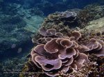
I had heard that the best snorkelling was at Area V2, so I headed straight over there. Well – I wasn’t disappointed. This is possibly the best hard coral you will see while snorkelling in Thailand:


.
Next, heading South to V3, (on a track just outside the designated swim zone), the coral quality dropped a little, but it was still very respectable.


.

Daahling – I am suuuuch an artiste 😉
.
On the North side of the middle island (near V4) a Titan Triggerfish was demolishing a sea urchin and a gathering of the local reef-fish-association was patiently waiting for the scraps.
.
They got some in the end

but you can understand them waiting – you wouldn’t want to get on the wrong side of those chunky teeth.

.
Further along, someone was seeding some corals. Good for them.

.
A bit further round, near area V5, there was some reasonable coral


.
.
and sponges

and some Virgate Rabbitfish trapped in an old fishermens’ net.

I tried to help them out, but they didn’t want to know.
.
.
Just inside the South Eastern swimzone (V6), there was some healthy, smallish coral


.
Outside the demarcation zone, the corals were broken up at the Northern end (V7)

.
with some friendly Trevelly passing by

.
Going further South towards V8, the seabed was rockier and the corals a little more healthy


.
continuing on South, drawing level with the Southern Island (V9), the corals all turned to crap.

.
even the Sea Urchins were trying to get out. Unfortunately the ‘Aerial Rescue’ division of the escape committee were continually let down by those slackers in the ‘H’ and ‘P’ teams.
__________
 _________
.
.
Moving on to the South West Corner (V10), coral condition picked up again:


.
The coral in and near the Western swim zone (V11) was OK, but nothing spectacular:


.
.
A chilled-out Grouper slinked away lazily, as I approached

Here is a view outside the Western Swim zone, looking North.

There always seem to be lots of Diveboats parked-up around here. I tried to plunge down to see what they were looking at, but whatever it was, it was beyond snorkelling depths.
.
.
The mid-West side was a mix of good and average. This Hump coral covered in Christmas Tree Worms was attractive:

and this Milkfish disappearing off into the distance, was an unusual spotting:

but the highlight of the wildlife trip was probably this lovely Dotted Nudibranch (Jorunna funebris).

I saw a couple of them around Tao, but this was the largest one at about 6cm long. They eat the blue sponges.
.
Now, if I could only get that butterflyfish to move into shot. . .
.
.

That’ll do!
.
.
Further on North, there was some more Hump coral/Xmas Tree worms and a school of Topsail Drummers passing by:


.
And beyond that, some more interesting coral:

.
Going round to the Northern coast – there was this unique field of soft coral:

and some interesting rock formations:


.
.
Going around the North East point:

(that’s the tallest (380m) peak on Tao in the background)
.
I found another long patch of really impressive, diverse coral here, similar to Area V2.


.
Looking back at these pictures now, the coral doesn’t look as good as I remember it. I’m not sure if that is due to my memory or my camera, but this area is worth looking at if you have the time and finpower. You don’t have to swim all round the island – it’s quicker to get there from Area V2. I saw some folks with kayaks, so I guess you can get them from the resort on Nang Yuan.
.
.
the swim back down to V2 was a mixed bag. A lot of it was steep rocky drop offs like this.

.
.
Area V to Area W: Ko Nang Yuan to Ao Ma Muang (Mango Bay)
After looking right, left and right again, I did the long boring swim back to Ko Tao. Arriving back on its West coast, the underwater scene was the usual ‘big rocks with bits of coral on top’.


.
Continuing North, there was a small bay with a line of demarc buoys for longtail boat-trip snorkelling. There was a small patch of Staghorn coral there but the marked-off area was nothing too exceptional.

.
You often see small white Sea-Cucumbers (Synaptula lamperti) living on the surface of Barrrel Sponges. The pairing has a symbiotic relationship. The cucumbers are protected from predators by the toxicity of the sponge and the sponge gets cleaned by the cucumbers’ feeding on the detritus settling on it – keeping its pores unblocked. These Sea Cucumbers had grown-up big and strong.

.
The North West corner of Ko Tao is called Laem Namtok (Waterfall Point). It looks like it used to be sponsored by Scotland or something:

Geologywatch
.
It is an hour’s swim from Laem Namtok to Mango Bay.
Here is a (sequential) set of snaps along the way:


About half-way (at W1 on the local map, below), there are a few abandoned huts in a little bay.

I’m not sure if this is an ex-resort or just fishermens’ huts. The first half of the sign is just the address of the place, I can’t see the second half.
.
Continuing on from W1 to Mango bay…


.
When you see a dozen snorkel boats off in the distance, you can conclude that you are close to W2, which (I guess) is considered to be the start of Mango Bay itself.

.
.
Area W: Mango Bay (/Ao Ma Muang/Au Muang)


All images on this site are clickable for bigger versions.
Mango Bay is large, idyllic, rocky bay. It has a tiny beach and two expensive resorts. There is good snorkelling on the East side of the bay and a roped-off swimzone. All the snorkelling day-trip boats come here.
There is a ‘road’ that leads to Mango Bay from the main part of the island, but it is very steep and in very bad condition. I recommend not taking a rental bike/motorbike on it. The road goes past the back of Ao Muang Resort. There is a tiny side track that leads down into Ao Muang Resort itself, but it is almost impossible to find. The main road continues on to Mango Bay Grand Resort where vehicles can park-up and people can walk down a long, easy-to-find track to that resort. At sea level, the two resorts are only about 200m apart, but there is no road/track between them. You could probably rock-hop it.
The most practical way to get to Mango Bay is by boat.
I was swimming-in from the West, so this was the view from point W2 (on my local map, above), as I entered the bay.

That’s Mango Bay Grand Resort on the right. You can also see Mango Bay Resort’s elevated restaurant in the distance, behind the second yellow flag.
.
Here are some (sequential) photos, along the stretch W2 to W3.


I have marked a W4 on the local map, because I notice that my pictures from the (busier) daytrip day show some big boats moored up there. I didn’t check this area – it might be worth a look.
Arriving at the beach, I climbed the mountain of steps and stopped-in for lunch at Ao Muang Resort’s restaurant. 180B for a fried rice with chicken seems like a crime to me. But I guess it’s worth it for the view:

This is mid-afternoon, after all the daytrip boats have moved off.
.
The best snorkelling is on the right (East) side of the Bay. My daytrip boat from a few days previous had dropped us by the little rocky cliff, behind the speedboat.

I wanted to explore a wider area, so went out to the far cape on a ‘deeper’ track (W5-W6-W7) and then came back closer to the shoreline (W8-W9-W10).
If you look at the photo closely, you can see the demarc-line of buoys for the swimzone (running past the speedboat and the distant longtail). Only W10 is inside that swimzone.
.
Here’s a (sequential) set of photos going out from the beach along line W5-W6-W7:


.
I turned around at the Eastern cape and headed back, closer to the land this time. Here are some (sequential) pictures from W8 to W9:


.
My daytrip snorkel boat had dropped us at Area W9 – these pictures are all from the daytrip, around W9:


.
And finally, here is the (shallower) return to the beach W9-W10, latterly passing through the swim-zone:


.
.
Area X – The Northeast corner
My visa was running out and I didn’t get time to cover this corner. Maybe next time eh?
Here’s a picture from a boat – you can see the lighthouse top-left.

.
oooooooooooooooooooooooooooooooo
.
.
Well, that’s it for the snorkelling.
Like I said at the start, what area is ‘best’ depends on your preferences about beaches, access to transport and the price of accommodation.
Classic contenders for best coral are Hin Wong (A), Nang Yuan (V) and Mango (W). But I was also unexpectedly pleased with Leuk (D) and the little patch outside Freedom beach (J).
Tanote (C) is good if you value convenience.
The sharks at Sai Daeng (F) were fun and the ones at Sai Nuan (N) were unexpected.
Up to you.
000000000000000000000000000000000
I haven’t said much about life up-top.
Ko Tao has a well established tourist industry and there are a hundred web sites out there with useful information about the place.
Tezza exceeds his usual excellent standards in his comprehensive post about Ko Tao. He has even done a dedicated page for Ko Nang Yuan. I urge you to have a good read of both. He also covers walking routes to beaches and walking distances/times between places. I had always regarded Ko Tao as a big island, but I found that it’s surprisingly easy to walk to places that look like they should be very far away.
Roads
The roads on the main, touristed Western side (Sairee-Mae Haat-Chalok) are tarmacced /metalled and reasonably flat. But if you go to the more remote parts of the island, it is a different story.
It doesn’t look like it, but this is a really steep hill. How would you like to be hurtling down it on your rental motorbike only to find that the road just stops in mid-air, Mr Keneval ?

I can’t communicate just how bad the roads are in places. And steep. Steeper than you could ever imagine.
It is possible to rent All Terrain Vehicles (ATVs)/Quadbikes, but they aren’t good for the environment and some resorts won’t let them in the car park/premises. If you have to get one, please drive it respectfully and don’t turn peoples’ villages into a racetrack.
Tao is somewhat famous for motorbike rental scams. That is – when you return your rented motorbike at the end of the day, the renter points out numerous scratches and scrapes on the paintwork and refuses to return your passport until you pay him the 300 US Dollars it will cost him to put it right. Tao’s police stations are full of angry tourists trying to get satisfaction on such disputes. It is not a very nice was to spend your holiday. It is better not to rent motorbikes in the first place, but if you have to, don’t get them from the main streets in the most touristed areas. And, given the state of the roads, remember that there is a strong chance of you dropping the thing and scraping-it-up for real – so get ready to pay-up.
Or just take that taxi-boat instead. Or walk.
Diving
Tao is famous for training new divers and holds PADI’s world record for most revenue, sorry, certifications per year. If you are new to the sport, you will love the training experience, the diving and the camaraderie. Old-hands might find the diving a little dull compared with some other places. I definitely recommend doing a dive out at Chumphon Pinnacle. It is a sea mount about 15km NW of Tao and is filled with schooling fish. I went there with New World Divers – a small outfit in Sairee who go an hour before everybody else, so you have the place to yourself. Sail Rock (halfway to Pha Ngan) is the other classy-spot. I enjoyed it, but the visibility was bad when I was there.
There is no shortage of dive shops on Ko Tao. I imagine that they are all perfectly safe and competent.
Cheap?
Ko Tao is no longer a place where you can get a 200B hut on the beach. Cheapskates might be shocked at the prices. Cheaper options include: a couple of aircon dorms in Sairee; a couple of old-school backpackers places in Hin Wong and Lang Khaii and various unglamorous places in Mae Haat town, all around 400B.
Full-mooners flock over from Pha Ngan straight after the party and Sairee is packed (and the prices go up) for a few days afterwards.
General planning
Here are a few useful looking websites: 1 2 3 4 5 6
If you are doing internet searches for information about the island, searching on the name of an obscure bay or rock might get you past the wall of hotel booking sites. If you are looking for pictures, you could search on the Thai spellings of the placenames (I have put a list of them at the bottom of this page).
If you are looking for information on specific hotels, there are the usual sources (tripadvisor, etc).
They give out free maps of the island at the ferry terminals. These are updated a couple of times a year. Here‘s one from 2012.
That’s it. Have fun
.
.
Thai spellings:
Ko Tao – เกาะเต่า – Turtle Island (say “Tao” with a deep note, otherwise you are saying “Stove Island”)
Haat/haad – หาด – Beach
Ao/ Au – อ่าว – Bay
Hin – หิน – Rock
Laem – แหลม – Cape/point/headland
Ko/Koh – เกาะ – Island
Placenames (starting at Hin Wong (Area A) and going clockwise). English translations are mine and might be wrong!
Ao Hin Wong – แหลมหินวง – Ring of Rocks Bay
Laem Hin Wong – อ่าวหินวง – Ring of Rocks Cape
Ao Mao – อ่าวเมา – Drunk Bay
Leam Thian – แลมเทียน – Candle Cape
Ao Tanode – อ่าวโตนด – Palmyra palm tree Bay
Ao Lang Khaai – อ่าวหลังค่าย – Back-camp Bay
Ao Leuk – อ่าวลืก – Deep Bay
Ao Hin Ngam – อ่าวหินงาม – Beautiful Rock Bay
Laem Kong Sai Daeng – แลมกงทรายแดง – Red boat-frame Cape (?)
Ko Chalaam – เกาะฉลาม – Shark Island
Haad Sai Daeng – หาดทรายแดง – Red Sand Beach
Ao Ta Som – อ่าวตาสม – Orange eye Bay (?)
Ao Thian Ok – อ่าวเทียนออก – Departing Candle Bay (?)
Ao Ta Cha – อ่าวตาชา – Numb-eye Bay
Jot Chom Wiw John Suwan – จุดชมวิว จอห์น ซูวรรณ – John Suwan Viewpoint
Hin Ar Mae – หินอาแมะ – Dispose-of-Uncle Rock (!)
Hin Ta Toh – หินตาโต๊ะ – Eye Table Rock
Laem Ta Toh – แหลมตาโต๊ะ – Eye Table Cape
Hin Por Ta Toh – หินพ่อตาโต๊ะ – Father Eye Table rock (?)
Hin Yaai Mae – ยายแมะ – Dispose-of-Grandma Rock (!)
Hin Kai Chaa – (?) หินไข่ชาว์
Ao Chalok Baan Kao – อ่าวโฉลกบ้านเก่า – Lucky Old House Bay
Haad Son Chao – (?)หาดสานเจ้า
Laem Kul Jeua – แลมกุลเจือ – Cape of something mix
Ao Kul Jeua – อ่าวกุลเจือ
Laem Jun Jeua – แลมจุนเจือ – Cape of Help
Laem Jae Ta Kang – แลมเจ๊ะตะกัง
Haad Sai Nuai – หาดทรายนวย – Beautiful Sand Beach
Haad Sai Nuan – หาดทรายนวน – something Sand Beach
Laem Hin Sarm Kon – แหลมหินสามก้อน – Three Rock Cape
Ao Jansom – อ่าวจันสม / อ่าวจันทร์สม – Crescent Bay
Ao Ta Saeng – อ่าวตาแสง – Ray of Light Bay
Ao Mae Haad – อ่าวแม่หาด – Big-Momma Beach Bay
Haad Sai Ree – หาดทรายรี – something Sand Beach
Ao Sai Ree – อ่าวทรายรี – something Sand Bay
Ao Ta Kan Di – (?) อ่าวตาคันดิ่
Laem Yaai Yii – แลมยายญี
Ko Nang Yuan – เกาะนางยวน – err, ‘Stimulate Lady’ Beach
Laem Nam Tok – แลมน้ำตก – Waterfall Cape
Ao Ma Muang/ Ao Muang – อ่าวมะม่วง / อ่าวม่วง – Mango Bay
Laem Kha Joam Fai – แลมกระโจมไฟ – Lighthouse Cape
Kluay Thoen Bay – อ่าวกล้วยเถื่อน – Illicit Banana Bay
.
.
————————————————————-
Written: June 2013 . . . . . . Last updated: June 2013


")
")


 Kaun aim/im rock) on the corner, at E. This kind of formation is considered sacred by Thai people and they celebrate it by tying long ribbons around it.


 friendly, chilled out vibe – the owner cooks the evening meal on the campfire and everybody eats it together and contributes toward the cost. Their tents are 200B. They are open all year round. It is called Freedom Campsite and/or


