
Wakatobi National Park, Sulawesi, Indonesia
![]()
![]()
All images on this site are clickable for bigger versions.
.
IN BRIEF :
Wakatobi Marine National Park is an archipelago of islands off the South East corner of Sulawesi in Indonesia. It has four largeish islands (~20km long), plus numerous smaller ones. It is sometimes known by its former name – ‘the Tukangbesi Islands’.
Wakatobi is great for reef-fish. The area is famous for its diversity and I saw several species that I haven’t found anywhere else. The fish are usually present in good numbers. Sometimes, the old “like swimming in an aquarium” cliché applies. Don’t expect to see any big stuff (sharks, etc.), though.
The soft-coral is awesome in places, but most of the hard-coral in snorkelling depths is dead.
Wakatobi is known more as a diving destination than a snorkelling one, but there is some good snorkelling if you know where to look.
Except on Hoga Island and at one super-expensive resort near Tomia, you won’t find anywhere where you can just roll out of bed and float out to the reef. Most places, you will have to get on a motorbike (/taxi) and drive 10km to reach that choice snorkelling spot.
Wakatobi is a remote area without much international-tourist infrastructure. Bring lots of time & patience; a sense of adventure and a few language skills.
Sleeps:
At the luxury end of the market, there is one exclusive, super-expensive resort hidden away in a remote corner. We’re talking 3000+ USD for a (minimum) stay of 5 days. It boasts its own airstrip! Fancy.
Mid-range: There are a couple of resorts in the 50-100 USD price range.
Low-end: It is perfectly feasible to visit Wakatobi on a tight-budget – there are many options for local-style (=cheap) transport, food and accommodation.

All images on this site are clickable for bigger versions.
Here is a sketch of the main five islands:
Wanci (aka Island 1 or ‘Wangi Wangi’)
Pronounced ‘wan-chee’, Wanci is the entry-island for the archipelago. Most people just pass through on the way to Hoga, but Wanci has some good soft-coral and fish on the North West corner, about 8km out of town. There are plenty of places to sleep in the main town; and the ferries to the other islands depart from here.
Kaledupa (aka Island 2)
Large and very remote – this island is mainly used by travellers as a (necessary) stop on the way to the more popular Hoga Island. There are a few local homestays on Kaledupa, but otherwise there is no tourist infrastructure. I’m told that the underwater visibility is poor. I didn’t really check out Kaledupa much.
Hoga
Located off the North East coast of Kaledupa, Hoga is the main destination for travellers. It has a beautiful, long, sandy beach and a few resorts and homestays – making it one of the few places where you can roll out of bed and onto the beach. About 150m off the beach, there is a drop-off with some good soft-coral and fish-life. Nearly all of the hard-coral is dead. There is a research/field station here and from May-September the island is over-run with European university students.
Tomia (aka Island 3)
The best ‘off-the-beach’ coral that I saw in Wakatobi was in Tomia – about 3km from the main town. There are guesthouses and homestays in the towns, but no resorts – you will need to rent a motorbike (/taxi) to get to the beaches and snorkelling spots. It is also possible to charter a boat for a 30 minute journey to some fantastic (world-class) offshore reefs. The super-expensive Wakatobi Dive Resort is located on a small island nearby.
Binongko (aka Island 4)
The last island in the chain is remote and rarely visited. There may be one or two homestays there. I didn’t go to this island.
Season:
I visited Wakatobi in August, which, despite being the dry season in the rest of Sulawesi, is not the best time for weather in the Wakatobi Islands. There was no rain, but wind and waves can make ferry journeys precarious and waves breaking on the reef-tops turn some spots into no-go areas for snorkelling. Underwater visibility ranged from good to appalling (15m to 3m) and I found the water a bit cold. Apparently, sea conditions are better in October/November and June/July.
Conditions:
Most snorkelling spots require a long wade/paddle through grassy shallows before you get out to the reef so take something solid to wear on your feet and try not to damage the wildlife. Currents weren’t much of a problem. See my page on safety for more general tips.
Transport:
There are daily ferries to Wanci from Kendari and Bau Bau in South East Sulawesi. Apparently, there are no speedboat ferries on that route any more, you’ll have to take the slow-boat. There are also slow ferries from Bau Bau to Kaledupa. There are daily flights Makkasar-Kendari-Wanci with Lion Air (Wings Air).
Public transport between Wakatobi’s islands is on small (~15 metre) wooden ferries. There are typically one or two sailings per day. Speedboat ferries weren’t operating when I visited, but check folks’ comments at the bottom of the page for updates.
Best-ish seascape:

Typical seascape:
It is difficult to select a ‘typical’ picture for Wakatobi. You will want to head for the best spots. If you just jumped onto the reef at a random spot, it might look like this.
All images on this site are clickable for bigger versions.
– – – –
IN NOT-SO-BRIEF:
All images on this site are clickable for bigger versions
A: Orientation
Topside:
Wakatobi used to be called the Tukangbesi Islands. Then, in 2002, much of the area was declared a National Park, which was named Wakatobi. The word “Wakatobi” is just the first two letters of the four big islands:
Wa nci
Ka ledupa
To mia
Bi nongko . . . .clever, huh?
The delineation of the National Park is shown on this map.
.
The traveller’s lifestyle:
The main attraction of the islands is the beautiful natural surroundings. Up top, you have lush greenery and some picture-postcard, palm-fringed white-sand beaches:

Below the waves, there is a vast diversity of reef-fish and a multitude of colourful soft-corals swaying in the, err, breeze.
However, despite the holiday-brochure looks, there aren’t many tourists around. Apart from a handful of mid-to-high-end diving resorts, there isn’t much foreign-tourist infrastructure. Wakatobi has an indigenous population of ~100,000. They are occupied by fishing & farming, not tourism.
Travel will be local-style. If you are used to travelling in Indonesia, this isn’t a big deal. But if you are new to the country, you should find-out what that means before coming. It means that it will be difficult to find where that ferry leaves from, or when it leaves, or whether it is running at all today. There aren’t helpful signposts or timetables around, because the locals who use the boats have been doing it all of their lives. It is unlikely that anyone around will speak English.
If you do manage to find a ferry, you might have to sit on the floor for the whole four-hour journey. As the boat departs, get ready to be doused by big waves as they splash in through the open windows of the rocking tub. As you strap-hang your way to the hole-in-the-floor toilet, be careful to side-step the patches of sea-sick on the floor, as they can be very slippery.
As you approach your paradise island, you might have to climb over the side of the ferry to make a mid-sea transfer into a local-boat the size of a bathtub. Your bathtub then splutters across the shallow waters to get you to dry land. Well, almost to dry land – you might have to get out and push it the last 30 metres, because the shallow waters were too shallow for it to float all the way to that wooden ladder leading up to the sidewalk.
At least when you get to your guesthouse you will be able to take a nice refreshing shower, eh? Well, maybe not. You might find that there is no water until 6pm when the island electricity comes on and pumps the ground water up to the overhead tanks. When the water does come on, you might find that your ‘shower’ is comprised of you ladling out plastic scoopfuls of water from a bucket and tipping it over your head. And that the soap doesn’t really work, because the water comes from a well which is a mix of fresh and salt water.
Still, at least you can relax and have a cold beer, eh? Well, probably not. The area is 99% Muslim and, apart from at a few resorts used by foreigners, you probably won’t find any alcohol on sale. And don’t be thinking you’ll be wearing that bikini on the beach – you’ll need to cover-up to respect local sensibilities if there is anyone around.
All this is pretty common stuff when travelling remote spots in developing countries. It’s not a big deal and you get used to it. If you are happy with a squat toilet, then you’ll be fine, but I met several people who had arrived in Wakatobi expecting it to be Paris-on-sea. They were quite freaked-out by the lifestyle there. If you need your home-comforts, it might be better to stay in Bali.
Talking about Bali – the super-expensive resort in Wakatobi has private charter flights direct from Bali to its own airstrip in Wakatobi. Their guests (i.e. people with $1000 a day to throw around), can bypass all the hassles of the real world. They can even opt for the personal ‘butler’ service to save making that troublesome walk from the bed to the minibar! Those of us not on a movie-star incomes will need to be ready for the character-building experience of using the same facilities as the locals.
Still reading? Well, alright, then.
.
Access to the snorkelling:
About 70% of Wakatobi’s coastline is cliffs. The good snorkelling spots are as much defined by the ability to get to the spot as it is by the state of the coral there. Except in Hoga, you will need to use road transport to reach sections of coastline where you can actually get into the sea.
Road transport probably means renting a motorbike. This may be an enterprising local’s own machine and might not be in the best condition. Alternatively, you can usually find an ojek (motorcycle taxi) in the towns, but be clear about making arrangements with the driver if you are day-tripping to a remote beach and want picking-up again later on. Your driver won’t speak English.
Sedan taxis and car rentals do exist, but seem to be pretty rare. I didn’t see anywhere where you could rent a (pedal) bike.
.
Here are a few Indonesian words used in the text:
Bajo – an ethnic group of seafarers who live in houses built on stilts suspended over the sea
Dermaga / pangkalan / pelabuhan – jetty / port
Desa – small village (abbreviated to D. on maps)
Jalan/ Jln. – Road
Mandi – ‘Shower’ – actually a concrete reservoir that you scoop water out of to shower with (and sometimes flush the toilet with)
Ojek – motorbike taxi
Kampung – village (abbreviated to K. on maps)
Penginapan/ Losmen/ Wisma – guesthouse or low-end hotel
Pantai- beach
Pulau – island (abbreviated to P. on maps)
Warung – local restaurant
It would be wise to learn some basic Indonesian before you arrive – please, thankyou, numbers, hours, days, “where-is” – that sort of thing : Some linkies: 1 2 3
IDR means Indonesian Rupiah. USD means US Dollars.
That’s about enough top-side orientation for now. In the detailed sections below, I’ve gone into a lot of detail about transport and logistics, coz Wakatobi isn’t covered very well in the travel books.
.
Underwater Orientation:
Detailed descriptions of the snorkelling spots are given down the page, but here are a few general points:

Back Reef:
You can see from satellite pictures that each island is surrounded by a fringing reef, with a drop-off some 30-150 metres away from the coast (The drop-off is at the border between the light-blue and dark blue areas on the satellite picture). The areas of snorkelling interest are (1) the reef-top in the last ten metres closest to the drop-off; and (2) the drop-off itself. To reach the interesting parts, you usually have to get across ~40 meters of sandy/grassy shallows. At higher tides, you can snorkel through the shallows (it is always better for you and the environment if you get horizontal as soon as possible). But, at lower tides, it may be too shallow and you might have to walk across (you will need something solid on your feet); or wait for the next high-tide.


High tide and low tide in Tomia.
Note that there might be undesirables (like spiny Sea-Urchins, Sting-Rays or Scorpionfish) lurking in the shallows.
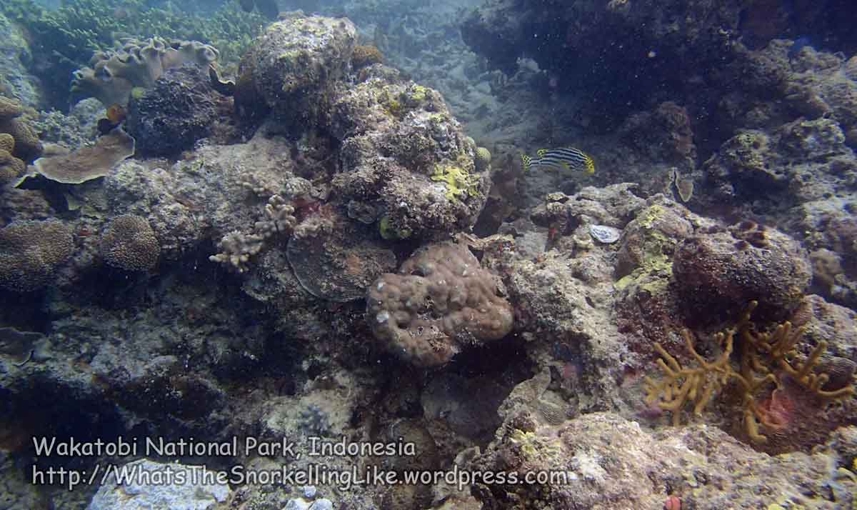
Hard-corals:
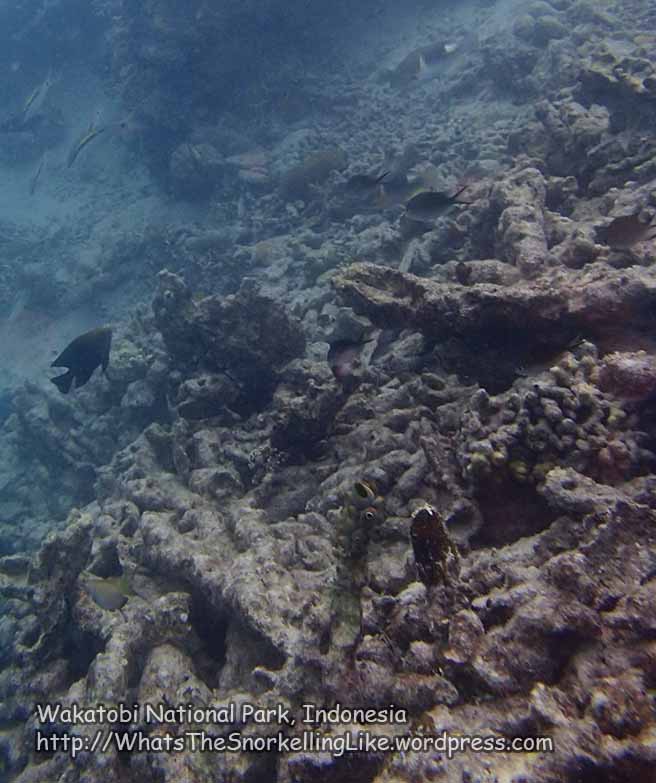
Given all the hyperbole I had read beforehand, I was expecting more from the corals. Most hard-corals I saw were dead – presumably from earlier dynamite-fishing or climatic trauma.
Soft-corals:
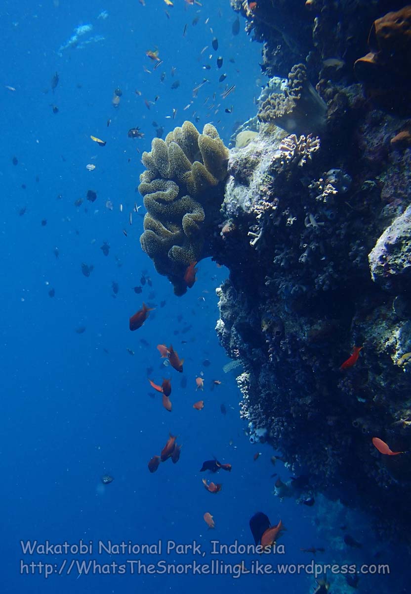
The soft-corals are the stars of the show. There are many colourful and diverse species to be found. In those spots where they all occur together, there is a veritable firework display of frondy arms waving about.
Fish:
The fishies are a big attraction. Wakatobi is famous for its species diversity and any dive resort web-site will tell you exactly how many hundreds of fish species there are.
You can expect to see everything from my East Indonesia Common Fish page, plus many more besides.
A few species (Indian Triggerfish, Redtoothed Triggerfish, Pyramid Butterflyfish) are usually found in large schools, but, in other cases, you will be looking at one-or-two specimens from each of many species of fish, rather than lots of fish of the same species.
There are lots of fish pictures in-line down the page, but worthy of special mention here are the Bicolor Angelfish; the Keyhole Angelfish and the Yellow-eye Filefish :


I found that the fish were a bit nervous. I guess that the National Park has not been established for very long and the fish are still used to running for their lives when splashy people show-up. Locals are still allowed to fish in the Park and a wander around the markets will reveal many fish who weren’t quite nervous enough.
Big stuff:
In two weeks’ snorkelling I only saw two turtles. No sharks. No dolphins, mantas or yetis. The local markets are full of tuna (some of them the size of a car!), but the biggest thing you are likely to find on the reefs is the occasional Bumphead Parrotfish, Bluefin Trevally, Humpback Unicornfish or some of the bigger Angelfish like the Six-Banded, Blue-Girdled, Yellowmask or Regal. (note: these are library pictures from my specieslist and weren’t taken in Wakatobi).
.
Btw, my camera had a stroke in Wakatobi. I couldn’t use the zoom or bump-up the resolution beyond 3 megapixels. Consequently, Wakatoban close-ups (mostly maps and fish) are unusually grainy. Sorry ’bout dat. It could have been worse, I guess.
.
Areas covered:
The areas I snorkelled at are marked by the burgundy lines on the maps below. The islands are quite big and there is no way I could cover all of the coastline, so I took the approach of asking locals about the best snorkelling spots and starting with those. I also dipped-into as many other ‘random sample’ spots as I could.
I had hoped to cover more, but the combination of distances, cliffs, tide and surf made this difficult. I think I have got most of the main spots covered.
.
All right, that’s enough preamble. On with the details.
If you want to go direct to a particular section, you can do a local search {Edit>Find (on this page)} on one of these textstrings:
C: Kaledupa Island / Pulau Kaledupa / Island 2
D: Hoga Island / Pulau Hoga
E: Tomia Island / Pulau Tomia / Island 3
F: Tomia Environs
G: Binongko Island / Pulau Binongko / Island 4
H: Other places
Otherwise, just read-on:
.
B: Wanci Island / Pulau Wanci / Island 1 / Pulau Wangi Wangi
You mostly see this island labelled as ‘Wangi Wangi’. Officially, the island is named “Wangi Wangi” and the capital ‘city’ is named Wanci (pronounced ‘wan-chee’). However, it seems that anyone under the age of fifty calls the whole island Wanci, so I’m doing the same.
Wanci is the entry-point to Wakatobi National Park. Most people just pass through on the way to Hoga, but if you have the time, Wanci has some good soft-coral and fish on the North West corner, about 8km out of town.
There are plenty of sleeps in the main town and all the ferries to the other islands depart from Wanci.
.

All images on this site are clickable for bigger versions.
.
If you ask the locals where the snorkelling is, they will point you towards Area 2b/2c– the jetty near Sombu. If you are in a hurry while reading this, just skip forward to that part.
I rented a motorbike and also dipped-in to a few other spots around the Northern half of the island.
Wanci town has a grid layout with three or four main streets running parallel to the coast. To get on the Northern coast road, pick the main one (the biggest one, nearest to the sea) and just keep going North. As you leave Wanci town, check your mileometer as you pass the big mosque with the blue and white dome (G4 on the town map below).
.
Wanci Area 1
I stopped first at Area 1 – about 7 km North of town. It was a mostly random selection, but this spot has easy access to the sea via some waste ground between the houses (mostly, the coastline is occupied by peoples’ houses, so you would have to drive/park in their garden to get to the sea).
For the first of many times that day I changed my Mr Benn outfit from motorbiking-guy to snorkelling-guy and launched myself into the water.
After passing the little floating house:

..it was a tedious 80m swim over sandy / weedy bottom to reach the reef.

There is a lot of this in Wakatobi.
Approaching the drop-off, the sea-bed starts to show some coral growth.

And, at the drop-off, it becomes a more grown-up version:

Note that the fish scooting away, mid-frame, is a Mimic Surgeonfish (Acanthurus pyroferus).
Overall, Area 1 had OK, but not spectacular corals. It won some extra kudos points by providing my first sight of the delightful Bicolor Angelfish (Centropyge bicolor):

.
Wanci Area 2 – Sombu
The main event for the snorkelling on Wanci Island is near the jetty at Sombu village.

The jetty is inside the grounds of an abandoned ice factory. They would store the ice there and use the long jetty to load it onto fishing boats (for preserving the catch while still at sea).
There is a ladder from the jetty into the water, making this easy access – you don’t have to slog across the shallows at low tides.
The snorkelling is very good here. It isn’t quite the best spot that I found in the Wakatobi Islands, but it is not far-short of it.
The best part of Area 2 is about 150m South of the jetty, but the drop-off and the soft-coral is pretty decent for 500m+ in either direction.

I went back a couple of times and checked-out the whole 2km stretch around the jetty. These pictures start from a point 1 km South of the jetty (accessed via a track down to a graveyard at the North end of Sombu village – 2a on the satellite picture). There is an idyllic looking beach here. The reef is about 40m away from the beach, so you start with the usual plod through the grassy shallows.
About 30m out, the reef starts off modestly:

A little further out, the drop-off starts. There is a nice mix of hard and soft-corals here:

Soft-coral is the main feature in the Wakatobi Islands – there is a good, colourful selection here, heading North from 2a:


.

I’m not sure who is winning the ‘conservation’ battle here !
Continuing North, there is some lovely coral:


The drop-off varies between steep-slope and vertical wall. In both cases, there is good coral (mostly soft-corals) in a depth of 1-3 metres. As you get deeper, the soft-corals thin out and the wall is comprised of (mostly dead) hard-corals:

This is looking straight down the drop-off into the depths:

You don’t really need to dive-down to see good coral here – the best stuff is in the first few metres. If you want to go deeper, there is the occasional spot of sea fan/sponge down there.
There are lots of fishies about. One of the most fun sights in Wakatobi is the big schools of Indian Triggerfish, nervously scooting off into the depths as you approach:

Here are some Lyretail Anthias, hanging around the steep wall:
And some Surgeonfish and Long-jawed Mackerel, skulking around in the depths:


An uncommon sighting is the Clown Triggerfish:

..hanging out here with a Moorish idol and a Longnose Butterflyfish.
There are a few nasty Crown of Thorns Starfish around. This one has left the white skeleton of the unlucky piece of coral he has just feasted on:

Although pretty nasty to individual corals, Crown of Thorns starfish aren’t a significant threat to the reef if they occur in small numbers. There weren’t enough of them here to pose much of a problem.
At about this point, I saw a small turtle, speeding-off from the reef-top towards the safety of the deep water. This was one of only two turtles I saw while snorkelling in Wakatobi.
Continuing North and past the little headland dividing two beaches at 2b , there are some more hard-corals:


And soft:


The deeper waters on the drop-off still have cruddy hard-corals:

I think that this little stretch, just North of 2b is probably the best bit of snorkelling on Wanci Island. It has a lovely range of colours in the soft-coral and a nice mix of hard and soft stuff:


This area is about 150m South of the jetty (turn left as you face the sea), so isn’t too hard to reach from there.
As you continue North (approaching the jetty) things go a bit patchy – sometimes good:

And sometimes bad:

The area right next to the jetty is nothing special.

We are at the jetty itself now, and heading North/right. The Northern end isn’t quite as attractive as the South, but still has its moments.
Entering the water here, you swim across 20m of shallows before getting to the drop-off:

There are some attractive small fish here and some juvenile versions of the bigger reef fish.

I like the face makeup on these cute Gold Head Sleeper Gobies:

Close to the drop-off, the coral starts getting denser:


Red-tooth triggerfish take on the role of the local mass-schoolers:


There were also a few of their big cousins, the Yellowmargin:

Emperors hang around in the blue, cautiously watching from a safe distance. They were too far away for photos, but here are some of their unfortunate cousins in the night market.
Similar to the more Southerly stretches of Area 2, the reef-edge here fluctuates between sloping wall and steep drop-off. Here’s the view of the steeper bits, with soft and hard-corals:


Table Corals are one of the more sensitive species of corals. The locals get very excited about areas where there is living Table Coral.
Continuing North, the soft-coral continues. Sometimes good:

Sometimes not so good:

.
Area 2c:
Continuing on North past the low-cliffs of the coastline, there are plenty of corals:


Indian Triggerfish are back to being the most proliferate schoolers:

..and there are a few other interesting things to see, like these uncoiling Anemones:

..and this chunky Sea-Krait/Snake:

These are poisonous, but they are very chilled-out and are unlikely to even notice you, let alone hurt you. See my Safety page for a run down on ‘harmful’ critters.
We are about 150m North of the jetty now. Rounding the corner into area 2e, you can see beautiful Cemara beach coming into view.

There aren’t always heaps of fish around, but look closely:

I spot Longnose Butterflyfish, Bristletooth Surgeonfish, Yellowtail Damselfish, Phantom Butterflyfish, Whitebelly Damselfish, Sergeant Major damselfish, Twotone Dartfish
The Redtooth Triggerfish are fighting back against the Indians in the ‘biggest school’ derby:

Here are views from the top and 4 metres down a steep wall:


Continuing North, there are some more patches of lovely soft-corals:

You can see from the satellite picture that there are big crescent shapes here that an ancient giant has bitten out the edge of the reef. The local name for these is “Ou”. To stay on the steep-ish drop-off, you have to slalom in and out, following the profile of these Ou. Or you can take the shorter route across the reeftop, but the coral isn’t too special there:

I’m not entirely sure what formed these Ou. If you look on satellite pictures further around to the North East, the crescents are fully-enclosed ‘blue holes” with reef on both the landward and the seaward sides. It is possible that these were formed during an ancient time when the established reef became elevated above sea-level. Rainwater pooled at the lowest points of the exposed reef and started to seep through the porous limestone. The continuous pooling and escaping of fresh water would have slowly dissolved the calcium carbonate, leaving circular ‘wells’ in the limestone. Perhaps, here, there was also a weak/fault line in the exposed limestone which caused the entire outer edge to fall off. Subsequently, sea-levels rose again, submerging the remodelled reef and, eventually, coral-growth resumed. Maybe. Alternative hypotheses welcome.
Continuing past area 2e, you draw-level with Cemara beach. This is the first opportunity after the jetty to enter/exit the water. The Ous continue, so try to get out of the water at the middle of one, as this will give you a shortest route across the delicate reef-top to shore. Locals have erected a red flag in the shallows to indicate the easiest spot to get in/out of the water.
Road directions to Area 2:
The Sombu Ice Factory is easy to miss as you whiz along the Northern coast road. Do you remember that you looked at your mileometer as you passed the big mosque in Wanci? Well, the Ice Factory is 8.2km further on from that.
If you have one of the many rental motorbikes with the mileometer disconnected – look out for the yellow concrete ‘milestones’ at the side of the road which show the distances to the next and previous towns. The last marker before the Ice Factory is the 6km marker and the Ice Factory is about 1.5km further on from that.
Mostly, the ‘coast’ road is just a straight line heading North from Wanci; but be sure to follow the curve round to the left just after the 6km marker (near a small ornamental fountain). When I visited, they were building a junction and a new road, going straight-ahead. When it is finished, it might seem more intuitive to take this (wrong) option.
The Ice Factory is inside a low-walled complex and it has three or four white buildings with blue window frames. Lookout for this sight on the left. There is also a clue from the overhead power cables, which run parallel to the road on the right hand side. When you get to the Ice Factory, the cables have a spur crossing over the road to power the freezers.
There are two gates to the complex – the first one is permanently shut, but the second one is open. Ojek drivers will tell you that this second gate gets locked at 5pm, but I think that this is just a rouse so that they can get home in time for tea. It was still open when I rode past at dusk (6pm). Still – something to keep in mind.
You can park your motorbike on the seaward end of the jetty.
.
Continuing North on the main coast-road – if you want to drive to Cemara beach or to the reef 400m North of the jetty (at Area 2e), then take a left off the main road at the bottom of the hill (near the ALFmart). There is a village road that runs close to the beach. You will probably have to go through someone’s garden to get to the sea.
From Area 2e, you can see another jetty in the distance. This looked intriguing and was my next stop.
.
Wanci Area 3 – Waha
It seems like someone has tried to kick-start a diving industry here in Waha.

I’m not sure what the status is. The intriguing looking jetty (“Wakatobi Diving Jetty”) is derelict, and things looked kinda quiet around there. But there were some diving tanks and new regulators in an open hut.

That last poster gives descriptions of the local dive spots:
1. Nua – This spot is called Nua because there is a small island separated from the land. Furthermore, it has various coral reef and in current seasons sharks appear around it.
2. Wambuliga – This diving spot is located near the ex-ice cube factory. In this spot there were been held underwater mass wedding. Coral reef and in current seasons sharks appear around it.
3. Watu Tofengka – The name is taken from the cracked rock near the beach. It has beautiful views and landscapes that can be enjoyed beside the diving and snorkeling
4. Kolo Watua – This spot has deep ocean morphology and curved bay. In the depth >20m there were found many kinds of coral reef and species of fish.
5. The amazing point of this spot is the Cockatoo fish that can be found in the depth more than 20m. However, tourists must be careful of the turbulances which are often happened here.
6. Toa Bantea – This diving spot is set about 150m from the beach. It has various admirable coral reefs as other spots have, but the unique point is many conserved Napoleon fish that can be found within.
7. Oguu Ulu-Ulu- This spot is placed in the conservation area of Daerah Perlindugan Laut (DPL). The unique point is seeing and interacting with green turtles here.
8. Untu Wa Ode – Divers often find exclusive coral reef which cannot be found in other sites. Therefore, it has been one of the sacred diving sites than others.
9. Unto Ndole-Ndole – The appearance of coral reef in Untu Ndole-ndole is dominated with the hollow shape or called ou. Many kinds of coral reef grow on the wall of the hollow shape corals. On the seashore, we can find a rock called Unto Ndole-Ndole.
I jumped in the water and had a look at the snorkelling there.
The visibility was awful.
There was some life around during the 70m plod out to the drop-off:

However, the steep drop-off was 90% dead:

One nice Sea-fan was doing its best to keep spirits up:

But, as far as I could see, this area is a non-starter. Well for snorkelling, at least.
Maybe everything is better at diving-depths. Try asking the manager, Mr Surdiman. No doubt he would be happy to give you the full SPs. According to the signs, his contact details are: Mr Surdiman 0852-4185 7674, wtcbeach_wktb@ymail.com (yes, that’s ymail (!))
The little beachside village road soon re-joins the main road and the main road moves inland for the next stretch.
.
Wanci Area 4
In Area 4, the road is set far-back from the sea. There is the occasional side-track leading towards the coast, but they all stop at some cliff-top and you can’t get down to the water. Here’s a shot from a cliff-top around point 4:

The tide was getting low, the sun was getting low and those breaking waves out on the distant reef were looking off-putting, so I put my fins away and called it a day.
.
Wanci Area 5
The next day, I picked things up again at Area 5, just West of Waetuno Village. There was a cute fishing village there, with a handy, short jetty to park the bike on.

After a 80m plod across the grassy shallows:

…I got to the drop-off:

Oh dear. This used to be Staghorn Coral. Either monsoon seas or dynamite fishing had put an end to that. On to the next place.
.
Wanci Area 6 – Patuno
Patuno is a long strip of town centred-around the Northern tip of the island. Of most interest to tourists will be Patuno Resort – the only true ‘beach resort’ on the island. 1km East from Patuno town, Patuno Resort is mid-high end with spacious wooden cabanas starting at 76 USD (plus meals). Patuno Resort 081 1400 2221, wakatobipatunoresort.com
As I turned-off the main road into the resort grounds, the old guy at the security gate gave me a friendly smile and lifted the barrier. Down the hill at the resort itself, I think they realised I was an interloper, but didn’t seem to mind as long as I parked in the car-park and not in front of reception.
Patuno Resort has a long stretch of decent beach and a little ‘sitting out’ jetty:

This ‘jetty’ also housed the resort jet-ski, which seemed to be out-of-commission and being used as some kind of hi-so art installation:

Hey, anything to keep the damn things out of the water.
There is a cool rock-formation at the edge of the shallows:

Don’t trip over the cables which run across the seabed. These provide electricity to two spotlights which illuminate the rock at night! I never saw it when it was lit-up. I guess it looks nice, (but probably not 76 USD nice!)
Snorkelling-wise, it was a real dilemma whether or not to get in the water. On the previous day, I had seen lots of white, breaking waves out on the reefs of the North coast. You should always be cautious about going in the water if you see breaking waves/ surf out near the reef-edge. Snorkelling, surf and coral do not mix. Snorkellers who are attached to their skin should stay away from the surf-zone if there is any chance of there being rocks or coral below the surface. If the gods of the sea decide that they are going to sandpaper you against some sharp coral, then that is what will happen. You can’t win (except by staying on dry land, that is).
The surf wasn’t very big at Patuno that day:

…but it was enough to prompt much chin-stroking before getting in the water.
Eventually, I decided to take my life and my hands and forged through the breakers onto the drop-off.
The reef was mostly skanky:

At a few spots, there were some patches of ‘Blue’ Coral (Heliopora coerulea):


I hadn’t noticed this elsewhere, but looking back at my pictures, the species is quite widespread in Wanci. It is just hidden –all mixed-in with all the other corals. As there aren’t any “all the other corals” here, you won’t have a problem finding it.
Patuno Resort has a dive centre, but looking at the condition of the local coral, I guess they take their guests elsewhere for the diving. Some folks I met on the plane who had booked at Patuno Resort were later seen renting motorbikes to get their snorkelling fix down at Sombu (Area 2).
The snorkelling at Patuno Resort did win some kudos points from an appearance by a small school of Convict Tang – a sight which I didn’t see anywhere else. Convict Tang (library picture).
Continuing along the North East coast, the road moves inland. Occasionally there is a little track to the left that leads down to a rustic beach. I think this one is called Mooli Sahatu Beach:

Further along the coast, the breakers out on the drop-off still looked menacing:

And again, at a later spot:

.
Wanci Area 7 – The little Islands near the airport
Satellite map:

At 7a, the road forks. There isn’t a signpost, but the left turn goes under an archway and down Jalan Pantai Sousu (Sousu beach street). The ‘straight ahead’ option goes to the airport.
Some maps show a couple of small, intriguing-looking islands on this Eastern point of Wanci island.

I like my islands small, so these were a ‘must’ to investigate.
.
There is a cute little village running along the beach, 7b to 7c.
After 7c, the road turns inland and the coastline changes from beach to cliff. Point 7c is still about 1km from the islands, but it is as close as you can get by road.
Well, technically, there are other options, but they are not very practical!
It is a fair hike from the beach to the islands. Here they are, looking from the beach at 7c:

Pulau Nuaponda is on the left/North and Pulau Matahora on the right.
.
There is marshy beach along the bottom of the cliffs so, I schlooped along it from 7c to 7d, (about level with an interesting looking rock at 7e) and then headed-out to sea.
Heading out to sea, the first stretch is all soft sand and sea-grass. Then you get to a ‘blue hole’ of deeper water. This is mostly sandy bottom at about 7m depth.
I didn’t expect too much underwater scenery on this landward-side of the islands. Sure-enough, the few patches of corals there were unspectacular:


After 200m of swimming across the ‘blue hole’, the seabed came back up to greet me and it was back to walking again. Walk, Swim, Walk, Swim, Walk, Swim.
The strange rock at 7e was my quest – mainly because it was the home of what must be the bravest little palm tree in Indonesia:

(That’s Nuaponda Island in the background).
Nuaponda Island has an (unspectacular) beach on its North side (7f).

Going round to West side of the island, there is an intriguing looking construction at 7g:

I guess that this is some kind of pond for keeping caught fish in. There was nothing in it when I passed. It looked like a medieval fort.
Around on the West side, Nuaponda is a beautiful, naturalistic island. The coastline is all mangroves.

There was a posse of large bats (flying foxes) all chirping in the top of the trees, top right.
Aside from a tiny beach at the South West end (7j), there isn’t any way to set-foot on this side of Nuaponda. This one is best appreciated from the water.
.
There is a long, thin rock between Nuaponda and Matahora Islands. It doesn’t seem to qualify for a name. Here’s a shot of the coral on its West side (7j-7k).

As you approach the beautiful Matahora Island, the coral has been flat-topped by the tidal height.

The coral heads in the water here do make it a little difficult to reach the island from this direction. It is easier to come-at-it from the Western (beachy) side.
.
I think I’ve found the perfect desert island for my retirement. Look – they’ve even built a little hut for me:

Well, actually, it is the Governor’s hut. But it seems like he is not that interested. It is unmaintained inside and starting to fall apart.
Who wouldn’t want to stay here?:

Gorgeous !
I had planned to get in the water on the East (seaward) side of the islands and swim along the drop-off from point 7m back down to 7e. I tried to get in the water at 7m, but the nasty surf breaking over the corals put an end to that:

Being dragged around over sharp corals was not on the itinerary.
I was later told that the reef on the East side of these islands isn’t spectacular. Do let me know if you get there in calmer conditions and can check it out directly.
Instead of swimming down the East side of the little islands, I walked South through Matahora’s Eastern shallows, then cut through between the islands and swam back across the ‘blue lagoon’.
There is a fisherman’s house floating in the water at 7n:

Maybe I’ll move in there if the Governor doesn’t like me taking his holiday home.
As with the other blue hole at 7d-e, the bottom here was (a) deep, (b) plain sand. There was a bit of scrappy coral on the edge of the lagoon at 7o:

Oh, and I saw a nudibranch in the grassy shallows at 7p (one of only three nudis that I saw in Wakatobi):

Phyllidia varicosa
Back on the cliff-top road, someone was building a swanky ‘resort’ at 7q. There will be a good view of the islands from this chalet, someday:

I’m not sure whether the place is going to be a tourist resort, or a new (more comfortable?) holiday-home for the Governor, but whoever owns it doesn’t want the likes of you getting in:

.
Wanci Area 8 – South East of the airport
I continued on South, down the East side of the island, but there were nasty-looking breaking waves all the way down this coast. It didn’t look safe to get out to the drop-off (plus, the drop-off is a looong way away from the coast), so when I reached Melai 1 village, I turned right and took the cross-island road back to Wanci town.
.
That’s all I had time for at Wanci Island. With 50+ km of coastline, it’s a big old island. And with reef-access limited to high tides; plus the scary August surf, that was all I could cover in the few days I had.
The Ice-factory jetty, near Sombu (Area 2) was undoubtedly the highlight of the snorkelling. But why don’t you try-out some other spots when the waves have subsided in November/December? Let me know how you get on.
.
Wanci Admin/logistics:
Wanci town
Unless you are booked at the fancy Patumo Resort on the North East side of the island, you will be staying in Wanci town (or at least going there and then searching for a jetty/ferry terminal to get out again).
There’s very little English spoken in Wanci and it is quite difficult to find where island-boats depart from. Here is my attempt to make it easier:
Wanci Town Map

All images on this site are clickable for bigger versions
“S” means places to sleep. “S” followed by a number means that I verified it still exists (in 2014). “S” without a number means I got the location off an old map and the place may or may-not still be in operation. “F” means food. All the other letters are referenced in the text below.
Here’s a printable version of the map.
Wanci Arrivals
Wanci town is on the West coast. If you are arriving by big-ferry from Bau Bau, you will arrive in the centre of things. From the big-boat jetty, it is about a 1km walk to the other (local) jetties and/or accommodation options. There will be plenty of ojeks (motorcycle taxis) touting for business when your boat arrives.
If you are coming by air, the airport is on the East side of the island and you will have to take a taxi/ojek the ~20km across the island to Wanci town. Taxi is 100 000 IDR. I paid 50 000 IDR for an informal ojek ride to one of the guys who works in the airport (he was going home anyway). His shortcut route started at the other end of the runway, so we screamed along the runway trying to reach take-off speed first. Which was nice.
.
Wanci Sleeps
Contrary to what you have read in travel books, there are plenty of places to stay in Wakatobi and (particularly) in Wanci town. Here are some of them:
The main player in Wanci town seems to be the Hotel Wakatobi (S5 on the map), Jalan Ahmad Yani (0404) 21823. Prices (correct in 2014):
AC room on the 3rd floor, cold shower– 182 000 IDR
AC room on 1st/2nd floor, hot shower – 275 000 IDR
. . . . . . . . . . . . . . . . . . . . . . . plus Minibar – 330 000 IDR
Next door (S4 on the map) is the (more upmarket) sister-hotel – Wisata Beach Hotel. Jl Jenderal Sudirman 0812 4563 9300. Prices:
AC room, LCD TV, Hot shower – 350 000 IDR
. . plus Widescreen LCD TV (gosh!) – 400 000 IDR
. . plus minibar 500 000 IDR
Despite the hotel’s name, it is not on a beach.
Being a cheapskate, I went for a more local option – The Penginapan Jelly (Jalan Samburaka No 77; S7 on the map) has comfortable but unspectacular fan rooms with private mandi from 80 000 IDR. There are no mozzie nets and the wall-fans are pathetic, so bring a net (good advice, generally, in Indonesia) or steal the free-standing fan from the hallway to keep the mozzies at bay. Price includes a light breakfast. I think that they also have cheaper rooms with shared mandi, and aircons for about 100 000 IDR.
Btw, “Penginapan” means low-end hotel and most of the sleeping-joints in Wanci are penginapans.
Similar to the Penginapan Jelly, and getting a reasonable write-up from travellers, is the Wisma Nirmala (S3). This is next to the jetty for big boats to Bau Bau (J3). Price is ~80 000 IDR for a room with a shared mandi.
Here are some other guesthouses that I noticed on my wanderings. They looked OK from the outside, but I didn’t investigate further:
S1 – Bajo Resort Jln Poros Liya Tel: 085 241 521 718 / 085 343 591 227
S2 – Hotel Al-Azizyah, Jln Poros Liya No. 5 Tel 0815 2472 7405 / 0812 4591 2744
S6 – Penginapan Ratna , 10 Jln Endapo 082196329894
The following places are in Wanci town. Details were sourced from a tourist leaflet I found in the airport):
Hotel Nur Rezki, Jln Jenderdal Surdiman, Pasar Malam (Night Market) 0404 21221
Hotel Fidel, Jln Jenderdal Surdiman, 0813 3076 6274
Wisma Maharani Jln Jenderdal Surdiman No.125, tel 0853 4166 4816
Hotel Nita Sari, Pasar Pagi (Morning Market) 0813 4176 2446
Wisma Ar Razaq, Jln Kontamale 0404 21285
These two were also in that leaflet but I’m not sure where they are located:
Hotel Lina, Endapo 0404 21691
Hotel 1000 Bulan, Lingkugan Ogu, Onelaro 0404 21019
Other sleeps marked on the map with just an “S” (i.e. without a number) are from listings on old maps. I didn’t check whether or not they are still operational (but I imagine they are – things change slowly in Wanci).
Note that it is highly unlikely that the staff in any of the above places will speak any English.
.
Outside of Wanci town, Patuno Resort is on the North East coast of the island and is a pleasant beach resort. It is suitable for people who have 75 bucks a night to throw around. English is spoken here. Tel: 081 1400 2221.
wakatobipatunoresort.com/
.
Wanci Eats
Places where I ate are marked “F” (for food) on the map. It can be difficult to find somewhere that’s open in the daytime, especially around prayer times. The little warung near to jetty J3 was usually a good bet. There are plenty of restaurants open in the evenings.
Note that Indonesians eat very small breakfasts. That ‘breakfast’ that’s included with your guesthouse stay will probably just be a slice of cake or half a fried banana, so it is an idea to squirrel-away something edible the night before.
.
Wanci Local transport
In town, there are plenty of ojeks (motorbike taxis) cruising around. They will find you. If you can’t find one, try looking at the North East corner of the football field (G5).
There is a road that goes all around the island; plus a few roads that cross the middle of it. The island is fairly flat.
If you want freedom to explore, you’ll need to rent your own vehicle. Most people use motorbikes. It is a good idea to give some advance notice to your intended rental place, to avoid delays in finding a bike on the day. The bikes might not be in the best condition. Mine threw a chain. Hardly surprising as it turns out! Still, my repair bill was cheerfully refunded afterwards.
Petrol/gas/benzin is sold in 1 litre glass bottles by private households at the side of the road, price 10 000 IDR per litre (in 2014). Supplies often run low at the end of the day, so fill-up early. Wearing a motorcycle helmet is compulsory. Outside of town, road surfaces aren’t always great, so go easy.
Prices for a day’s motorbike rental:
Hotel Wakatobi (S5) 100 000 IDR
Little hut outside Wisata Beach Hotel (S4) 70 000IDR
Penginapan Jelly (S7) 50 000 IDR
Galaxy Rental (G2) 50 000 IDR
Galaxy Rental and Hotel Wakatobi also rent out regular (sedan) cars. Hotel Wakatobi’s price is 350 000 IDR.
Bicycles – a famous travel book says that Wanci is good for bicycling. I have no idea where they managed to find a bicycle for rent!
Bemos – out in the sticks, I saw one or two Bemos (local minibuses) scooting around. They seemed to be pretty infrequent. I’m not sure what the routes are. One for the brave.
.
Wanci Ferries / jetties
You’ll need that town map again:
At 2014, THERE IS NO DIRECT FERRY FROM WANCI TO HOGA. You have to go to Kaledupa first and get another boat from there. There seems to be lots of confusion on this point.
Generally, the situation with ferries from Wanci and their departure points is confusing and what is written in the travel books doesn’t help much.
With an island full of sea-farers, it is not surprising that there are dozens of jetties all up and down the coast of Wanci town. As a tourist, you only need to be concerned about two or three of them. Starting in the South:
.
Jabal Jetty (J1)
Point J1 on the map is (supposedly) the public speedboat ferry terminal for speedboats to Tomia Island. It is said that these speedboats also call-in at Kaledupa on the way. This jetty is called Pelabuhan Jabal. (“Pelabuhan” means ‘jetty/harbour/port’, “Jabal” is the name of the location).
It is quite a hike here from the main ‘downtown’ area (G5) – about 2.5km. Look out for Hotel Al-Azizyah on the right. The turning down to the jetty is a tiny gravel road on the right (about 100m after the hotel). The overhead electricity cables to nearby Kapota Island go down here and also give a clue to location.
Why do I say that this is “supposedly” the speedboat ferry terminal? Well, I came down here for a wander one evening and there was certainly a speedboat ferry parked up at the jetty. However, when I came here to catch the boat a few days later, it wasn’t there and some local residents said that the boat wasn’t running that day. Also, the speedboats are supposed to go to Tomia Island, but I stayed in Tomia’s main port town, Waha, for four days and I never saw a single speedboat come or go. (Although it is possible that the speedboats use a different port-town in Tomia – Tongano Timur. I saw a couple of speedboat ferries parked-up there when I passed through).
So, I didn’t have any luck catching a boat from Jabal jetty. I can’t tell you for sure whether the speedboat ferries still run or whether-or-not they call-in on Kaledupa. Supposedly, they depart daily at about 8am, which at least gives you time to get to the slow-boat jetty for the “about 9am boat” if your speedboat turns-out not to exist.
.
Mola Jetty (J2)
Slow ferries to Tomia and Kaledupa depart from Pelabuhan Mola (=Mola Jetty) (J2). If you are going to Hoga Island, you also will have to use this jetty to get to Kaledupa first.
The jetty (J2) is about 2km South from the main downtown area (G5). The jetty is set-back from the main road – it is buried at the far-end of the Bajo village. Heading South from downtown, look out for the open courtyard and the blue roofs of the central market (M2) on the right. In the mornings, the market is very busy so it is easy to find. About 150m after the market, look out for this archway on the right welcoming you to the Bajo Village. Turn right and pass underneath it, then just keep walking until you reach the sea. This is what the jetty looks like and, yes, those are the boats that are going to take to the islands:

Apparently, slow boats to Kaledupa leave about 8am and 1pm (and sometimes 5pm as well). Emphasis on the “about”. Time is very elastic in Wakatobi and it pays to get there early and wait patiently as long as it takes.
I took the slow boat to Tomia which leaves ‘about 9am’, and actually set-off at 9:30am.
Journey time was 3 hours to Kaledupa and another hour on to Tomia. My boat had padded mats to sleep on. There was a lot of rockin goin on that day. It wasn’t quite as life-threatening as some other people have experienced, but it was very uncomfortable and lots of people lost their breakfast.
It is 65km from Wanci to Tomia. It is further than you think, especially on such a, err, rustic, vessel.
Wanci-Tomia costs 120 000 IDR. Wanci – Kaledupa is 50 000 IDR. (Prices correct at 2014).
If you are going to Hoga, you will have to take a boat to Kaledupa, then find another boat to continue on to Hoga. There are two types of boat that go to Kaledupa from this jetty (J2) – one that terminates in Kaledupa; and another that just makes a stop at Kaledupa on the way to its main destination, Tomia. If you are going to Hoga you need to get to the East coast of Kaledupa first. Note that the Tomia boats drop you off on the ‘wrong’ (=West) side of Kaledupa. If you catch a Tomia boat from Wanci, you will have to take an ojek the 8km across Kaledupa before you can continue on to Hoga. It is better to get on a boat in Wanci which is terminating in Kaledupa. This should go direct to the correct (East) side, but check first. You want a town called Ambeua.
As you approach the jetty at J2, you will probably see guys calling out ‘Hoga, Hoga’. Don’t think that they are offering you a boat direct to Hoga. Those don’t exist. You are just being put on a boat that goes to the East (and not the West) coast of Kaledupa. You will have to figure out the Hoga part later on.
Alternative jetty names: The favourite name for this jetty (J2) is “Mola jetty” (=Pelabuhan Mola). I have also seen it called Pelabuhan Kaledupa (which is fair-enough, as boats to Kaledupa leave from here, although this seems to be an uncommonly used name). If you have to ask for directions to the jetty, it is probably best to state your final island destination (Tomia, Hoga, etc) to make sure you get sent to the right jetty.
.
Pangulubelo Jetty (J3)
The next jetty to the North (J3) is a massive, long beastie that takes you out to water deep-enough for the massive ferries that go to Bau Bau and Ambon. I guess that if you are leaving from here, then you probably arrived here too, so there’s not much new to say about it. This jetty is called Pelabuhan Pangulubelo, (but there aren’t any signs up to indicate the fact). There’s a mini-roundabout with a distinctive (lighthouse) clocktower-sculpture, at S3 on the map. If you are arriving here for the first time, turn left for most of the accommodation options.
.
You probably don’t need to think about the other jetties. There are a multitude of small local ones up the coast, like this one near the football field (G5), which takes people to nearby Kapota Island.
But, just for completeness – there are two big jetties at the Northern end of ‘Wanci’ town – Fairi Jetty (J4) and La Selimu Jetty (aka Wanci Harbour) (J5).

These two are right next to each other. Apparently, one of them (probably J5) has mid-sized boats to Bau Bau and Kendari, although I’m not sure why you would choose these in preference to the big boats down at Pangulubelo (J3).
.
Jetty-name hell:
I hope that was clear. The information I started from was a real tangle. I suggest you skip the next paragraph unless you are particularly trying to correlate what I’ve said with what is written in your travel book.
The famous travel book says that Public Speedboats leave from J2 (rather than J1). I’m pretty certain that this is not the case.
The famous travel book sorta says that Public Speedboats go direct to Hoga. This is not the case.
The famous travel book sorta says that boats to Kaledupa go from a different jetty from the other boats to the Wakatobi islands. This is not the case.
The famous travel book says ‘boats to Kaledupa leave from Mola Utara (1km North of the main harbour)’. It isn’t specified where ‘the main harbour’ is, but the most likely contender is J3. Boats to Kaledupa leave from J2, which is South from there, not North, and it isn’t called Mola Utara.
Mola is the name of the Bajo (sea-gypsy) village. Jetty J2 is best called ‘Mola Jetty’ (=”Mola Pelabuhan”, in Indonesian). Mola jetty is located in an area of Wanci called Mola Utara (North Mola), but Mola Utara is not the name of the jetty. If you ask for Mola Utara Jetty, you will likely be directed to any other jetty that happens to be North of Mola (probably J3). Confusion reigns.
The solution is never to use the phrase ‘Mola Utara’: Use these names:
J1 is Jambal,
J2 is Mola,
J3 is Pangulubelo.
Pelabuhan is jetty or port.
One last ‘boaty’ thing – I hear you can charter a private speedboat from Wanci to Hoga for about 500 000 IDR. I have no idea how you go about doing this. Ask at your expensive hotel, I guess. (edit: Graham has kindly confirmed the price and made some other updates in the comments at the bottom of the page. He booked his speedboat through Budi (see two paragraphs down from here).
.
Wanci Areas of interest
I saw a lot of untouched forest scenery around Wanci Island but I didn’t spend too much time investigating designated tourist sites. I think that there is a viewpoint, some fort ruins and some modest waterfalls. There are a couple of tourist brochures/posters here to tell you what’s out there. 1 2
The brochure mentions a tourist information office at Lalan La Ruku. I didn’t find it and there is no reply from their email address. A good source of local information is Budi (pronounced ‘Boodee’) – a local fella who runs ‘Galaxy Rental’ – a shop that sells cellphones/simcards and rents-out cars and motorbikes. Budi speaks English well and is very friendly and helpful. Buy a phone top-up or rent a motorbike and he will tell you everything you could ever want to know about Wakatobi. Galaxy Rental is at G2 on the map, or call him on +62 853 9998 2999 / 0853 9998 2999.
G5 is the town open-space, just across from the government offices – there is a volleyball court and a parched football field there. In early August the schoolkids are always there, learning military marching in preparation for the Independence-day parade on the 17th.
While you are in the area, you can get a close-up view of the reef fish you have been hoping to see. There is a scrappy, improvised ‘village pond’ at G3. From the Southern edge of the football field, head West along a track towards the sea; and the ‘pond’ is on the left. They don’t look very happy, but you can see Red Tooth Triggerfish; Blackpatch Triggerfish; Orangespined Unicornfish being fed their natural diet of deep-fried corn-chips by the local kids.
The area near the football field is a good place for eats, with restaurants to the West and South of it. I have marked the places where I ate as “F” on the map. It can be difficult to find open restaurants in the daytime. The one near to the Jetty at J3 is usually open. There are plenty of options in the evening time.
Also, check out the morning markets at M1 and M2, and the night market at M3.
Wanci town has several banks with ATMs. The other islands won’t have ATMs. It is still preferable to bring lots of cash with you as the ATMs may dispense only limited amounts. I hear that exchange-rates for foreign currency are poor in Wanci, compared with, say, Kendari. Kevin, in the comments below, notes that the ATMs are BNI and BRI banks.
Wanci Island has several hospitals and a university. There is good 3G phone/internet reception (on Simpati) on most of the island.
.
Wanci Diving / Dive shops
I didn’t try diving at Wanci, but it seems there are several dive shops in town. This map is from Mawadah Dive Centre (G1) and shows dive sites all along West Wanci and along the North Coast of nearby Kapota Island.
G1 – Mawadah Dive Centre +62 821 96095175 MawadahDiveCentre@gmail.com
The Patuno resort website has a similar map and a description of some dive sites: wakatobipatunoresort.com/The-Dive-Sites.php
Also there are descriptions of Waha town /area dive sites in the text above (do a text search for “Wanci Area 3”).
There are a few more Wanci dive shops listed in the brochure.
.
By the way – confusingly, Wanci town is not actually Wanci town….
Eh?
Well, the area where I listed all the restaurants, hotels and jetties, etc. is actually in a district called Mandati 2. The place that is, technically, Wanci town is an unremarkable residential area, 2km North East of there.
While we’re on the subject – the more Southerly stretch of the map is in yet another district called Mandati 1.
These distinctions are mostly irrelevant, but it might make a difference if you are asking a local person for directions to Wanci when you actually are trying to get to Mandati 2.
Other stuff about Wanci:
Blogs: 1
.
.
C: Kaledupa Island / Pulau Kaledupa / Island 2
Kaledupa Island is large and remote – it is mainly used by travellers as a (required) stop on the way to popular Hoga Island.

All images on this site are clickable for bigger versions.
Apparently, there are a few local homestays on Kaledupa, but otherwise no tourist infrastructure. The tourist brochure mentions a “Wisma Madya Siru” in Kaledupa, but I don’t know where it is located. It seems that Opwall have some operations in Ambeua town on the East coast – that might be a good place to start looking for accommodation.
edit: In the comments at the bottom pf the page, Kevin gives some details about three losmen (guesthouses) he found in Ambeua.
A dive guide on Hoga told me that the snorkelling at Kaledupa was nothing special and that the underwater visibility there was poor. But, then, he would, wouldn’t he?!
Diving liveaboard boats visit a dive-site they call ’Kaledupa Karang’ (‘Kaledupa coral reef’), but that seems to be an underwater atoll, 30km to the South West.
I can’t shed much light on Kaledupa as I didn’t check it out much.
.
Kaledupa (/Hoga) Transport
If you are going to Hoga from Kaledupa, you will have to use a jetty on Kaledupa’s East coast.
If you are arriving in Kaledupa from Tomia; or if you came from Wanci on the Wanci-Tomia ferry – you will arrive on Kaledupa’s West coast (at 1) and you will have to get across to the other side of the island (3) before you can find a boat to Hoga.
Here’s the shuttle-boat from the Tomia ferry to the jetty on West Kaledupa (10 000 IDR):

I came to Kaledupa from Tomia, so I arrived on the ‘wrong’ coast for getting to Hoga. When I arrived at Kaledupa jetty 1, no ojek ever showed-up, so a local family co-opted a nearby 12 year old to take me to the East side on his motorbike. He wasn’t happy carrying me and my backpack, so I took the driving duties. The journey is longer than I expected (about 8 km) and the road surface is pretty bad. I don’t know what the normal price for an ojek is, but the kid only stopped frowning when I reached 20 000 IDR.
Getting to Hoga:
There aren’t regular boats from Kaledupa to Hoga. You will just have to try your luck. I waited ages on the jetty at Ambeua (3 on the map) for something to turn-up. In the end, I had to pay some guys taking building supplies across to let me join their boat. I’m sure that 50 000 IDR is a bad price for a seat in a shared boat, but wotcha gonna do?
I imagine that Hoga’s mid-range resorts will lay-on a boat for their pre-booked guests.
If you are a hardcore traveller (and on a ferry that goes to the East coast of Kaledupa), apparently you can ask the ferry to drop you off at Buranga (map point 5) or the Bajo village (at 4). Here, you might find better prices for the hop-over to Hoga than at the default jetty at Ambeua (3), which most tourists use. Good luck with that.
.
When I made the return journey Hoga-Kaledupa-Wanci, the Kaledupa-Wanci ferry left from Ambeua (3) at 05:30 am. Yes – 05:30 am. (I guess that there must be later boats, as well). The floor of the ferry (covered with a bamboo mat) was the only seating option. The fare Kaledupa-Wanci was 50 000 IDR.
I also had to pay 50 000 IDR for a private boat Hoga-Kaledupa.
.
Kaledupa areas of interest
Here’s a snap of a Bajo village at 2.

Apparently, there is another one at 4.
Near the village of Sombano (in the North East of the island) there is apparently a salt water lake containing oodles of red shrimps: Blog entry.
Some more links about Kaledupa: 1(!) 2
.
.
D: Hoga Island / Pulau Hoga
Hoga is the most common destination for mid-rangers and backpackers. It has a beautiful, long, sandy beach and a few resorts and ‘homestays’ – making it one of the few places where you can roll out of bed and onto the beach. About 150m off the beach, there is a drop-off with good fish-life and some areas of good soft-coral. The hard-coral is almost all dead.
There is a research field-station on Hoga and from May-September the island is over-run with up-to 200 European university students from the Operation Wallacea (Opwall) station. Well, people say, May-September but, I arrived on August 15th and all the students had left a couple of days earlier. August 17th is a National Holiday in Indonesia, so I assume that the students are always cleared-off before the holiday, so the staff can go home for a well-earned rest.
There is a beautiful, long beach all the way down the West side of Hoga. This is where your main focus is – all the accommodation is here and there is a reef running all along it. It is the only area that you can realistically access for snorkelling, as there are no paths on the island.
The snorkelling is a mixed-bag. The hard-corals on the main drop-off were 90% dead, which I found very disappointing. However, the soft-corals and sponges are good. They kindly provide the occasional bright patch on the drop-off, but the main highlight is a few gorgeous soft-coral gardens on the reef-edge, just before the drop-off. Fauna is good and diverse – lots of fish species, often present in good numbers.
When I visited, the August winds blowing in from the South did nothing for the underwater visibility, which ranged from 4m-7m.
The water was pretty cold. For the first time ever, I rented a wetsuit for snorkelling.
.
You can see from satellite pictures that there is a wide expanse of sandy shallows surrounding the island. This is typically 50-150m wide. You have to get yourself across this before you reach the snorkelling spots. This is easy to do at the South end of the beach, where there is a long jetty. At other points, you have to don strong shoes and try not to injure the grass-dwelling wildlife (or yourself) as you wade out to the reef.

All images on this site are clickable for bigger versions.
Map references are from the text below. Capital letters are landmarks. Numbers (sometimes followed by lowercase letters) are, err, seamarks.
.
Areas covered:
I snorkelled all the areas marked in burgundy on the map. Unless you have a boat, these are all that you need to know.
I had hoped to swim round the whole island but: (1) it is 12km around the island and 20km at the reef-edge; (2) there are no walking tracks to let you break the journey up; (3) in the August winds, the surf breaking on the North and East coasts made it impossible to access the reef on half of the island.
There was usually a mild current running South to North along the main (beachy) West coast, but it wasn’t an issue. I have read that Opwall don’t let their students snorkel without shore-cover, so presumably there are some potential risks with currents.
Navigational beacon:
This is a long article. If you are only interested in the pretty, easy-to-reach places, scroll down to “Hoga Area 5”, below. Otherwise, we are going to start in the South East corner of the island.
.
Hoga Area 1 – South East corner to the Lighthouse
Area 1 is for hardcore-types only. It is difficult to reach and not very beautiful when you get there. That said, I did find some cool species there that I didn’t see anywhere else on the island.
Starting from the Opwall site, you can walk East along the coast, past all the huts (I and H on the map) and a couple of small beaches (Mushroom Bay (G); Bounty Bay (F)). When the huts and the track finish, roll-up your trousers and (at low-tides) paddle around a rocky headland to reach the next bay. This bay (D on the map) has a long, deserted, picture-perfect beach.
Sweet.
At the Eastern end of that beach, wade around another headland and you get to another (shorter), deserted beach (C). There are a few cool-looking rocky islets in the sea to your right.

Walk to the end of that beach then wade out to the tip of the headland and you will be where I was when I turned to the right and headed out to sea (‘B’ on the map).
(Actually, it is possible to continue another 1.5km to the actual South East corner of the island (A), but the tide wasn’t completely out and I was all-done with wading by that stage.)
Note that you probably can’t enter the water earlier than point B, as the whole of those two big bays are used for seaweed farming. Farmers spear pairs of sharpened tree branches into the seabed 50 metres apart and string nylon cord between them. The seaweed grows around the cord.

If you wanted to get to the reef earlier (=further West) than point B, you will need to swim under a thousand of these weedy cords.
Btw, they are farming seaweed because extracts from it are used in the food industry as additives to things such as ice-cream.
.
Hoga Area 1a – From the coast at B out to the drop-off
As is often the case in Wakatobi, there is a long swim over grassy bottom before you get to the reef.

The reef is pretty far-out at this point. About 800m far, infact.
Occasionally, there is an isolated coral-head housing some interesting life:

..but mostly it is just boring seagrass, a metre deep.
.
Hoga Area 1b – The far-South reef to ‘Seaweed cottage’
On reaching the reef, first impressions weren’t encouraging.
Generally, the reef was in poor condition at this end.
There were some interesting/unusual fish to see here, though. This Semi-circle Angelfish was the only one that I saw in my two weeks in Wakatobi.

This one is a late-stage juvenile. The juvis have very pronounced semi-circle markings and the adults have none at all. (Library pictures: juvi, adult.)
Your opinion of Hoga’s snorkelling might depend on whether you are a glass-half-full or glass-half-empty kind of a person. Check out these pictures from Area 1b. Are you looking at the interesting/unusual fish species or at the ugly settings that they are in? (Mouseover the pictures for species names).


I only saw one Yellowmask Angelfish in Hoga and just two Napoleonfish.
Also in Area 1b were lots of scaredy-cat Sting-rays, flying out of the reef-shallows towards the safety of the deep water. They were too fast for my camera.
Although this area was mainly comprised of dead hard-corals, it did have the occasional attractive spot:


Further North and a ways out from the reef, was this little floating hut. Presumably, it has something to do with the seaweed farmers.

Check out that toilet!
`
The next 300 meters continued with dead hard-coral and the occasional patch of colourful soft-coral.
.
Hoga Area 1c – The Eastern half of the homestays/huts
Continuing West, the reef-edge gets closer to the island. You can see the Opwall huts from the reef. Drawing level with the Eastern-most huts (map point H) (or Bounty Bay (point F)), the condition of the coral improved a little.
There were also lots of my favourite Angelfishes to be found here – the Bicolor and the Keyhole:


These are shy and relatively uncommon species. It was nice to see them popping-up regularly.
It is possible to access Area 1c by starting from the beach at F. It is very shallow here, so try to go at high tide to minimise damage to you and the environment as you make your way across the grassy flats to the reef.
.
Hoga Area 1d – Midway huts to the Lighthouse
Passing the midway point of the huts on the shoreline, the coral condition picked up a bit:


.

Actually, I think that this shot is quite representative of the ‘typical’ snorkelling at Hoga. The hard-corals look pretty skanky, but if you look closely you can see seven different species of reef-fish in there.
Yelllowtail (aka Behn’s) Damselfish; Black-lip Butterflyfish ; Phantom Bannerfish, Maouri Wrasse, Sergeant Major Damselfish, Lined Bristletooth Surgeonfish, Parrotfish).
The juvenile and adult versions of the Black Snapper look very different from each other. Here they are posing together for a family picture.

(The adults are in the murky distance, those are a couple of Bannerfish at the lower edges).
This Cleaner Wrasse is taking a break from his job (cleaning out the nooks and crannies of other fish) to pose for a shot in front of a sea fan:

Banded Sea-krait:

.
Hoga Area 2 – Lighthouse to the jetty.
Area 2 wouldn’t be your first choice for making a special visit, but if you wanted, you could swim to this area by turning left off the jetty. Here, we are approaching it from the opposite direction (South).
Near the lighthouse, the steep drop-off was mostly dead hard-coral again.


…but the shallow area at the reeftop had some patches of nice soft-coral.


Those two yellow and white fellas in the distance are the, quite uncommon, Teardrop Butterflyfish (Chaetodon-unimaculatus).
There were one or two dramatic looking sea-fans:


..an unusual-looking sponge:

(Those are Convict Blennies hanging around the base).
..and a patch of Scleronephthya species soft-coral:

There weren’t many of this species around.
Some notable schooling fish in the area included these Pearly Monocle Bream and Striped Large-eye Bream:


About halfway between the lighthouse and the jetty, at area 2b, the coral condition picked up:


And there were some interesting fish on view:

This green wormy-looking thing is a juvenile Cigar Wrasse. These are quite uncommon and I only saw two of them in Wakatobi.
These schooling Longspot Snapper are joined by some Damselfish and an Orange-Spined Unicornfish:

Centre-frame here are a couple of (Chinese) Trumpetfish.

Around the edges, we have a Big-Scale Squirrelfish, two Pink-Tail Triggerfish and some Sergeant Major Damsels.
Coming into the shallows, there were a few of what seemed to be an albino version of the common Bridled Monocle Bream/Spinecheek. This is a new one to me:

Turns out it is a Three Lined Monocle Bream (Scolopsis trilineatus).
Saddle Butterflyfish are always attractive and it is nice to find one in such shallow water.

To finish-up this leg of the journey – you often find thousands of tiny schoolers underneath jetties and Hoga is no exception:
.
Hoga Area 3 – The Jetty to Ola’s restaurant (K)
The jetty is the obvious place to start or end a snorkelling trip in Hoga, as it provides the easiest access to the reef. The better snorkelling is round to this right (North) side.
There was often a mild current running from South to North, so it makes sense to start here and drift down towards Hoga Island (Dive) Resort.
At the end of the jetty, edge yourself down some (slightly scary) wooden steps, then turn right and head towards the sloping reef-edge:

For the first ~50 meters, the reef is nothing to get excited about, but you might find some of these interesting fish there:
Scorpionfish. Don’t step on one! They have poisonous spines and they won’t swim away as you approach them.
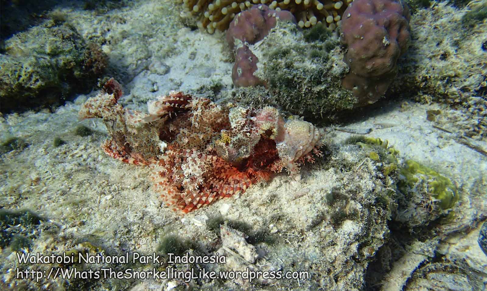
…which is good for photographers!
This was another good location for seeing cute Keyhole Angelfish:

There is also a nervous Wirenet Filefish to the left, darting for cover.
Difficult to spot here is the uncommon Scythe Triggerfish (in front of the coral head):

And here is its, similarly uncommon, cousin – the Flagtail Triggerfish:

Here are lots of juvenile Cardinalfish taking cover around a piece of old coral.

It is difficult to tell the species at that age. I think the yellow ones are Bargills.
Here is a Bluefin Trevally, trying to look mean:

Here is the Adult of the (earlier, green, wormlike) Cigar Wrasse:

A dozen Bluespine Surgeonfish turn-tail and head off to the deep:

Was it something I said?
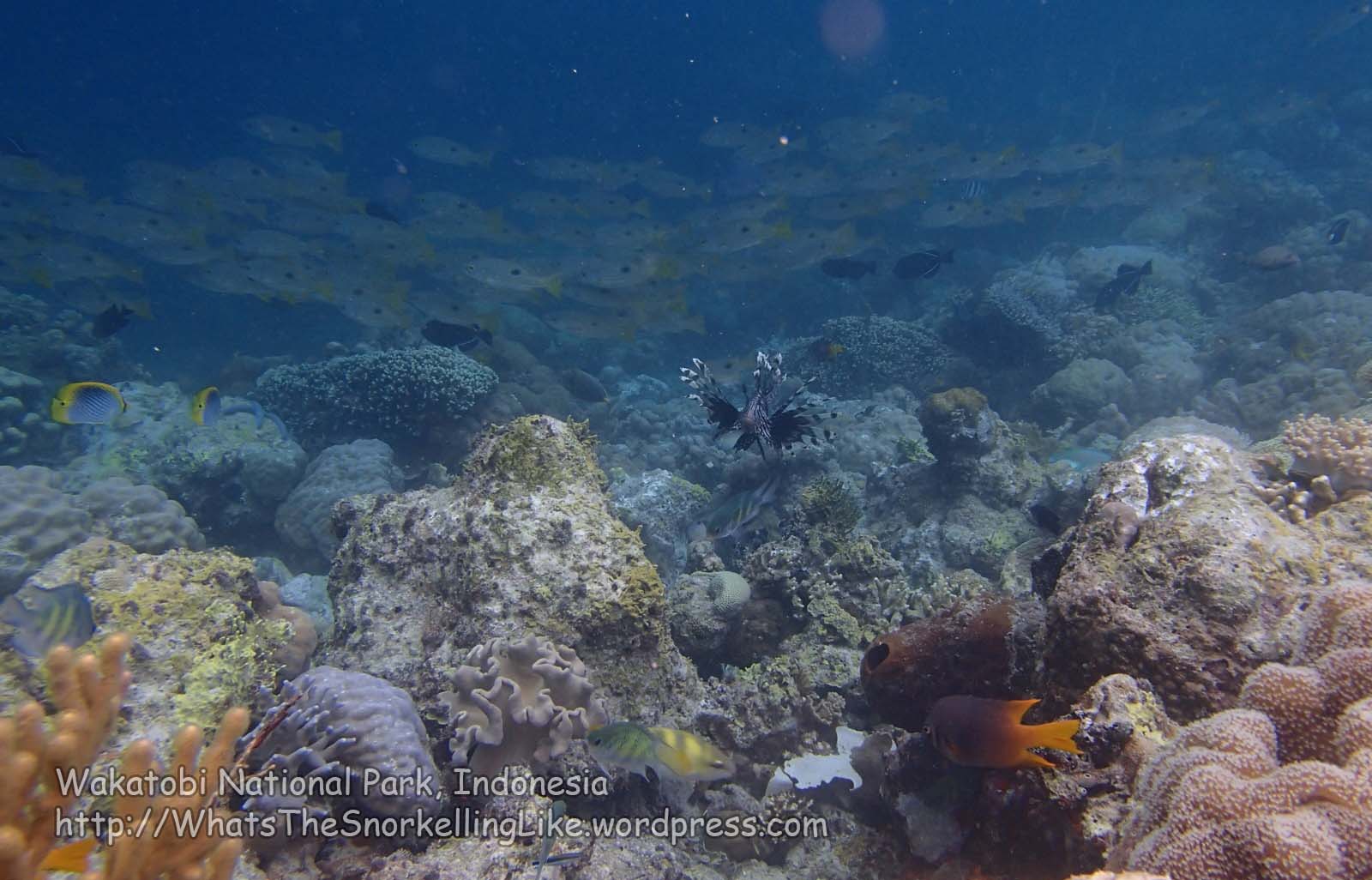
And an inquisitive Lionfish steals focus from a crowd of passing Oval-Spot Snapper.
After a while in the scrappy shallows, you reach the drop-off itself:

(which is none too impressive).
Opwall have put-up underwater bamboo platforms here (presumably as a place to do the ‘skills’ section of dive-training courses).

The platforms can be a good backdrop for fish who stop for a rest:


There is a nice patch of branching Acropora coral nearby:

As you start to draw level with Ola’s restaurant, the sloping drop-off turns itself into a plummeting vertical wall. The coral on the wall is kinda skanky, but you might find some cool fish at the top of the wall, like these Red-toothed Triggerfish.

.
Hoga Area 4 – Main beach (South end) – Ola’s Restaurant to South Hoga Island Resort
I had heard that there was a wall here and I was expecting great things from it, but it was a real disappointment:

Occasionally, there would be a better-looking spot:


But mostly it was just dead hard-coral.
There were some cool fish on the edge of the wall:


That lovely Squarespot Anthia was a new one on me. He was only a few metres deep. Apparently they usually skulk about 15m deep.
After the disappointment of the hard-coral, I was relieved to find that there was some nice soft-coral on the reef-top ~20m back from the wall (towards the beach).
It starts up slowly:

but gets better, as you head North:


I found that the best approach was to weave between the attractive coral on the reeftop and the interesting fish on the edge of the drop-off:


(Mouseover for speciesnames).
.
Hoga Area 5 – Main Beach (Middle Section) – Around Hoga Island Resort
Continuing North down the beach, we are starting to draw-level with Hoga Island (Dive) Resort.
The wall is still mostly dead, but it does have its moments:

Continuing my weavy perambulations, I saw some schooling Sleek Unicornfish near the wall, heading for the depths:

..and a school of the always-fun Long-Jawed Mackerel. They look quite dull when they are swimming along normally, but when they swing open their huge jaws to hoover-up everything in their path, it’s a different picture!:


Meanwhile, back on the shallows of the reef-top (about 20m back from the drop-off), the soft-coral gardens are just getting better and better:


This is the reason to snorkel in Hoga. How beautiful !
The best area on Hoga is near the drop-off and in-line with Hoga Island Resort. But it’s pretty decent for over 100 metres North and South of that point, too.
.
The zoom on my camera had died, so I was having fun trying to get close enough to this Keyhole Angelfish for a decent picture, when she kindly led me to this Nudibranch:

.
.
I mean, this, nudibranch:

An Anna’s Chromodoris.
I guess that there must be lots of nudis in Wakatobi, but I only saw three.
The second one was also in this area, and was a Magnificent Chromodoris:

You don’t tend to notice them while snorkelling, as it takes a while to see the tiny things (difficult on a single breath-hold). I’m sure that divers see heaps of them.
Some attractive reef-fish living on the reeftop:


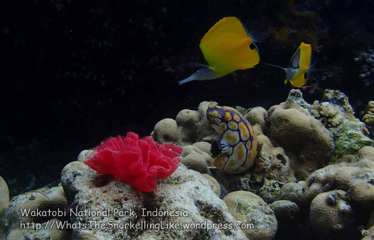
A couple of notables in that last one – the yellow and purple blotchy thing is a Sea-Squirt (Polycarpa aurata) – they suck the water in one hole, filter it for food and then pump out the effluent from the other hole. There are lots of these around Wakatobi. The red ‘flower’ is actually the egg-sack of a nudibranch.
Again, the edge of the drop-off proved a good source of reef-fish pics – this time with the advantage of the beautiful soft-coral backdrop:


In the last picture those pretty white, yellow and black fish are Pyramid Butterflyfish (library picture). They are usually seen in big schools and are a lovely sight to see. There are a fair-number of them in Hoga.
.
Hoga Area 6 – Main Beach (North end) – North Hoga Island Resort to the end of the island
Continuing North past Hoga Island (Dive) Resort, towards the far end of the island, the drop-off changes from being a vertical drop to just a steep slope. It is still mostly unappealing, though.

Schooling Surgeonfish and Indian Triggerfish do improve things:

I met this monster Crown Jellyfish, here.

What a beauty. I think they sting a bit, but nothing serious. This was the only jellyfish I saw in the water in Wakatobi.
Away from the drop-off at the reef-top, the soft-coral gardens were still being gorgeous:


As you continue North, eventually the coral gardens on the reef-top start to peter-out, so it’s time to head back out to the drop-off to see what it is like there:

Lotsa fish, but still yukky coral.
Sensing the point of diminishing returns at the reef-edge, it was time to take a track closer to shore, to see what was living there.
It is Pufferfish-land, it seems!
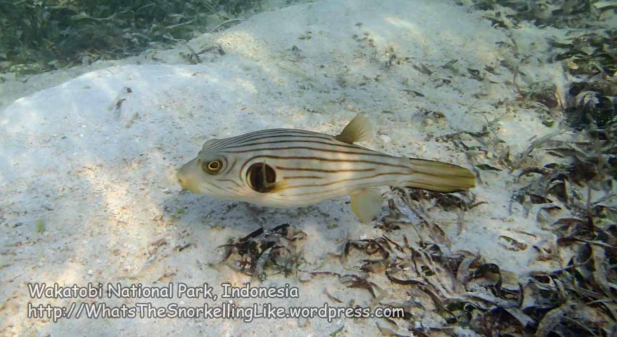

The folks from the fishermen’s village have set up a large V-shaped net to trap any unlucky fish that wander in.

Unsurprisingly, they only seem to ever catch Pufferfish.

I can’t imagine they are very tasty.
Someone from the village comes across at low tide and walks down the V of the net and just scoops out the unlucky puffers to go in that night’s dinner.
I guess that the sea kraits can slither their way out.

Navigational beacon:
This is a long article: If you just want the underwater pictures at the next pretty spot, then do a local search for “Tomia Area 3”
This is largely the end-of-the-road for Hoga snorkelling. The coastline takes a turn to the right, towards the fishermen’s village. This North-Eastern aspect was getting some dangerous-looking surf at the drop-off and the empty plains between the beach and the drop-off weren’t proving very interesting, so the only thing left to do was get all ‘macro’ and see what there was to find in the grassy shallows.
.
The Grassy Shallows
There’s no shortage of grassy shallows in Hoga (or Wakatobi, generally):

Mostly, they are something to endure as you fin for fifteen minutes through a foot of water to get to the reef-edge:

Cymodocea serrulata
But, like in life, it is surprising what you find when you slow-down and start looking more closely.
Be careful not to step on that Sting-ray, now:

Or those Sea Urchins:


The locals love to eat Sea Urchins – the markets are full of them. In the Hoga fishing village, collecting them is the childrens’ job. They all walk around in the shallows at low tide, dragging around plastic trays (like a dog on a leash) collecting their unfortunate, spiny victims.
Another thing to avoid stepping-on are Sea Stars:

This Banded Goby was a bit flighty:

But at least this Cymbiolacca species snail isn’t going to run away.

If you go really slow, you might find some tiny juvenile reef-fish. I’m not sure who this is, but he sure is cute:

Also hanging out here were these small eels:


Do try and leave the wildlife in the sea when you leave:

.
Have a poke around in the ‘boring’ sea-grass – what can you find?
.
Hoga Area 7 – Northern surf safari
I had hoped to snorkel around the whole island, but the breaking waves at the reef-edge on the North & East coasts made shore-access there impossible.
I wasn’t going to give-up trying entirely, so I did make one risky sortie through the surf at Area 7.
Actually, the reef on the other side of the breakers was quite attractive – with a few healthy-looking coral patches:


Maybe it’s worth taking a look in a season when the breakers have gone away, I certainly wouldn’t risk a sandpapering again during August. Thank heavens for rental wetsuits!
.
Village tracks
There is a track that leads out the back of the fishermen’s village. I had hoped it would lead to a spot on the East coast where I could get in the water and check-out the reef there. I spent half a day exploring the track and its various branches, but it turned out to be a fruitless exercise. The tracks just wind round in wiggly circles – they are for villagers to collect coconuts from the forest, not for tourists to make leisure trips out to the East coast.
.
Excursion – Round-the-island walk
It is possible to walk around the whole of Hoga’s coastline. It took me four hours. If you try it, go at low tide and even then, there will be a fair-bit of knee-deep wading required. Wear something solid on your feet as there might be some spiky and/or dangerous critters hiding in the shallow waters.
Here are a few snaps from the walk:
The main, West-coast beach is all easy-going, picture-postcard stuff:
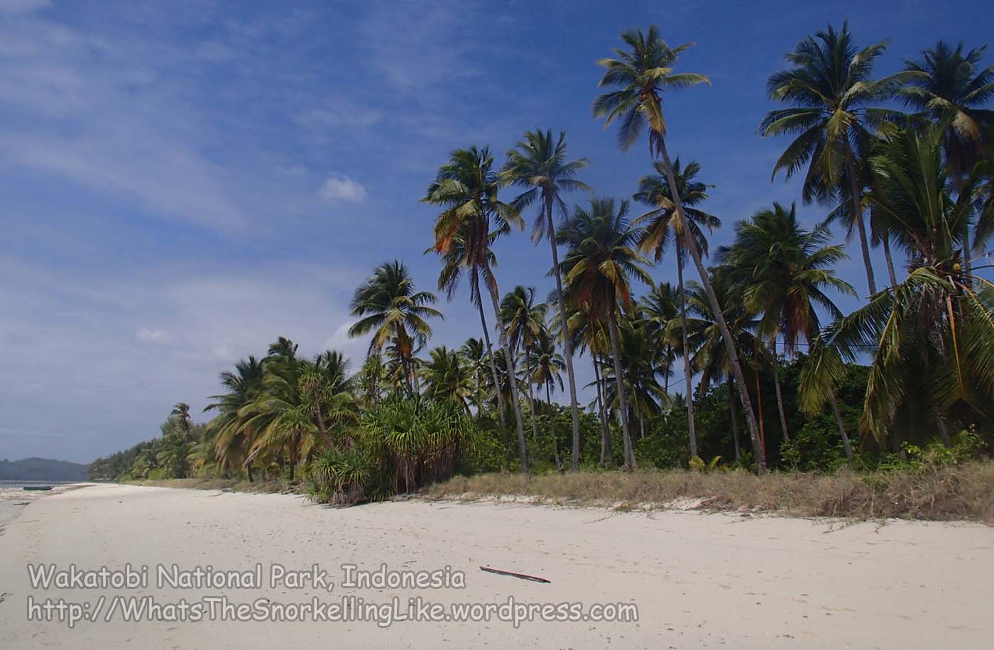
At the end of the beach, you’ll reach a rocky headland that looks like it is also the end of the island, but go round it (either side – there is a track behind it) and you get to another short beach and then another rocky headland (also with a track behind it). This takes you to the beach with the fishermen’s village (Q) on it.

The kids in the fishermens’ village yet haven’t learned the fine art of ‘Hello Mister’-ing, so will ignore you as you pass.
Beyond the fishermens’ village, there is a large rocky headland (R) – you could either walk around the outside of it; or take the track out the back of the village and then the first branch to the left. This will bring you back to the coast at point S.
At S, at low tides, there is a huge sand-plain spreading out in front of you.

It is tempting to follow it to the right, but there isn’t a through route – head towards the open sea then turn right and walk round.
The journey around the island is an alternating mix of wading through shallow waters, past low, rocky “cliffs”:

..and walking along deserted beaches:

The beaches often have lots of dead sea-grass washed up on them:

One notable feature is the three little rocky islets off the big beach on the East coast (T):

The rake of the beach is almost flat here. At low tide, it is a dry walk to the little islands. Even at higher tides, it would be less than knee-deep.
A worrying thing I found while walking around the far side of the island were three Portuguese Man O’War jellyfish, washed up on the rocks:

These are bad dudes – you don’t want to have a close encounter with one in the water. Presumably it is just the August winds blowing them in on the seaward side of the island, but it is probably wise to keep your eyes open and cover-up any loose skin while snorkelling anywhere, just in case.
Continuing on around the island, there are more mixtures of beach & rock:

It is a fair-old hike all the way around the island (about 12km). I had been told that it takes two hours. After three, and with the incoming tide turning a long walk into a long wade, I was quite happy to see Kaledupa appear on the horizon at the South East corner (point A).

There is a lone fisherman’s house out here:

No, that’s not the house, just the garage.
Although we are back on the West coast now, it is still about an hour’s hike to get back to the accommodation. The big beaches on the way are beauties and there are some cool ‘mushroom’ shaped rocks on the way (at C on the map).

Here’s big beach, C, on a sunnier day:
Eventually, you will reach the Eastern-most huts/homestays at Bounty Bay (F) and can get on the easy, paved path, back towards your accommodation and a cooling beverage in a comfy hammock. You will need it.
.
Hoga Admin/logistics:
Hoga Sleeps and Eats

Midrangers will head for Hoga Island Resort (which is the same thing as “Hoga Island Dive Resort”) (P on the map).
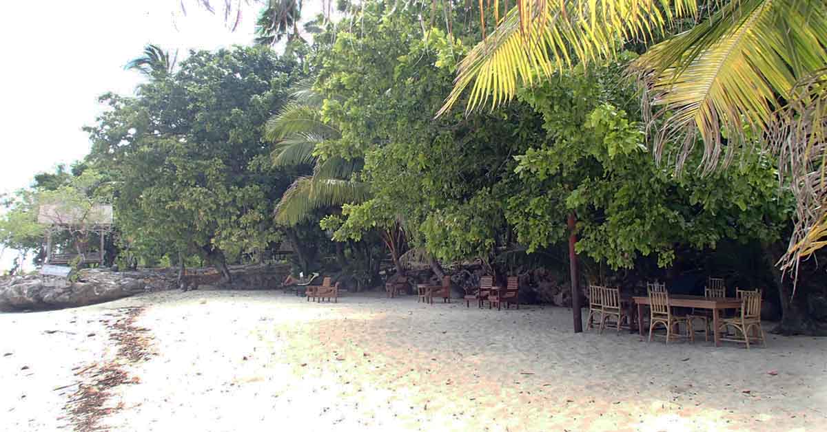

Hoga Island Resort has a beautiful spot on the main beach about 1km North of the jetty. Turn left as you come off the jetty. Actually, try and get a boat direct to the resort, because it is a long, shadeless hike on soft sand). Accommodation price is 400 000 IDR for a wooden bungalow including three meals a day. Or one million IDR, including two dives (prices correct at 2014). There is no pressure to dive. Rooms have mozzie nets, but I didn’t see any fans. Toilet/showers seemed to all be outdoors and one bathroom is shared between two bungalows. I’m told that the resort accepts Euros if you run out of IDR.
hogaislanddiveresort.com
.
A new midrange resort opened in 2014. Wakatobi Indonesia Dive Resort (not to be confused with Wakatobi Dive Resort) is 100m North of the jetty and set back 40m from the beach (at L on the map). They have 10 luxurious-looking AC wooden cabanas set around a small courtyard:

..and they were furiously building more on the other side of the restaurant.
I expect the prices will change as they find their market position, but what they told me was 525 000 IDR without meals or 650 000 IDR including 3 meals. That’s for the hut and single occupancy. Extra people pay extra for food (presumably 125 000 IDR per person). The dive shop wasn’t yet open.
WakatobiIndonesiaDiveResort.com
.
Low-enders have two options – staying in an unused hut at the Operation Wallacea (Opwall) research/education/volunteering station; or staying in a ‘homestay’. Both these options cost ~ 200 000 IDR including 3 meals a day (prices correct at 2014).
The more I stay in ‘homestays’, the less I understand what they are. Finding something that matched my image of a homestay was much harder than expected:
The Opwall site is straight-ahead as you come off the jetty (their restaurant is at J, on the map). I had been told to turn right (South) for the homestays. I was expecting a small village where any locals who had entered into the homestay business would call-out as I walked past. I found nothing like this – just the long, Opwall-laid concrete path that winds its way (through map point I and) dozens of empty (presumably Opwall) wooden huts. I figured that, eventually, the Opwall path would change in character (indicating the end of Opwall ‘territory’) and then there would be homestays. But it never did. It just turned back-around on itself. After an hour of searching down all its loops and cul-de-sacs, I ended-up back where I started, with not a homestay to be found! Hot and tired, I gave up searching and went into the Opwall restaurant to ask where I could find a homestay. The lovely restaurant manager, Eeloo, told me the deal would be 200 000 IDR including meals. She made a phone call and a guy came to show me the homestay. It was one of the huts I had walked past twenty minutes earlier! The accommodation was fine, so I took it. Meals were to be served in the Opwall restaurant.
I think what we discovered here is that a Hoga ‘homestay’ is just a normal Opwall hut that doesn’t have any students in it. I stayed in Hoga for five days and I never saw anything that that was anybody’s ‘home’. Some of the huts towards the Eastern end of the Opwall path (map H) felt like they might be more independent, but there was never anybody there to ask.
I met some Europeans who were staying on the other side (North) of the jetty in huts behind (associated with?) Ola’s restaurant (K), but I never found anything that I would call a ‘homestay’.
There is a small fishing village 3km away (Q on the map). This is comprised of about 20 fishermens’ huts. There are no facilities for tourists there. No homestays. No restaurants. Other than the fishermen and the resort staff, nobody lives on Hoga.
The bottom line is – if you want a ‘homestay’ on Hoga, don’t wander around looking for one. Save yourself the hassle and go straight to the Opwall office/restaurant (or maybe to Ola’s restaurant).
(Edit: I have since read that all the huts near Opwall (map points I & H) are actually owned by people from Kaledupa and are regarded as ‘homestays’. But the point remains – the owners don’t live there and you will probably never see them. All your interactions are through the Opwall office).
Edit: in the comments below Graham and Kevin give their experiences of using Opwall at different times of the year. Also, in 2016, it looks like there are some moves-and-changes in the layout of Opwall’s huts following some disagreements with their landlord.
.
I loved my little Opwall/homestay place. It was a raggedy wooden hut with a huge balcony, right by the sea. The view:

Inside, it had a wooden cabinet and three single beds with mozzie nets and pokemon sheets (!) It had an attached bathroom, but there is no running water in the huts. The bathroom has a door at the back which opens to the outside world and a little man comes round and fills up your mandi with brackish well-water every couple of days. There is a squat toilet. The room had four electricity outlets and there was electricity from 6pm to 11pm ish. The generator is near the jetty, so shouldn’t disturb anyone trying to sleep. There was no fan, but there was no need for one, as it was pretty breezy.
Homestay food:
My Opwall/homestay price included three meals a day in the Opwall restaurant. The food was fantastic – really tasty and huge servings. I can’t recommend it enough. But I might have been getting extra-special service, because the students had all just left and the few remaining staff didn’t have too much to do.
There is unlimited drinking water/tea /coffee available all day. Sodas and Bintang beer are for sale. Big Bintangs are 50 000 IDR, which is standard island prices.
I spoke to some folks who were staying in the huts behind Ola’s restaurant (K). They were paying 75 000 IDR per person for the sleeps (including a small breakfast), and had a ‘deal’ from the restaurant of 125 000 IDR per person for lunch+dinner. So all the ‘homestays’ worked out at 200 000 IDR a day, wherever you went. Despite being seasoned travellers, these folk were unimpressed with the food at Ola’s restaurant. Well, it was a public holiday, so maybe the standards were down to problems with supplies. There are only two public restaurants on Hoga (and the other one (The Pygmy Seahorse, map M) was closed). The last time I saw those budget-backpackers, they were heading towards expensive Hoga Island Resort to see if they could eat there instead.
.
Hoga Local transport
There are no roads on Hoga, but you can walk all the way down the long Western beach. There are couple of rocky headlands seemingly obstructing progress at the Northern end, but you can find tracks behind them.
There is a track that runs South East out the back of the fishermens’ village (Q). The first turning (left) off it can be used to bypass headland R, but otherwise the track (and its various branches) don’t lead anywhere useful.
At the Eastern end of the Opwall huts (H, F) there were two shiny Kayaks labelled ‘Hoga Island Water Sports’. I don’t have any more details. Presumably they are for rent if you can find someone with the paddles and a cash register.
.
Hoga Ferries / jetties
There are no public boats to/from Hoga. When I was leaving, I paid Opwall 50 000 IDR for a private transfer from Hoga to join the 5:30am Kaledupa-Wanci ferry.
I’m sure that all resorts will organise your transfer to Kaledupa, for onward travel.
.
Hoga Areas of interest
Activities on Hoga include sitting on the beach, snorkelling and diving. That’s it.
Opwall have an extensive library of conservation and wildlife books (above the restaurant).
You could wander down to the fishermen’s village, but it’s not really a tourist spectacle.
You could charter a boat to take a trip to the Bajo (stilt) village and some other spots on Kaledupa.
It is possible to walk around the coast of Hoga in about 5 hours. Centre your trip around low tide and wear solid footwear which can take getting wet. Even at low tide, there’s quite a bit of knee-deep wading required.
The sunsets off the main beach are gorgeous:
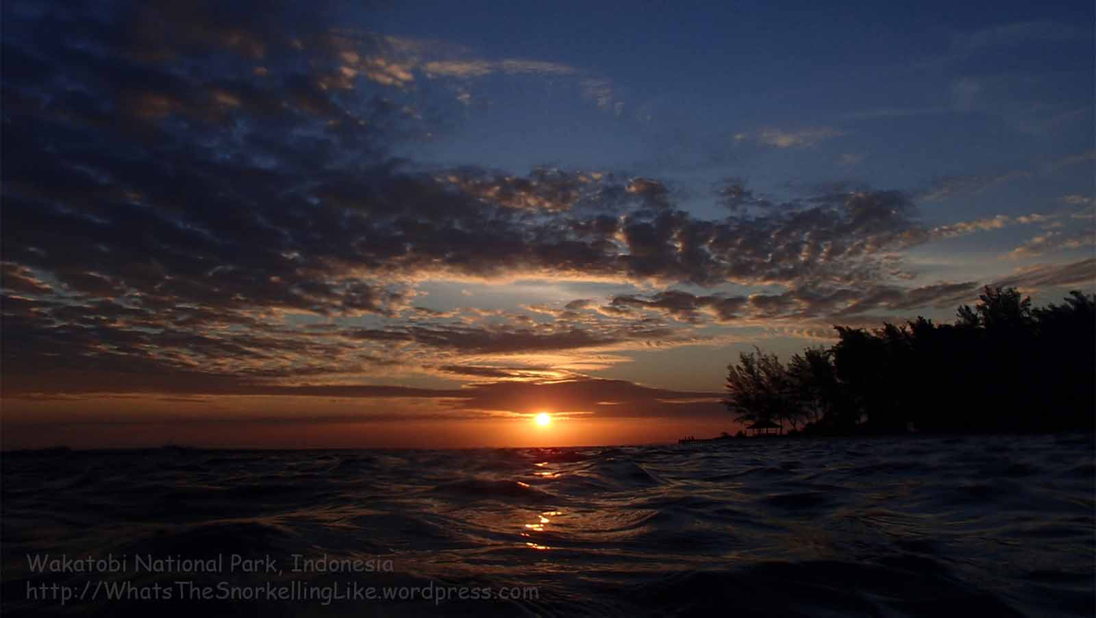
.
Hoga Diving / Dive shops
Hoga is a popular spot for diving. The whole point of Operation Wallacea is to study underwater ecology, so they are diving all day, every day.
I did one dive, just to compare the diving with the snorkelling. The dive-site chosen for me was a deep water pinnacle about 1 km off Hoga Island Resort. There were tons of schooling Bluestreak Fusiliers and Pyramid Butterflyfish there (library picture). I don’t have pictures from the diving – my camera doesn’t go beyond 10m, This pic of the fusiliers (taken while snorkelling at Area 7), gives you the general idea:

There were a lot of soft-corals and sponges on the pinnacle, making for some lovely ‘firework-display’ dioramas. But I didn’t really see anything that I hadn’t already seen while snorkelling.
There are dive shops at:
Hoga Island Resort (P on the map)
Wakatobi Indonesia Dive Resort (L)
Asrul’s dive (contact him at Ola’s restaurant, K)
Opwall. (J)
Asrul is 450 000 IDR per dive; Opwall are 400 000 IDR. I didn’t ask about the others, but I’d guess they are more expensive.
.
Other :
There are no ATMs or stores on Hoga. I got phone signal, but no (Simpati, mobile) internet. Opwall have some internet terminals, but they use the same (mobile data) technology. Don’t count on using the internet on Hoga.
As I understand it, the swathes of students are at Opwall from May to ~13th August each year;. During March there are lots of research scientists staying there. I guess that during the rest of the year, it is pretty quiet. Opwall is open all year round.
.
.
E: Tomia Island / Pulau Tomia / Island 3
The best ‘off-the-beach’ coral that I saw in all of Wakatobi was on Tomia Island – about 3km out of the main town, Waha.
There are guesthouses/homestays in Tomia’s towns, but there are no beach resorts on the island. Similar to Wanci, you will need to rent a motorbike (/taxi) to get to the beaches and snorkelling spots. It is also possible to charter a boat for a 30 minute ride to some fantastic (world-class) offshore reefs. The super-expensive Wakatobi Dive Resort is on a small island nearby.

All images on this site are clickable for bigger versions
.
Slowboat ferries from Wanci arrive in the town of Waha, on the North (West) corner of Tomia.
Waha is the main town and it has several guesthouses/homestays/low-end hotels. I based myself in Waha, so that is our startpoint:

Tomia Area 2 – West of Waha harbour
The main seafront in Waha town has vast sandy shallows stretching out to a drop-off 800-1500m away. In the windy month of August, there were always scary-looking breaking waves out at the reef-edge, so for the whole time I was staying in Waha, I regarded this area (2) as a non-starter for snorkelling (snorkelling and surf do not go together well).
On my last day in Tomia, I had the brainwave to use the shipping channel, (dredged into the seabed to allow boats in and out of the harbour) to get past the dangerous breakers and onto the deep-water side of the reef at 2a.
Getting to the reef via the harbour shipping-lane is a bit of a ‘hard-core’ exercise. Although Waha isn’t exactly a busy industrial harbour, swimming along the shipping-lane, 500m offshore, with surf breaking on the shallows to both sides, was a little scary.
.
There were a few Trevally hanging-out in the shipping-lane.

Turning left at the mouth of the shipping-lane, there was cause for cautious optimism about the reef:

Soon after, the coral quality picked-up nicely:


And soon settled into a pattern of good, then not-so-good, then good, etc. Mostly, it was pretty respectable.
In one scrabbly patch, there was a Bicolour Angelfish hanging out:

A big multi-species school of fish cruised past. How many species can you spot here?

Along with the usual Black Surgeonfish, Goldsaddle Rabbitfish and Indian Triggerfish, we have Bumphead Parrotfish, Blue-spined Surgeonfish and Yellowmargin Triggerfish. Front and centre is (probably) the uncommon Green Jobfish (Aprion virescens).
A Yellowmask Angelfish prepares her escape:

The decent coral continues along the reef-edge:


At a point level with the town beach (2b), there is a brief bad-patch where something has killed this Acropora coral:

The town beach, itself, is a cute little number:

Being so close to the (muslim) town, it is probably not suitable for sitting-out in your swimsuit, though.
In seasons without wind and surf, this beach might be the obvious point-of-entry into the water. It is a still a helluva hike out to the drop-off, though.
Continuing West on the drop-off, another mega-school showed up– mostly Blue-Spine Surgeonfish. Bottom-right is my first Hump-nose Surgeonfish. (Naso Tuberosus). Yay!

At 2b, the reef-edge turns Southwards. Continuing South, the coral is pretty-decent:


Interesting fish here include a Clown Triggerfish and a couple of Blue-Girdle Angelfish:

…one or two Red-tooth Triggerfish:

and a ‘close’ approach from a big family of Bumphead Parrotfish, who had been following me all day:


Probably the sweetest spot in the whole of Area 2, was at 2c – about 80m short of a distinctive-looking breakwater. The reef here was fantastic:


Pufferfish party:
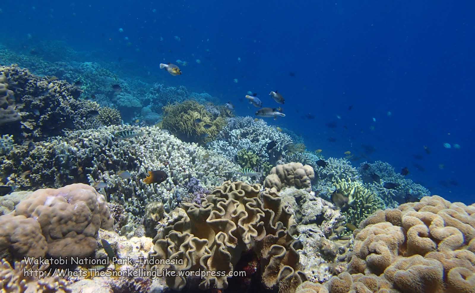
The reef was also in good condition closer to the breakwater:


The coral is also pretty-good on the South side of the breakwater:

..but there is no exit-point South of the breakwater. I went a couple of hundred meters past it then swam back to it and got-out there. It was easy to get back to shore along the edge of the breakwater and was not-too-hard to climb up the rocks and out of the water.
Overall, my ‘Area 2’ snorkel was a pleasant surprise (I had expected not to be able to get in the water at all!). It was a (leisurely) 90 minute snorkel from the harbour entrance to the breakwater.
With the surf up, there was nowhere to safely cross the reef (and get out of the water) between the two end-points, so it’s not really a casual undertaking. Presumably, in months other than windy August/September, the seas are calmer and you don’t have to worry about being beaten-up by breakers and sharp coral.
Also, getting to the reef via the ‘shipping channel/harbour entrance’ isn’t really suitable for the casual snorkeller. Plus some people will feel uncomfortable about being 1km away from the nearest dry-land.
If you want an easy-snorkel in Waha town, use the breakwater to enter and exit the water. It is too rough to walk along the top, but it is easy to walk or swim along the shallows next to it.

When you get to the end, turn right – that choice snorkelling spot (2c) is just 50-80 metres along the drop-off.
To reach the breakwater from the land – head West to the edge of town – past the town beach and football field. Go up the steep hill and turn sharp-right at the top. It is a 200m walk, past a viewpoint; that nasty ‘Hollywood’ sign and a small restaurant; then down to the breakwater.
.
Continuing the journey (South) around the island, the coastline turns to rocky cliffs and (unless you are up for a 2km swim) you must use the road to get to the next access point.
(Oh, btw, were you wondering why there is no Area 1? Well – I guess that it is possible to get to the reef on the East side of the harbour by turning right at the mouth of the shipping-channel. I didn’t have time to try it, but here’s what the area looks like from a hilltop viewpoint North of Onemai village. Maybe someday I’ll go back and explore this ‘Area 1’. )
.
Tomia Area 3 – Soha beach/ Pantai Soha
Continuing South from Area 2, the next place you can access the water is at the start of Tomia’s best two snorkelling beaches, at 3a.
Drive* 2km South from Waha, past the big telephone towers, an abandoned shopping complex, a couple of roadside houses and some open scrubland. Then look out for this unassuming little turn-off on the right. The concrete track stops at the cliff-top. Then there is a set of steep concrete steps down to the Northern end of this long beach (3a).
Alternatively, you can drive another 1 km into (Kollosoha) village and take this distinctive turning leading down through residential streets to the South end of Soha beach (3b). (Btw, Coremap II (written on the archway) is the name of an environmental program – COral REef MAnagement and Protection). There is lots of interesting marine information on their website.
*At a push, you could walk from Waha town, but it is a long-hike, especially in the hot sun. /edit@2019 – in the comments below, Jos mentions a new dive resort on Soha beach – Marind Dive resort
.
Soha beach is a bit of a beauty. The North end is deserted:

.
Entering the water at 3a, you have the usual stretch of boring, sandy shallows before you reach the interesting reef. Actually, the reef is quite close to the beach here, only about 30 metres away.
Here is the run down the 1km Soha beach (North to South). I think that the pictures speak for themselves:


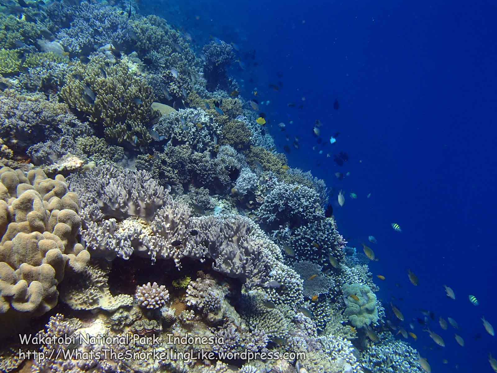
Notable fish include these cute Reticulated Dascyllus:

And some schooling Blue-streak Fusiliers:

.
Tomia Area 4 – The headland between Soha and Hunduai beaches
Continuing South from Soha beach, there is a big (~100m long) headland that separates it from the next beach (Hundue). If you are feeling energetic, it is not that far to continue along the drop-off on to the next beach. The snorkelling on this stretch is marginally better than the, already good, stuff on either side. This nets it the prize for ‘best off-the-beach-snorkelling in the whole of Wakatobi’:


Notable fish include this Myers Butterflyish:

This Oriental Sweetlips:

And these, uncommon, yellow ‘versions’ of the Bluestreak Fusilier.

The yellow ones are Randall’s Fusiliers (Pterocaesio randalli)
.
Tomia Area 5 – Hundue/ Hunduai Beach
Pronounced “hon-doo-eye” (I think), this is your classic picture-postcard, beautiful, deserted beach.

If you didn’t swim round from Soha, you can drive to it via a concreted track off the main road. It is difficult to find the turning, which is almost at the end of the village. If you go past a school, set-back on the right, you have gone 30m too far.
The snorkelling is awesome here, too. Here are some snaps going from North to South on the drop-off:


.
These are Sea Pearls/Sailors Eyes (Ventricaria ventricosa):

They are sometimes (mistakenly) thought to be Octopus eggs. Actually, there are an alga(e). Each ‘pearl’ is a single cell – one of the biggest cells in nature.
Other interesting life here included a posse of four Diagonal Banded Sweetlips:

Some Pyramid Butterflyfish:

A Six-Banded Angelfish, slinking away under a rock

(library pic)
Oh yeah, and a Turtle:

One of only two that I saw while snorkelling in Wakatobi.
.
Generally – this North West corner of Tomia (Areas 3, 4, 5) was the highlight of the off-the-beach snorkelling in Wakatobi. Definitely worth a visit. Hopefully someone can do something about passing (?fishing) boats dropping-anchor on the reef:

.
South from Hunduai beach, the coast-road stays inland, some 200+ metres away from the sea. Occasionally, there is a narrow track leading-off to the sea. I checked out a few of them. Some led to cute little fishing villages:

.
It’s not too long before you reach Waitii town. Here, the drop-off says goodbye to Tomia Island and takes a sharp-right, skirting-around Tolandona Island (aka Onemobaa Island). You can forget about doing any snorkelling for a while.
.
Waitii town is notable as you can charter a boat from Waitii jetty to get to the beautiful offshore reefs 5km to the South West. But more of that later (in the “Tomia Environs” section).
.
Continuing South East along Tomia’s coast, there is no terrain suitable for snorkelling. The strait between Tomia and Tolandona is shallow with a sandy bottom.
There’s an aerial shot of it here (image credit: Panoramio user HeliAgus).
You pass the airstrip for the expensive dive resort on the left.
Continuing East, there are a couple of small towns that merge into each other.

Tongan Timur is the biggest conurbation on the South coast. Along with Waha, it qualifies as a “Kampung” (big village) (as opposed to a “Desa” – small village) on local maps. It has a few places to stay, a couple of English-speakers and a big jetty.
There were two speedboat ferries parked-up at the jetty. This makes me wonder whether this place, (and not Waha) is the ferry-terminal for the speedboats. But I’m only speculating.

Check out those breakers on the reef-top behind the boats. Snorkelling here was a non-starter.
.
Unfortunately, the surf continued all along the South East coast. Not that you could really get to the coast, as the road was 500m inland.
Occasionally, there was a small side-road down to the sea.

That’s Island 4, Binongko, off in the distance
.
After a nice ride through some green wilderness, the next stop was Tomia’s Easternmost town – Kulati. Kulati is featured on some tourist posters as having homestays and nearby beaches.
As it turns out, the beaches are not that nearby – you would probably need wheels to reach them. Here is a sign (at a crossroads in the centre of town) which lists out the beaches on the Eastern cape:

Some friendly, English-speaking, locals came up for a chat while I was looking at the sign. They said that, because of the condition of the roads, you couldn’t get to all of the beaches by motorbike.
.
As you head out of the East side of town, you go past a little (?security?ticket?) barrier and enter the rugged wilderness on the windswept cape. Here’s the view from the top of the hill:

Out to the left is the North face of the cape (i.e. between 4- Situs Sejarah and 5 – Tebing Ampobero on the blue & white map).
Those breakers don’t look encouraging do they?
.
The villagers had told me it was possible to drive to beach 3, Pantai Huntente – so that was my goal. However, on the way, I thought I’d try out a likely-looking side track towards 5 – Tebing Ampobero. The guys in the village had been right. The closer you get to the coast, the more broken-up the sealed track got, and the hill got steeper and steeper. Common sense eventually won-out – getting a motorbike down there was not going to happen, so I turned-around and continued on the main ‘road’ towards Pantai Huntete.
.
Pantai Huntete is a rustic beauty:


But with those breakers out on the reef, snorkelling was a non-starter.
That’s a Nautilus shell, btw.
.
With the sun getting low, I didn’t have time to hang-around. For a change, I took the Northern road across the island, back towards Waha.
For a while, I followed these guys – who were out shooting dinner!

I had been told that the North side of the island was all cliffs and that there was no access to the sea for snorkelling. The road was a couple of km inland, too, as it turns out. Here’s a shot taken from point 8 on my Tomia map.

Pretty, but so many reasons not to snorkel!
The road is mostly in good condition, but there is the occasional stretch where it is terrible, so I recommend going-slow and timing things so that you get home before dark.
Here’s another road/coast shot from near point 8 .
.
There is an old fort (Benteng Patua) on the way (see alternative map 1 for the location)

Those steps look intriguing, but it was too late in the day to investigate further.
.
As it turned out, I did have enough time to do a 150 degree turn just before Onemai village and follow another road running parallel (and closer) to the North East coast. But it was still a long way from the sea. Looking at satellite pictures now, it does look like there are some turn-offs leading down to the water. Please give it a try when the surf’s gone and let me know what’s underwater there. From the satellite pictures, it also looks like this Northern road connects with the central road at Kahiyanga town, but I can’t say I noticed the junction there.
.
.
F: Tomia Environs
There a couple of interesting-looking islands close to Tomia:
Sawa Island
There is a huuge underwater atoll/patch-reef about 5 km South West of Tomia. It doesn’t seem to have a name. You can see the corner of it on some satellite pictures, but the famous one has cropped-out the biggest part of it. It is shown on this map of dive sites (Light green colour, surrounded by dive sites 5-26; 43):

(It is also shown on these maps of the National Park 1 2)
There are a couple of places where high-spots on the reef poke-up above the surface and form islands. Sawa Island / Pulau Sawa is an idyllic looking little desert-island with a perfect white-sand beach and a fuzz of palm trees.

(Here is an aerial shot of it (image credit: Panoramio user harryjuselius)).
I chartered a boat to visit a snorkelling spot near to Sawa Island (Area 7 on the map). Snorkelling locations around here are referred to as “Sawa Island”, although technically, the place I visited is on the reef-edge about 1km away from Sawa. I don’t think you can set-foot on Sawa Island itself – the water is too shallow for boats to get there. I hear that at low tides, the whole reef-top is out of the water.
.
The snorkelling at Area 7 was awesome– the best that I saw anywhere in Wakatobi National Park.
I assume that the diving is similarly good. The super-expensive dive resort is 3 km to the East and this reef is where they come for the awesome diving they rave-about on their website. (btw, I snapped that divesite-map in town. I see that it is also on the dive resort’s website. The original source is unknown).
.
Here are some snaps from the snorkelling at Area 7:


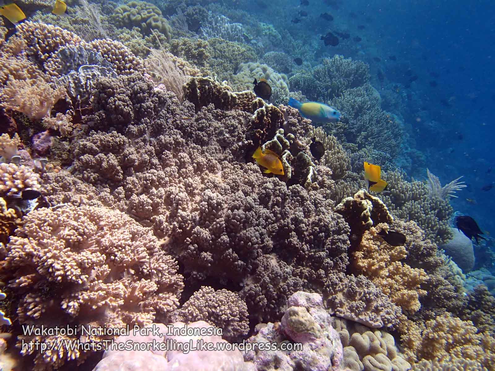


Nice, eh?
The visibility was great, but the water out here was pretty cold.
.
Practicalities:
To get to the Sawa Island area, you need to charter a local boat. You can get one from Waha town jetty, but Waitii town jetty is closer, so the prices should be lower. There are small, independent, ferry-boats taking locals from Waitii to Lamanggau on Tolandona Island (aka Onemobaa Island). Their captains will be happy to take some time-out and make a buck from taking you on a private snorkelling trip.
You’ll have to negotiate a price with your boat-driver. The English speaker at Waitii jetty is captain Udi (pronounced “oodee”). Tel 0821 96669345. His opening price for one hour’s snorkelling at Sawa is 250 000 IDR (this this the price for the whole boat, with only a few people in). Start negotiating from there. There are several other boat drivers around, but you’ll have to negotiate in Bahasa Indonesian or by holding up fingers.
.
It is difficult to find the road-access to Waitii jetty. It might be easier to go by ojek. If you are driving there yourself – this is the junction. No help, huh? Well, Waitii is about 5km from Waha. As you drive along the main (coast) road through Waitii, look out for this government building on the right and, when you see it, turn around and backtrack 400m until you find the jetty-turning (on the left, now). You go down a rough road through a residential area, then down a steep tarmacked hill to sea-level. At the bottom, follow the rough white sand road round to the left, then over a small bridge to the right and you are there at the jetty. If you took a turning from the main road that ends at the top of a long set of steps, you haven’t gone back (North West) far enough, so try it again.
.
.
Wakatobi Dive Resort house-reef
Tolandona Island is a ~2 km square island just South West of Tomia. It is also known as Onemobaa Island (pronounced On-ee-moh-baa). There is a large town, Lamanggau, on the North corner (map).
On Tolandona’s remote South West corner is an exclusive dive resort – Wakatobi Dive Resort (WDR). Their rock-bottom price is 3000 USD for a (minimum five days) stay. Plus 200 USD a day for diving.
The resort has a very slick website – wakatobi.com (such a humble url – do they own the entire National Park?) It gushes effusive testimonials about the place. A famous travel book describes the house reef as ‘celebrated’.
The resort is off-limits to non-guests (I suppose the definition of ‘exclusive’ is that it EXCLUDES anyone not paying to stay there). But I like going where I’m not supposed to and I wanted to see what this magical reef looked like, so I crashed the party and checked it out.
Local boatmen can’t/won’t go there, so I took the public ferry from Waitii to Lamanggau then swam from there (along the West coast of Tolanda – Area 6 on my map). It was a four-hour swim (one way, with fins and overarm stroke, against a strong current) so I don’t recommend you try it.
You can get a feel for the area from the resort’s 3D virtual-reality thingy: wakatobi.com/vr/index.html
If you are standing on the jetty looking out to sea, Lamanggau and Tomia are off to the right. Sawa Island is straight-out from the jetty.
.
Actually, given the all the hype, I found the house-reef to be far less spectacular than expected. It’s not that it was bad, but the hard-coral was mostly dead and I didn’t see much wildlife that I couldn’t find (for free) on the main island.
Here are the pics:
Dead hard-coal along the drop-off:


Red-tooth and Indian Triggerfish surface-feeding in the shallows on the reef-top:


Lovely Blue Tang:

(aka regal tang; palette surgeonfish; royal blue tang; hippo tang; flagtail surgeonfish; pacific regal blue tang; blue surgeonfish, etc., etc.)
Ornery reef-top:

Nice reef-top:

Start of reef-edge:


Notable fishies (mouseover for speciesnames):


Unique fishies:
I saw a couple of fish species here that I didn’t spot elsewhere on Tomia:
These Adult boxfish

(Captured here makin’ sweet luurve)
And a school of four Giant Trevally. They were too fast for me – here’s a library pic.
Decent spots on main reef:
Having been disappointed by all the dead hard-corals (especially towards the Northern end of the wall), I was happy to see that there were some nice-spots, too:


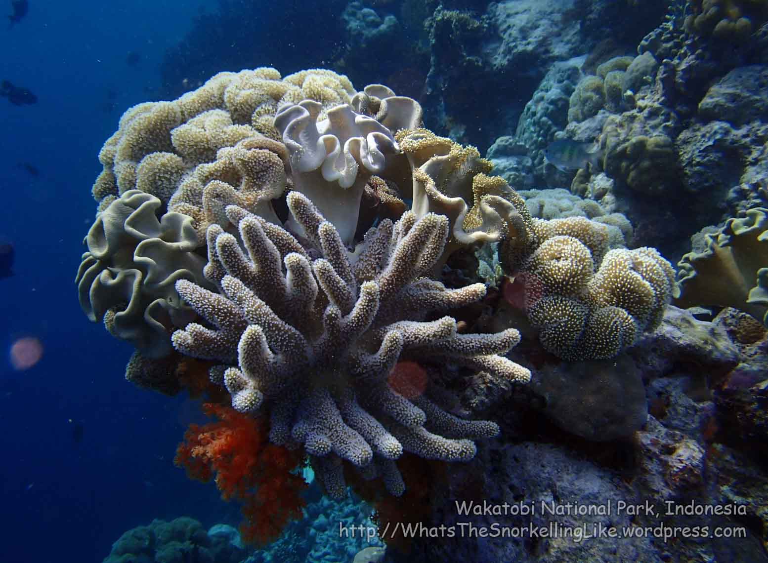
…and there was the occasional lovely patch of multi-coloured sponges, tunicates, fans and assorted soft-corals:


Most of the jaw-dropping internet photographs you see of WDR are close-ups of striking subjects, with a field of view about 30 centimetres across. Certainly, some beautiful little patches exist.
Just don’t zoom-out too much:

.
Generally, us paupers don’t need to feel like they have missed-out by not going to WDR’s house-reef. The snorkelling is just as good (probably better) at Soha and Hundue beaches.
btw – is ‘exclusive’ exclusive?
As I snorkelled along the reef in front of the resort, I did get some stares from the security-guy on their jetty, but nobody actually said anything about my ‘trespassing’. Once they figured-out that I didn’t come by boat and wasn’t trying to land on the beach, they relaxed a lot.
.
Tomia Admin/logistics:
Tomia Sleeps
In Tomia, I stayed in Waha town. Waha is the biggest town on the island and the slow boats from Wanci arrive there. There are at least ten guesthouses/low-end hotels there. There are also guesthouses/homestays in at least two of the other towns.
Generally, owners/staff won’t speak any English.
.
Waha Town:
I stayed at Penginapan Abi Raya (“Penginapan” means guesthouse, “Abi Raya” is the name). 0852 9969 1275/0853 9591 0275. I can’t say it was the friendliest place I have ever stayed, but it ticked the boxes on functionality and price. 100 000 IDR for a comfortable fan room with private mandi. Western style toilet. 200 000 IDR for an AC room with a proper shower. Price includes a light breakfast, but no other meals. They will provide other meals (25 000 IDR per meal) if you ask; or there are some local warungs and a sea-view restaurant nearby. There are 11 bedrooms, mostly aircon. Island electricity is on all night, but the power-outlets in Abi-Raya go off with the room lights, so charge your electricals early-evening or you’ll have to sleep with the lights on. The family motorbike is up for rent at 50 000 IDR. Don’t leave gas in it for the next day, as it will have been emptied by the morning and you will have to buy some more (!) There is no motorcycle helmet (most people don’t wear them in Tomia). To find Abi Raya, turn right off the jetty, walk 50m, then take (the first) left. Abi Raya is 40m on the left side of the road. There is a sign outside.
Given the choice again, I would try LaboreStay homestay (EDIT new phonenumber @ April 2016 +6282393083595 [Oldies +6285796640612 / +62 813 43730361 no longer valid]; LaboreStay@gmail.com, website (in Indonesian). 140 000 IDR for a fan room with TV and private mandi; 180 000 IDR for the AC version. This place is right on the seafront and has a small communal balcony where you can take-in the view. The owner (Mr Fahmi) is helpful and speaks perfect English – quite a rare and useful thing in Tomia. The price includes a light breakfast, but no other meals. There is a warung 30 metres away. LaboreStay is a small place with 3 rooms only. They have (three) motorbikes for rent for 50 000 IDR. To find LaboreStay, turn left off the jetty and walk 40 metres. It’s not a very obvious building (and doesn’t have a sign). It’s the first house that has a sunshade/awing. The front face is a printing/copy shop.
.
I didn’t try any of these out, I just noticed them from the outside:
Terapung Hotel – 0852 9957 1215 / 0815 2477 0689. Turn right out of the jetty and walk 150m. It is on your right, on the seafront. Edit: In the comments below, Kevin gives their off-season (February) prices as 100 000 IDR for a fan room and 200 000 IDR for aircon.
Wisma Tomia Inn (0821 9685 4610) and Losmen Mardika (085 7568 72599). Near the police station. Zig-zag left and away from the jetty for about 1km.
Rough Waha town map (looking at it as you do when getting off the ferry).

.
Tongano Timur (‘East Tongano’) Town:
I just drove past these on the main drag through town:
Pengingapan Aris Jaya – Jalan Poros Patipelong, Kec. Tomia Timur 0813 6222 1170
Losmen Amriani Jaya, Kec. Tomia Timur
Tongano Timur has a big jetty. The town looks like it is used to (domestic) tourists, so I’m sure there are other sleeping options available. A chap who spoke English came up to me when I was looking around the jetty, so I guess you will be able to find an English speaker to steer you in the right direction.
.
Kulati Town:
I saw a poster (in Bahasa Indonesian) which mentioned homestays in Kulati (Kulati Homestay 165 000 IDR per person). I am told that there are about ten homestays there in total, but I don’t have details. As I was looking at the big map posted at the main junction in town, an English-speaking guy came up to me, so I guess that someone will usually show-up to steer you in the right direction.
.
The super-expensive Wakatobi Dive Resort is on the island next door, (about 3km South West of Tomia). Their rock-bottom price is 3000 USD for a (minimum five days) in a bungalow. Plus 200 USD a day for diving. You get there via their 700 USD transfer flight from Bali. I imagine their butlers will carry you from the airstrip to the resort on a bed of silken cushions. Seriously – if you have that much money, then give it to someone who can’t afford to eat. Wakatobi.com
.
Tomia Local transport
Ojeks and motorbike rentals seem to be your only options for getting around Tomia. You can rent motorbikes from Abi Raya and Labore Stay (See ‘sleeps’, above) and no doubt from other places, too. Helmets don’t seem to be compulsory. Petrol/gas/benzin is sold in 1 litre glass bottles from private houses (10 000 IDR to 12 000 IDR per litre). Fill-up early as everywhere in Waha is sold-out by about 10am.
There is a road all the way around the island. It is generally in good condition.
There are regular public shuttle-boats between Waitii town and nearby Tolanda Island for 6 000 IDR.
You can charter small boats in Waitii (or Waha) to take you out to the big atoll reef to the South West.
.
Tomia Ferries / jetties
The main jetty for Tomia is in Waha town. Slow boats to/from Wanci and Kaledupa go from Waha jetty. My boat leaving Waha (the Dito 2) left Waha at 9am. It is 120 000 IDR to Wanci (4 hours) and 50 000 IDR to Kaledupa (West coast, 1 hour). I never saw any speedboat ferries coming or going from Waha.
There is a big jetty at Tongano Timur town. There were two speedboat ferries parked-up there when I passed through, so maybe speedboat ferries from Wanci go to Tongano Timur, rather than Waha. Just guessin’.
.
Tomia Areas of interest
The scenery above the water was pretty nice all around Tomia and driving around the island looking out for hidden beaches is a pretty good way to spend a day or two. I didn’t really investigate whether there were any specific tourist attractions.
There are a couple of forts on higher ground (250m hills). See Alternatemap1 for their locations. This big set of steps at Benteng Patua (Patua Fort) looked intriguing, but it was getting dark and I didn’t have time to investigate. Let me know what you find.
.
Tomia Diving / Dive shops
Dr Yuri is a sweet guy who trained in scuba diving with Operation Wallacea in 2009 and opened up a dive operation in Tomia in 2012. Tomiascubadive.com There isn’t a physical dive ‘shop’ (he is a full time medical doctor) but you can call him on 0821 8787 7751 and he will come-a-running (medical emergencies permitting!). He speaks perfect English and will run through the dive-sites and options with you, but he may hand you over to a local (speaking) dive guide for the actual dive.
He seems to be the only show in town, diving-wise. His price is 400 000 IDR for one dive; 700 000 IDR for two. Price includes equipment rental. The dives are generally boat dives on the reef close to Tomia Island. If you want to go out to more distant dive sites, you might have to pay a little extra for gas.
You might have to wait until high tide to go diving (so there is enough water for the dive boat to float off the beach!)
(edit: in the comments below, Kevin gives a couple of alternative contacts for diving).
.
I did one dive in Tomia. The dive site was “Roma” – close to the phone masts between 2 and 3 on the map. The soft-coral was very good and the hard-corals were middling-to-good. At a few points where everything came together, the dive site was just spectacular.
Interesting sightings were: Turbinaria species/vase corals about 1.2 metres across (they are usually about 30cm); big schools of Midnight Snapper; a passing Turtle; a white-variation Leaf Scorpionfish (Taenianotus triacanthus); some Spotted Garden Eel (Heteroconger hassi); a very chilled-out Many-Spotted Sweetlips and lots of Randall’s Fusilier – (Pterocaesio randalli). Sorry, no pictures – my camera only goes to 10m.
Edit: Actually there’s a picture of the big Vase Corals here (image credit: Mr Offer Kohen)
.
Alternative Tomia maps:
Detailed island map, courtesy Mr Fahmi of LaboreStay homestay
Waitii/Lamanggau Area
That Kulati/‘Eastern cape/beaches’ map again
Other info:
If you cut through all the glossy marketing blurb on Wakatobi Dive Resort’s website, there is lots of useful underwater information there. Head for the “The Diving” tab. wakatobi.com
I couldn’t get (Simpati mobile) internet reception from inside my guesthouse in Waha town. It did work when I was standing near the massive telecom towers between 2 and 3 on the map.
.
.
G: Binongko Island / Pulau Binongko / Island 4
This final island in the chain is very remote and is undeveloped for tourism. Sorry, I can’t tell you much about it, I didn’t go there.
.
.
H: Other places
There are a few patch-reef systems/underwater atolls dotted around the far-reaches of the National Park. You can see them on these maps 1 2
Also, if you use zoom-in on g0ogle Earth, you can open the “Explore” bar at the bottom to see photos that people have taken there.
Unfortunately, there is no way to get to these spots other than by private-charter boat or a liveaboard diving boat. Sounds expensive.
Most notable is Pulau Runduma, 80km East of Wanci. This is apparently the acknowledged place to find sea turtles. There aren’t too many around the rest of Wakatobi (I only saw three in two weeks’ underwater). The locals love the taste.
.
.
Well, that’s about it. In summary, I would say that Wakatobi is well worth the visit if you have the time (and constitution) to handle the “local style” transport and living conditions.
.
Other Admin:
The airport code for Wanci / Wangi Wangi airport is WNI .
Lionair/Wings air have a 10kg checked-baggage allowance. It is 22 000 IDR for every (part) kilo over.
The speedboat ferries from Kendari to Bau Bau don’t run any more. You can only take slow-boats on this route.
Prices listed on this page were correct in 2014, but inflation is very high in Indonesia, so expect to have to use a large multiplier in future years. Please post in the comments section if you have updated prices.
IDR means Indonesian Rupiah. USD means US Dollars.
The telephone country code for Indonesia is 62. Numbers written in the format +62 853 1234 5678 are the international version. If you are inside Indonesia, dial 0853 1234 5678.
Many people visit Sulawesi in August (for the peak of the funeral season in Tana Toraja, etc), but if you could slip it by a couple of months either way, you can avoid the wind/waves that interfere with reef-access and ferry crossings.
In the comments below, Kevin mentions that he had to pay a National Park fee of 150 000 IDR which was apparently introduced in 2014, but so far doesn’t seem to be collected very often.
.
Alternative maps:
1 2
(There are also alternative maps for each island in the detailed ‘island’ sections, above)
.
Some useful links:
“Wonderful Indonesia” National tourism page
Blogs:1 2 3 4
Coremap II Marine species/ conservation in Indonesia
—————————————————————————————————————-
Originally written: September 2014 Last updated: April 2016


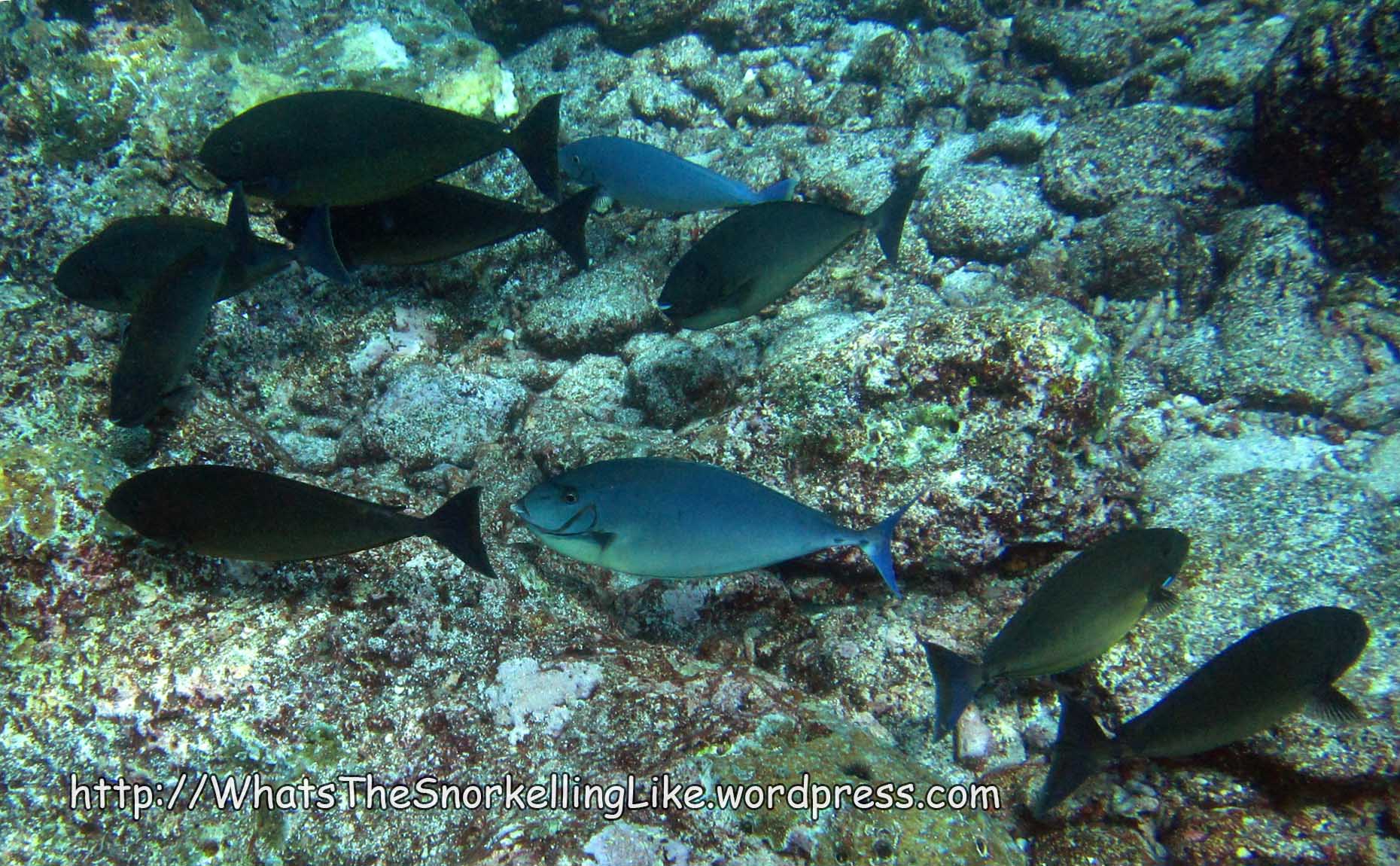


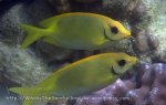


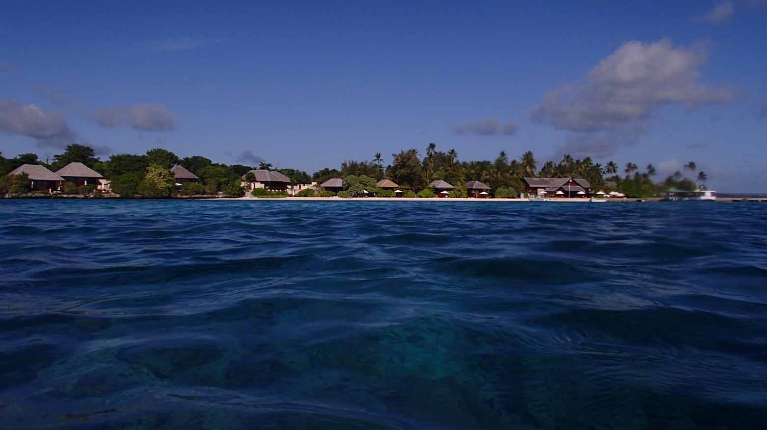